Shows
VerySpatialA VerySpatial Podcast – Episode 781A VerySpatial PodcastShownotes – Episode 78115 March 2026
Reflections
Click to directly download MP3
YouTube (audio only)
AVSP – Episode 781 Transcript (docx)
http://traffic.libsyn.com/avsp/AVSP_Episode781.mp3
News:
QGIS 4.0 Norrköping release
Google Maps and Gemini
ADA Web & Mobile Rule countdown
CMU uses Sleep Cycle data to detect outbreaks
Web corner:
ESRI 3D interactive Dance of Continents
Topic:
https://blog.geomusings.com/2026/01/28/post-gis-revisited/
https://blog.geomusings.com/2026/03/02/when-geospatial-is-consumed-at-ai-scale/
Events:
Louisiana Remote Sensing & GIS Workshop: 14-16 April in Lafayette Louisiana
ACH 2026: 24-26 June, Virtual
2026 ASPRS International Technical Symposi...
2026-03-2300 min
A VerySpatial Podcast | Discussions on Geography and Geospatial TechnologiesA VerySpatial Podcast - Episode 781News: QGIS 4.0 Norrköping release Google Maps and Gemini ADA Web & Mobile Rule countdown CMU uses Sleep Cycle data to detect outbreaks Web corner: ESRI 3D interactive Dance of Continents Topic: https://blog.geomusings.com/2026/01/28/post-gis-revisited/ https://blog.geomusings.com/2026/03/02/when-geospatial-is-consumed-at-ai-scale/ Events: Louisiana Remote Sensing & GIS Workshop: 14-16 April in Lafayette Louisiana ACH 2026: 24-26 June, Virtual 2026 ASPRS International Technical Symposium: 5-8 October, Virtual GIS-PRO 2026: 12-15 October, Milwaukee Music: Sad That I'm Still Sad by Liminal
2026-03-2343 minA VerySpatial Podcast | Discussions on Geography and Geospatial TechnologiesA VerySpatial Podcast - Episode 781News: QGIS 4.0 Norrköping release Google Maps and Gemini ADA Web & Mobile Rule countdown CMU uses Sleep Cycle data to detect outbreaks Web corner: ESRI 3D interactive Dance of Continents Topic: https://blog.geomusings.com/2026/01/28/post-gis-revisited/ https://blog.geomusings.com/2026/03/02/when-geospatial-is-consumed-at-ai-scale/ Events: Louisiana Remote Sensing & GIS Workshop: 14-16 April in Lafayette Louisiana ACH 2026: 24-26 June, Virtual 2026 ASPRS International Technical Symposium: 5-8 October, Virtual GIS-PRO 2026: 12-15 October, Milwaukee Music: Sad That I'm Still Sad by Liminal
2026-03-2343 minThe GeoholicsEpisode 276 - ASPRS Gulf South RegionIn this episode of The Geoholics, we go full geospatial nerd mode with several leaders from the American Society for Photogrammetry and Remote Sensing (ASPRS) — a professional organization that’s been shaping the mapping and imaging sciences since 1934. That’s right… these folks were advancing mapping science before lidar was cool and long before anyone thought strapping cameras to drones was a good idea.
Joining the show are Dr. Balaji Ramachandran, Dr. Unal Okyay, Bill Swope, and Scott Dunham, representing the ASPRS Gulf South Region, where they’re working to grow a tight-knit geospatial community across Texas and Louisi...
2026-03-061h 08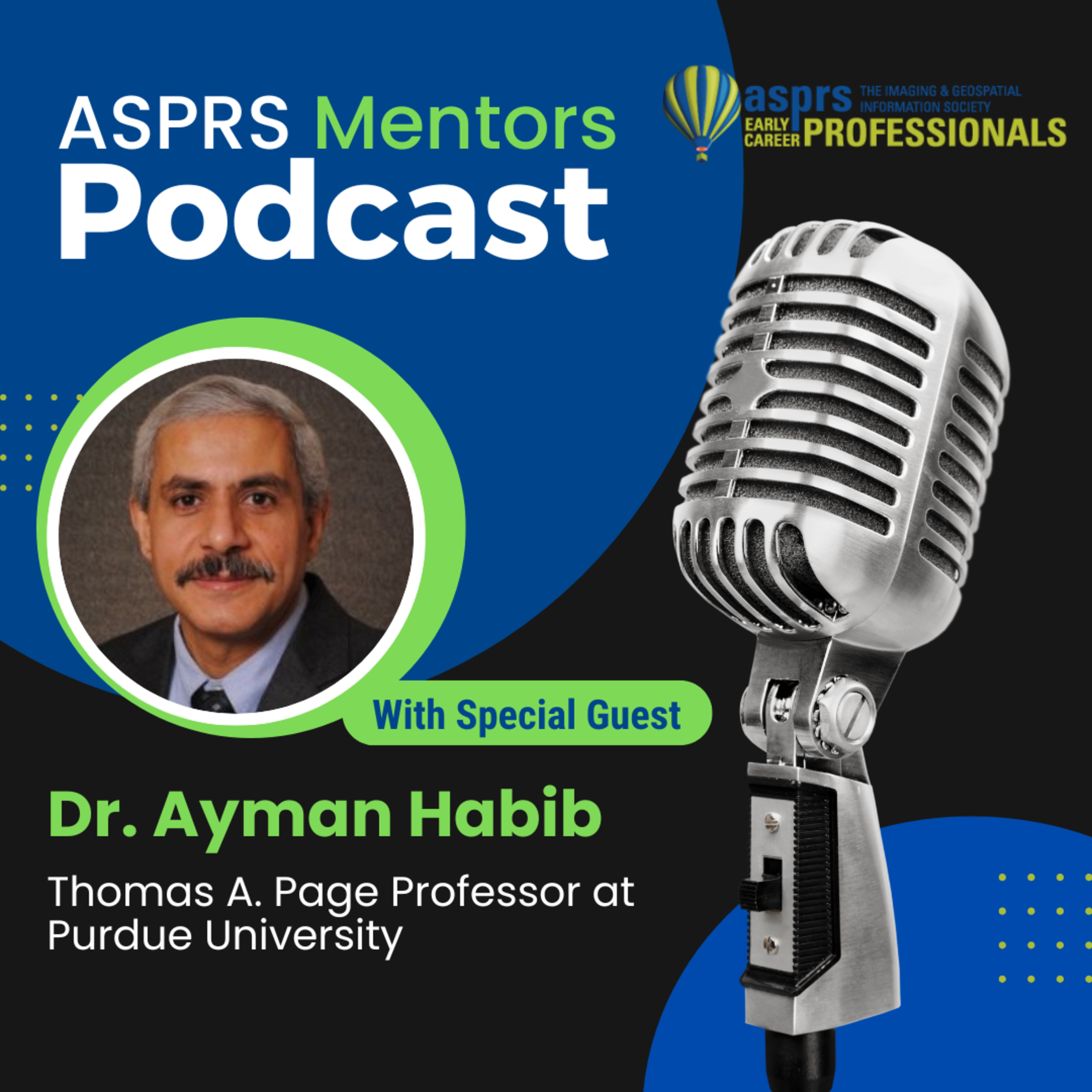
ASPRS Mentors PodcastASPRS ECPC Mentors Podcast - Episode 37, Dr. Ayman HabibDr. Ayman Habib is the Thomas A. Page Professor in the Lyles School of Civil and Construction Engineering at Purdue University. He serves as Co-Director of the Civil Engineering Center for Applications of UAS for a Sustainable Environment(CE-CAUSE) and is the Associate Director of both Purdue’s Joint Transportation Research Program (JTRP) and the Institute of Digital Forestry (iDiF). He earned his M.Sc. and Ph.D. in photogrammetry from The Ohio State University in 1993 and 1994, respectively. His research focuses on terrestrial and aerial mobile mapping systems that employ photogrammetric and lidar remote sensing, UAV-based3D mapping, and th...
2026-01-271h 03Spatial SignalsPhotogrammetry Is Not Exactly A Household Word with Karen SchuckmanKaren Schuckman from RRC Companies and ASPRS joins us to talk about riding Argentinian horses on vacation, living the farm life and an equestrian background, Karen’s time as an international-level gymnast in high school, meteorologists who study meteors, remote sensing and oceanography, photogrammetry courses for surveying, a momentous summer picnic, teaching at Penn State, participation in ASPRS, aerial GPS and topographic lidar, the importance of locational accuracy, positional accuracy and automated processes, a growing demand for an understanding of photogrammetry, GeoWeek 2026, new developments at ASPRS, student chapters of ASPRS, and much more. Show notes and photos are available at...
2026-01-1945 minSpatial SignalsThe Emotional Hook of Remote Sensing with JB SharmaJB Sharma from the University of North Georgia joins us to talk about JB’s transition from a physics background to geospatial technologies, grassroots STEM literacy, how to get students interested in remote sensing, JB’s work with AmericaView, AI-based techniques for handling the volume of remote sensing data, deep learning, GEOBIA for classifying UAS data, learning communities in online learning, ASPRS, and much more. Show notes and photos are available at: https://americaview.substack.com
2025-11-2435 minThe GeoholicsEpisode 262 - ASPRS Early Career Professionals CouncilThis week The Geoholics dive deep into the heart of the geospatial community with the rising leaders of the ASPRS Early Career Professionals Council — Jordan Hicks, Greg Stamnes, and Riley O’Donnell
From lidar to leadership, mentorship to momentum, these three are proving that the next generation of mapping pros is fired up and ready to shape the industry’s future.
Jordan, Greg, and Riley share what drew them to ASPRS and why getting involved early changed everything. They talk about building confidence, seizing opportunities, and the power of showing up — even when you feel like the...
2025-10-231h 16
The Spatial ConnectionSteve KastenIn this episode of The Spatial Connection, I talk with Steve Kasten, Vice President of Surveying and Photogrammetry at Bowman Consulting.Steve takes us on a journey through his career in cartography, photogrammetry, and surveying — from his first spark of interest in high school geography class, to working with the Defense Mapping Agency, to becoming a licensed land surveyor and Vice President at Surdex. Along the way, he shares stories of early mapping technology, government training programs, mentorship, and the evolution from analog tools to digital geospatial systems. It’s a fascinating look at the people, challenges, and...
2025-09-0952 min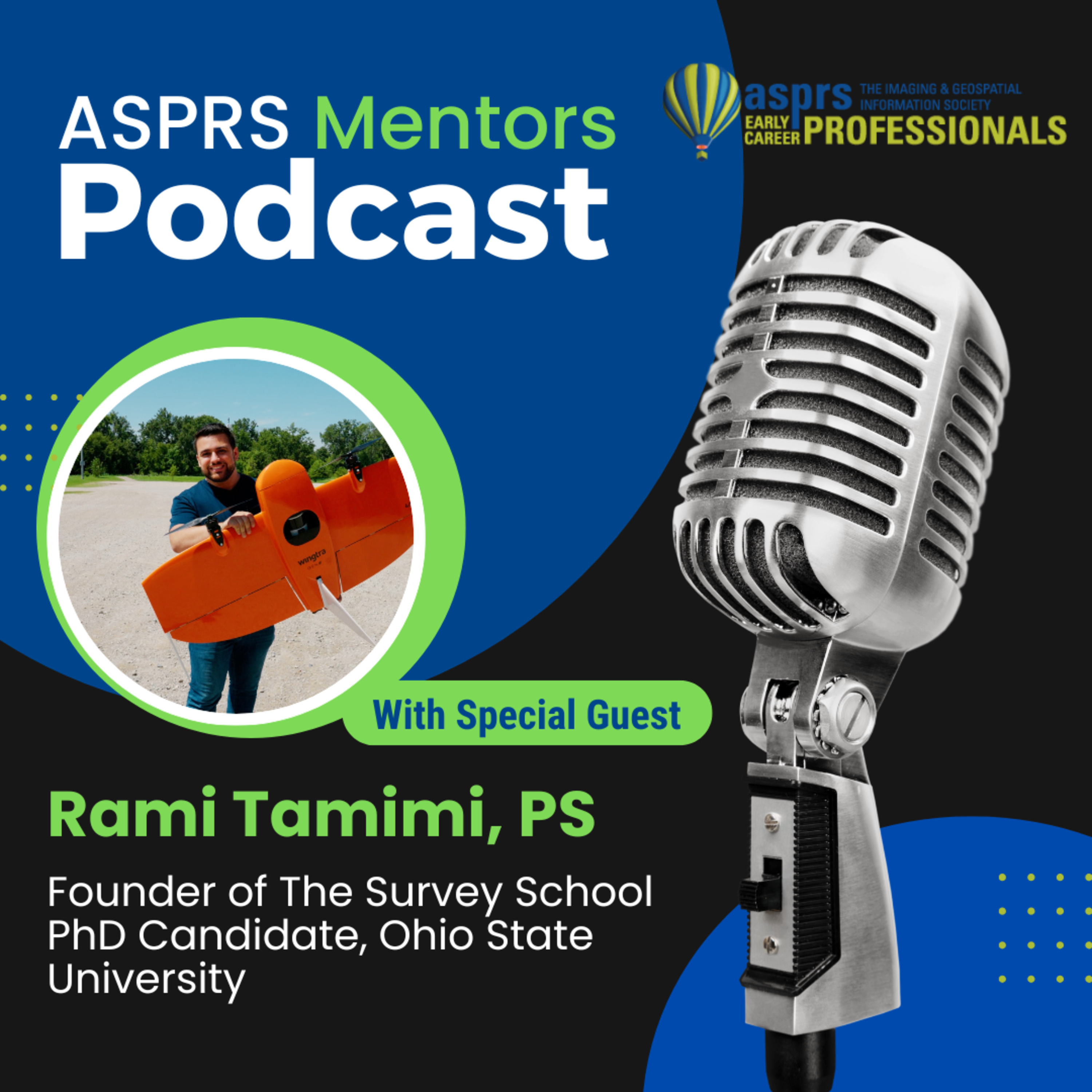
ASPRS Mentors PodcastASPRS ECPC Mentors Podcast – Episode 36, Rami TamimiRami Tamimi is a Professional Surveyor, UAS Pilot, and the Founder of The Survey School where he teaches future surveyors how to blend solid fieldwork with modern tools like LiDAR, drones, and photogrammetry while maintaining the core fundamental principles of survey-grade accuracy. Rami is also a Ph.D. candidate at The Ohio State University as a pursue a Ph.D. in Geodetic Engineering. His focus is to bridge traditional surveying with cutting-edge geospatial technology in ways that are practical, precise, and future-ready. The ASPRS Early Career Professional Council Officers, Jordan Hicks and Riley O'Donnell host this podcast.
2025-08-0740 min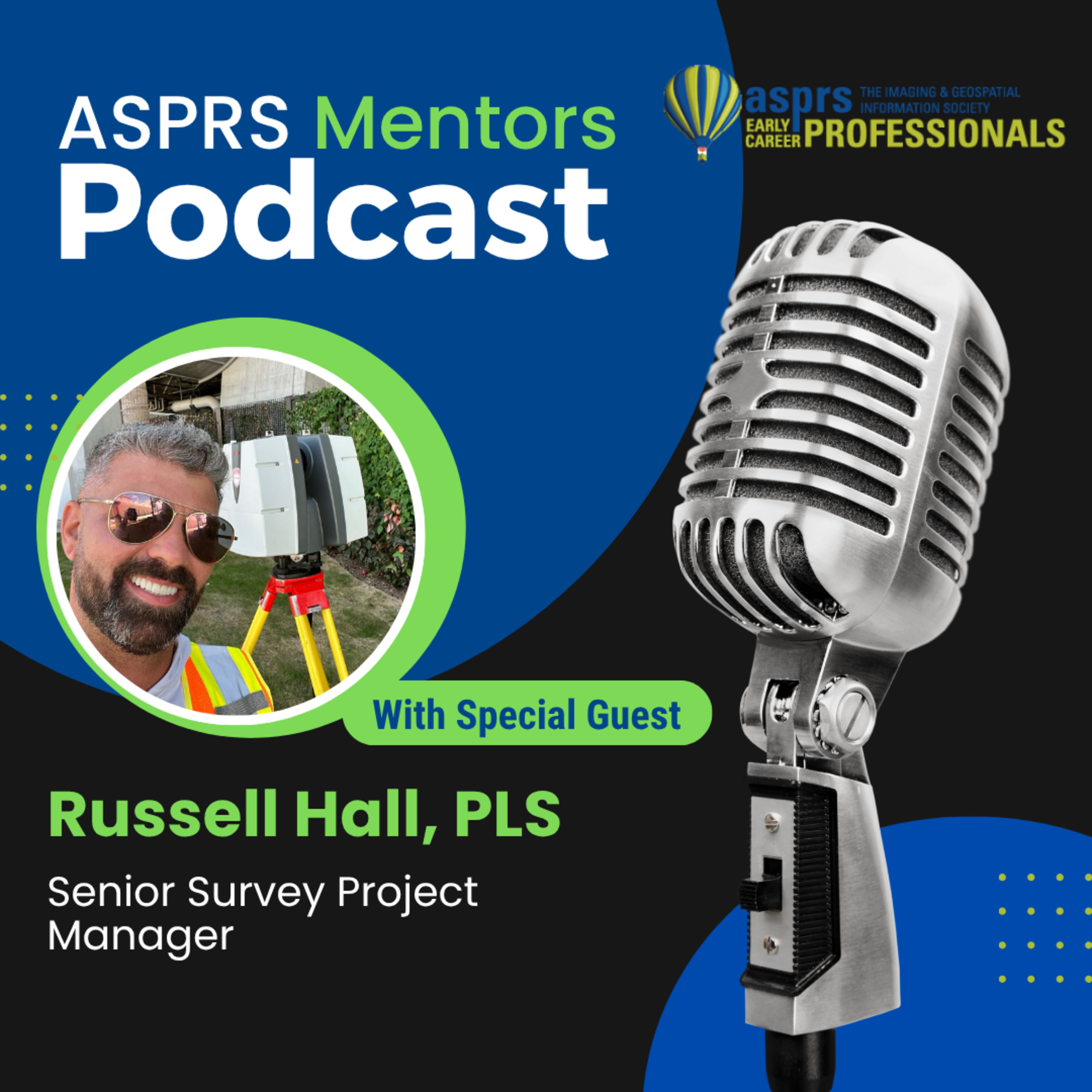
ASPRS Mentors PodcastASPRS ECPC Mentors Podcast – Episode 35, Russell HallThe ASPRS Mentors Podcast welcomes Russell Hall, PLS—a respected land surveyor, leader at Langan Engineering, and co-host of The Geoholics podcast.As a licensed Professional Land Surveyor with 24+ years of experience, Russell helps engineering firms, municipalities, and agencies unlock faster, more accurate decisions through advanced surveying and reality capture solutions.Learn more about the American Society for Photogrammetry and Remote Sensing (ASPRS)!• Website: https://www.asprs.org• LinkedIn: https://www.linkedin.com/company/asprs• Facebook: https://www.facebook.com/ASPRS.org• Instagram: https://www.instagram.com/asprs_org/• X: https://x.com/ASPRSorgASPRS - Early Career Professionals Council (E...
2025-07-2858 minSpatial SignalsThe First Digital Global Map with Bobbi LenczowskiBobbi Lenczowski, formerly of the National Geospatial-lntelligence Agency (NGA), joins us for a discussion of the highlights of her all-star career with her time at the Defense Mapping Agency, gathering early map data and the progression of geospatial technology, data classification and data management techniques, development of the first digital global digital map made from scanning paper maps, Bobbi’s time as Executive Director of AmericaView, her service with ASPRS, as well as her involvement with multiple geospatial initiatives in the St. Louis area, including NGA, GeoFutures, and drone training for high school students. Show notes are available at: http...
2025-06-3045 min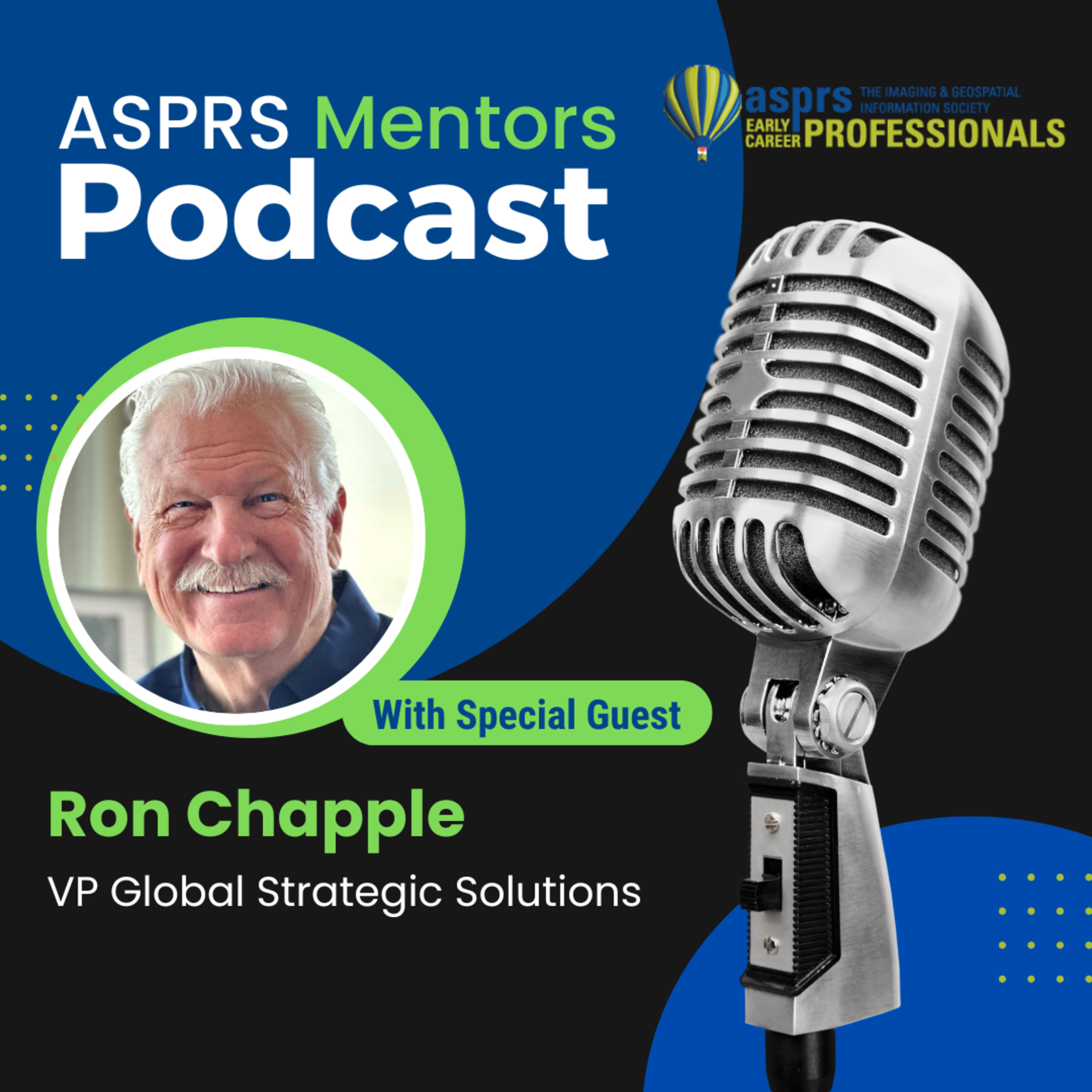
ASPRS Mentors PodcastASPRS ECPC Mentors Podcast - Episode 34, Ron ChappleRon Chapple is the VP Global Strategic Solutions for NV5. He works with a team of geospatial and building analysisprofessions that deliver industry-leading projects for airports, urban environments, building infrastructure, and data centers. Ron’s unique background in storytelling connects digital twins and technology. Ron’s clients include the BBC, PBS, and National Geographic. Ron has won two EMMY awards including a PBS project entitled “OnBecoming California”. Ron pioneered the use of remote sensing as part of a Pulitzer Prize award-winning project withUSA Today.This podcast is hosted by the ASPRS Early Career Professional Council...
2025-06-0559 min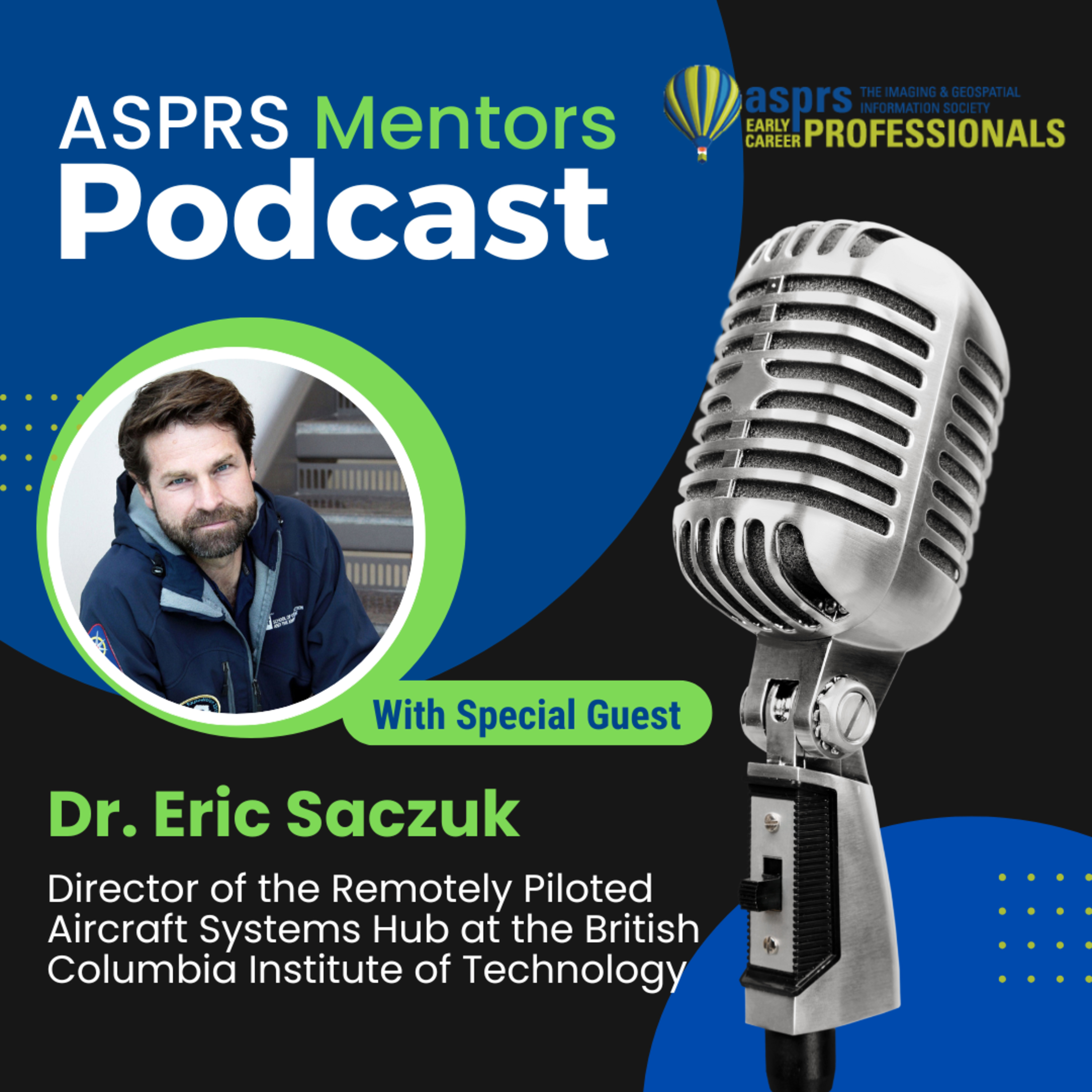
ASPRS Mentors PodcastASPRS ECPC Mentors Podcast - Episode 33, Dr. Eric SaczukListen to the exciting conversation with Dr. Eric Saczuk, Research Chair at BCIT and RPAS Hub Lead, who specializes in drone-based remote sensing, photogrammetry, and innovative climate research in polar regions.Dr. Saczuk shared insights from his groundbreaking drone mapping projects in Antarctica and Svalbard, his experiences training citizen scientists, and how UAV technology is reshaping environmental monitoring.Educational Resources that are mentioned in the podcast;https://flyy.thinkific.com/https://coastaldrone.co/courses/?gad_source=1&gclid=Cj0KCQjw1um-BhDtARIsABjU5x6AwS2vZuCauc9BN4fYiyWVyBzVUBEIXEJ77ZJu8OSp2i...
2025-06-0238 minThe GeoholicsEpisode 252 - Chad Maxwell, PLSStrap in and grab your Trimble, because Episode 252 of The Geoholics takes us on a globetrotting, tech-loving, swamp-sloshing survey saga with none other than Chad Maxwell, PLS—a man who’s mapped more terrain than your Roomba on espresso.
We kick things off with the usual “Jake Owen sings while KG wings it” intro, followed by breaking news from the land of satellite miners, career advice from the GeoSearch crew, and an ESRI pro tip that may or may not involve chair-based motivation.
Then it’s time for the main event: Chad “Every Mode of Transport” M...
2025-05-121h 48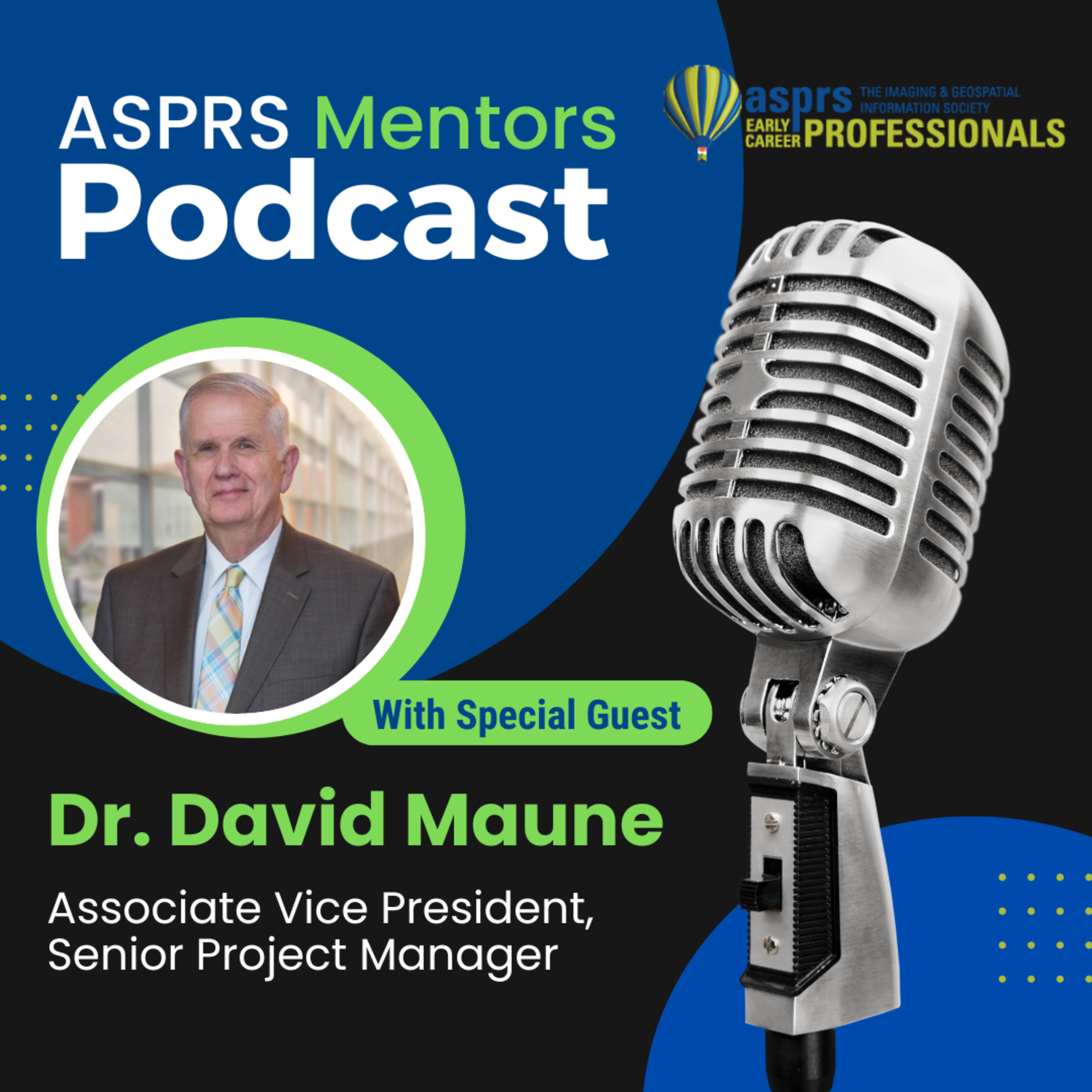
ASPRS Mentors PodcastASPRS ECPC Mentors Podcast - Episode 32, Dr. David MauneWe’re thrilled to welcome Dr. David Maune, the Father of Lidar and author of The DEM Users Manual, as our guest mentor. He’ll share his expertise and exciting career journey to inspire geospatial professionals like you!This podcast is hosted by the ASPRS Early Career Professional Council Officers, Jordan Hicks and Riley O'Donnell.Learn more about the American Society for Photogrammetry and Remote Sensing (ASPRS)! Website: https://www.asprs.orgLinkedIn: https://www.linkedin.com/company/asprsFacebook: https://www.facebook.com/ASPRS.orgInstagram: https://www.instagram.com/asprs_org/X: https://x.com/ASPRSorgASPRS - Early Career Professionals Council (ECPC)Website: https://community.asprs.org/ecpcLinkedIn:
2025-04-2955 minThe GeoholicsASPRS Gulf South Region 4th Annual Geospatial Conference - Part 2Check out these highlights from this year's awesome event!!!
01:05 - Nathan Jones, UAS/GIS Department Lead @ AG3 Group LLC
18:50 - Will Alexander, Geospatial Specialist @ Centurion Planning & Design, LLC
29:50 - Scott Dunham, Geospatial Director @ Gorrondona & Associates, Inc.
38:28 - José A. Pilartes-Congo, Jr., Ph.D. Research Assistant @ MANTIS Lab (Conrad Blucher Institute for Surveying & Science)
2025-04-1448 minThe GeoholicsASPRS Gulf South Region 4th Annual Geospatial Conference - Part 1Check out these highlights from this year's awesome event!!!
00:40 - Vladimir Serkov, LiDAR Manager @ Poznecki Camarillo, LLC
17:30 - Alex Sorrells, Student @ Texas A&M University
31:15 - Terrance Ranney, Drone Services Manager @ UNICO Engineering, Inc.
44:25 - Stephen Anthony, Principal Geospatial Data Engineer @ CoreLogic
53:50 - Sally Holl, GIS Professor @ Austin Community College
2025-04-141h 08
Site and SceneS1E9 - Precision + Perspective: Russ Hall on Reality Capture Done RightJoin us and Russ Hall of Langan Engineering—licensed surveyor, reality capture expert, and regular on The Geoholics podcast.
We go deep into the evolving landscape of reality capture in AEC and surveying. Russ shares practical insights from 20+ years in the field, including:
🚧 How Langan uses multi-sensor fusion on their projects
📐 Why licensed surveyors are critical for capture workflows—control, error management, and liability
💻 Game-changing tools like TopoDOT and Leica 3DR
📊 The rise of point cloud viewers and improved data accessibility
🤖 The future of AI in automated feature extraction
📉 Workforce shortages and ideas like tiered licensing and early education
📜 Regulatory shifts, ASPRS involvement...
2025-04-091h 21
Your Drone Questions. Answered.YDQA: Ep 97- "How To Calculate Vertical Positional Accuracy Using the ASPRS 2024 Standards?"In this episode of Your Drone Questions. Answered, host Chris Breedlove provides a follow-up to last week's interview with Ravi Suneja about the ASPRS positional accuracy standards.Chris walks through a real-world example of calculating vertical positional accuracy using actual drone data from a community college campus. Learn how to:-Understand the components of the ASPRS 2024 vertical accuracy standardSee how product fit to checkpoints is measured in practice--Observe the importance of having 30+ checkpoints for proper validationCalculate the combined accuracy using both product fit and control network accuracy-Properly r...
2025-03-1308 min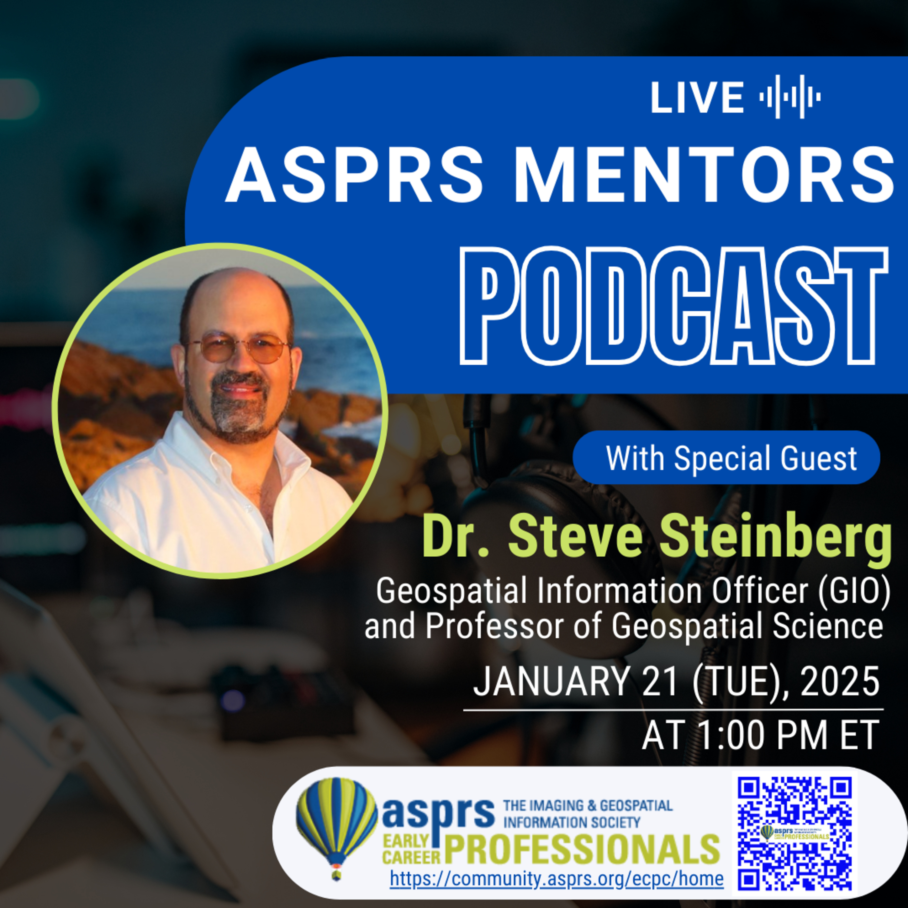
ASPRS Mentors PodcastASPRS ECPC Mentors Podcast - Episode 31, Dr. Steven SteinbergDr. Steinberg currently serves as the Geospatial Information Officer (GIO) for the County of Los Angeles California where he works across departments to develop and implement geospatial strategy with a team of over 150 highly skilled geospatial professionals. Throughout his career he has focused on the application of geospatial analysis for modeling and visualization of spatial data in both human and natural environments. He also serves as program director for the Los Angeles Region Imagery Acquisition Consortium (LARIAC) Program, a consortium of approximately 50 local, state and federal organizations, academic institutions, and NGOs that collaborate in the acquisition of remote sensing...
2025-03-131h 05Your Drone Questions. Answered.YDQA: Ep 96- "What Industry Accuracy Standards Apply to Drone-Captured Mapping Products?"🚁 Drone Mapping Standards Explained: What Every Aerial Mapper Needs to Know!In this episode of Your Drone Questions. Answered, host Chris Breedlove sits down with Ravi Soneja to dive deep into the critical world of industry accuracy standards for drone-derived mapping products.Key Highlights:Discover the latest 2024 ASPRS Positional Accuracy Standards updatesLearn the difference between ground control and checkpointsUnderstand vertical accuracy reporting for drone mapping projectsGet insights from a professional with extensive aerial mapping experienceWhat You'll Learn:The role of ASPRS (American Society for Photogrammetry and Remote Sensing)Critical changes in map...
2025-03-0617 min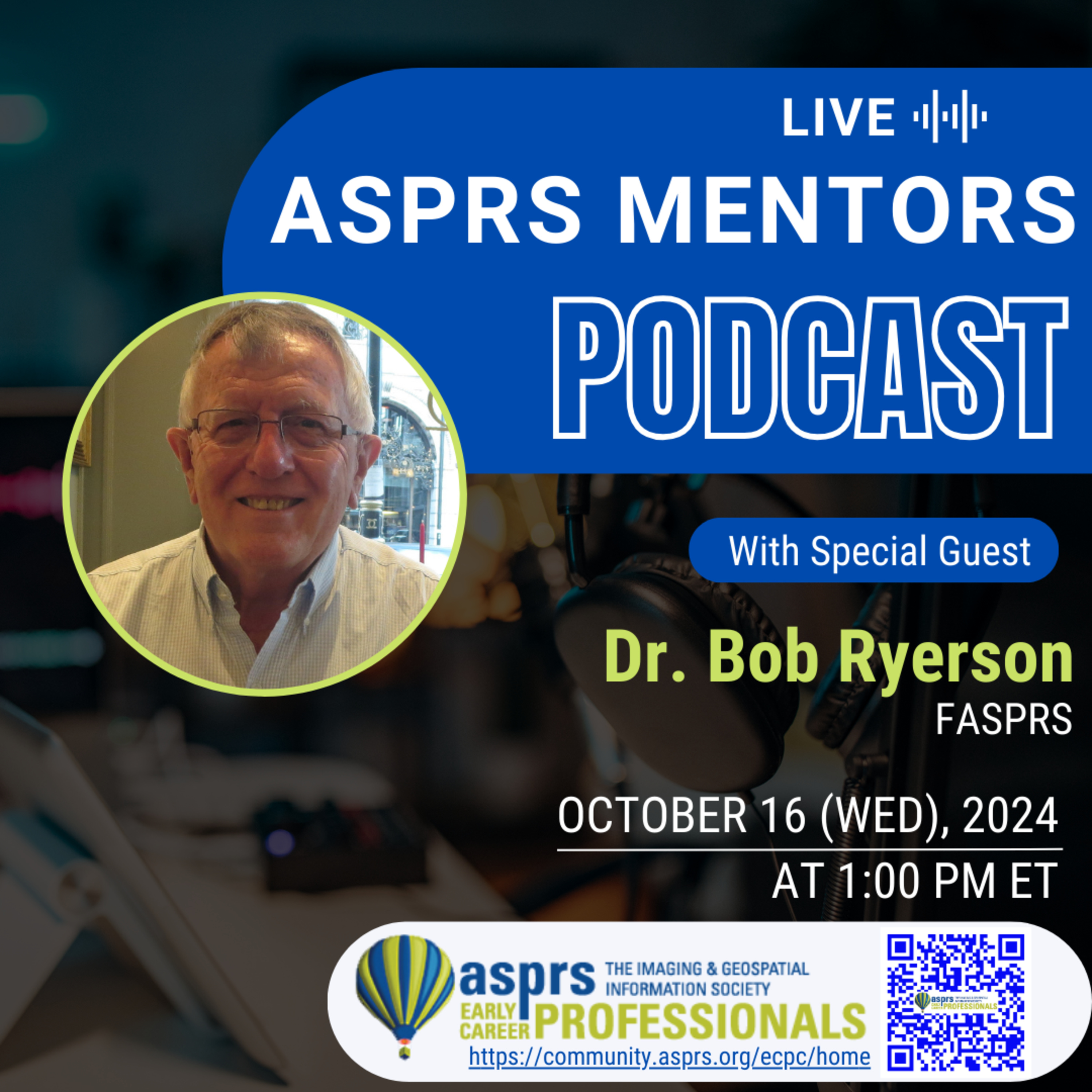
ASPRS Mentors PodcastASPRS ECPC Mentors Podcast - Episode 29, Dr. Bob RyersonDr. Ryerson has served in a variety of senior positions in industry and government. He is a a Fellow of the American Society for Photogrammetry and Remote Sensing (ASPRS), has served on the Board of the ASPRS, and is a Past-Chairman of the Canadian Remote Sensing Society. He has won a number of awards, including the Gold Medal of the Canadian Remote Sensing Society and the Alan Gordon Memorial Award for “Outstanding Service over his career to Remote Sensing.” He has been interviewed on national radio and television and by every major newspaper in English Canada. Several examples of his...
2024-12-1847 minPodcast349. World LiDAR Day Returns for its 2nd Annual Celebration on February 12, 2025 | Geo Week 2025World Lidar Day Returns for its Second Annual Celebration on Feb. 12, 2025
Global event to shine a spotlight on the transformative power of lidar technology with celebrations at Geo Week in Denver, Colorado.
December 18, 2024, Denver, CO - The second annual World Lidar Day will take place on February 12th, 2025, coinciding with Geo Week in Denver, Colorado, inviting industry professionals and enthusiasts to honor the global impact of lidar technology. Following a successful inaugural event, World Lidar Day 2025 is set to foster awareness, collaboration, and education surrounding lidar’s vast contributions across the geospatial industry, including environmental monit...
2024-12-1706 minThe GeoholicsEpisode 238 - ASPRS Geospatial Conference 2025We love it when a plan comes together! The guys were joined this week by a gaggle of mapping professionals including our good friend Bill Swope - Technical Leader for Survey & Geospatial @ Halff, Scott Dunham - Geospatial Director @ Gorrondona & Associates, Inc., and Balaji Ramachandran - Associate Research Professor @ Nicholls State University. Each of these guys plays an integral part in facilitating the upcoming 2025 ASPRS Business Meeting & Geospatial Conference to be held March 12th-14th in one of our favorite cities, Austin, Texas. You will learn everything there is to know about ASPRS in addition to being privy to all...
2024-12-131h 04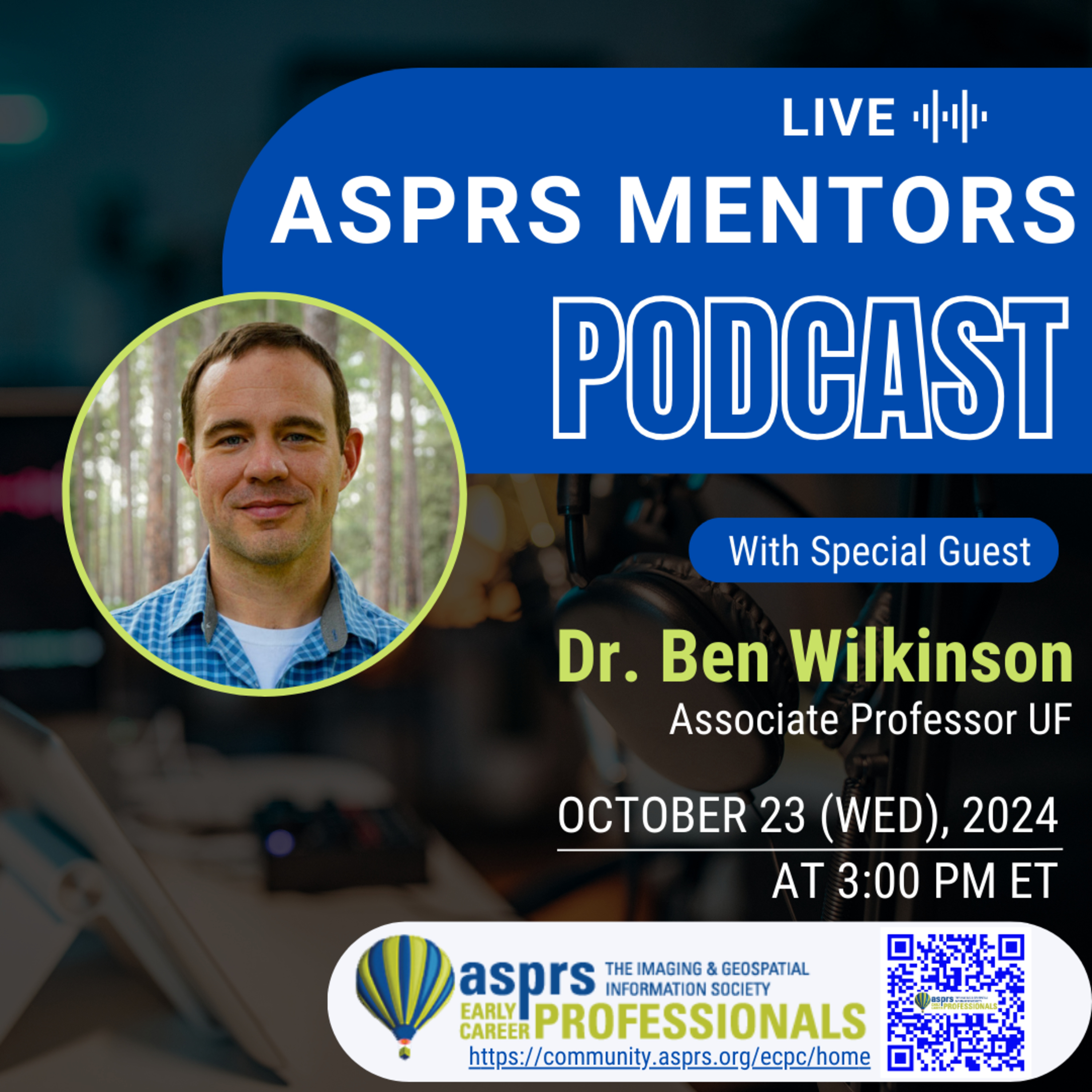
ASPRS Mentors PodcastASPRS ECPC Mentors Podcast - Episode 30, Dr. Ben WilkinsonBen Wilkinson is an Associate Professor at the University of Florida. There, he teaches undergraduate and graduate photogrammetry courses, and administers the Mapping with UAS certificate program. He is a coauthor of the textbook Elements of Photogrammetry. His research focuses on foundational geomatics topics in UAS photogrammetry and lidar, and applications to natural resources.
This podcast is hosted by the ASPRS Early Career Professional Council Officers, Greg Stamnes and Jordan Hicks.
Learn more about the American Society for Photogrammetry and Remote Sensing (ASPRS)!
Website: https://www.asprs.org
LinkedIn: https://www.linkedin.com/company/asprs
Facebook: https://www.facebook.c...
2024-11-1251 min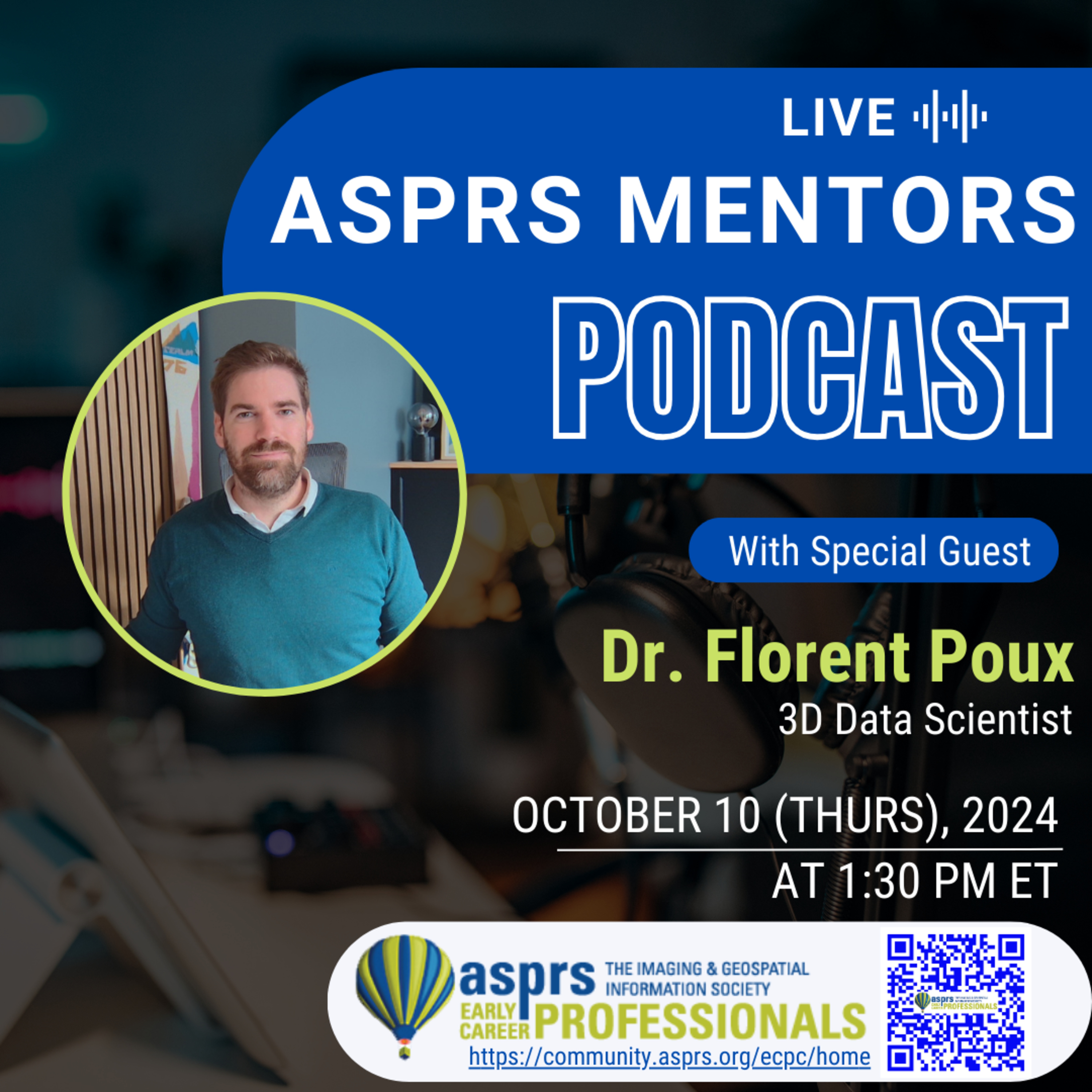
ASPRS Mentors PodcastASPRS ECPC Mentors Podcast - Episode 28, Dr. Florent PouxFlorent is an esteemed authority in the field of 3D data science. He teaches and conducts research for top EU Universities. He is also the Head Professor of the 3D Geodata Academy and Innovation Director for FrenchTech120 Companies. With a decade of experience, Florent's expertise in Python and its applications to 3D data is unrivaled. His groundbreaking research and real-world contributions have garnered acclaim in academia and industries with several awards. His unique journey merges a deep academic perspective with a pragmatic view of creating innovative 3D products and solutions. Whether you're an early career professional, coder, data scientist...
2024-10-2552 minPodcast323. Scholarship to provide university students with the opportunity to attend Geo Week | Discussion by Google NotebookLM AIDiscussion by Google NotebookLM AI
Scholarship to provide university students with the opportunity to attend Geo Week
Portland, ME, Thursday, October 10, 2024 – Organizers of Geo Week announced the launch of the Geo Empower Event Scholarship, an initiative dedicated to empowering university students passionate about utilizing geospatial, surveying, mapping, and 3D technology for social good. With a vision to foster an inclusive and diverse community, this scholarship program seeks to nurture innovation, facilitate knowledge exchange, and provide access to mentoring and networking opportunities by selecting university students to attend Geo Week through an event scholarship.
“We are...
2024-10-1009 min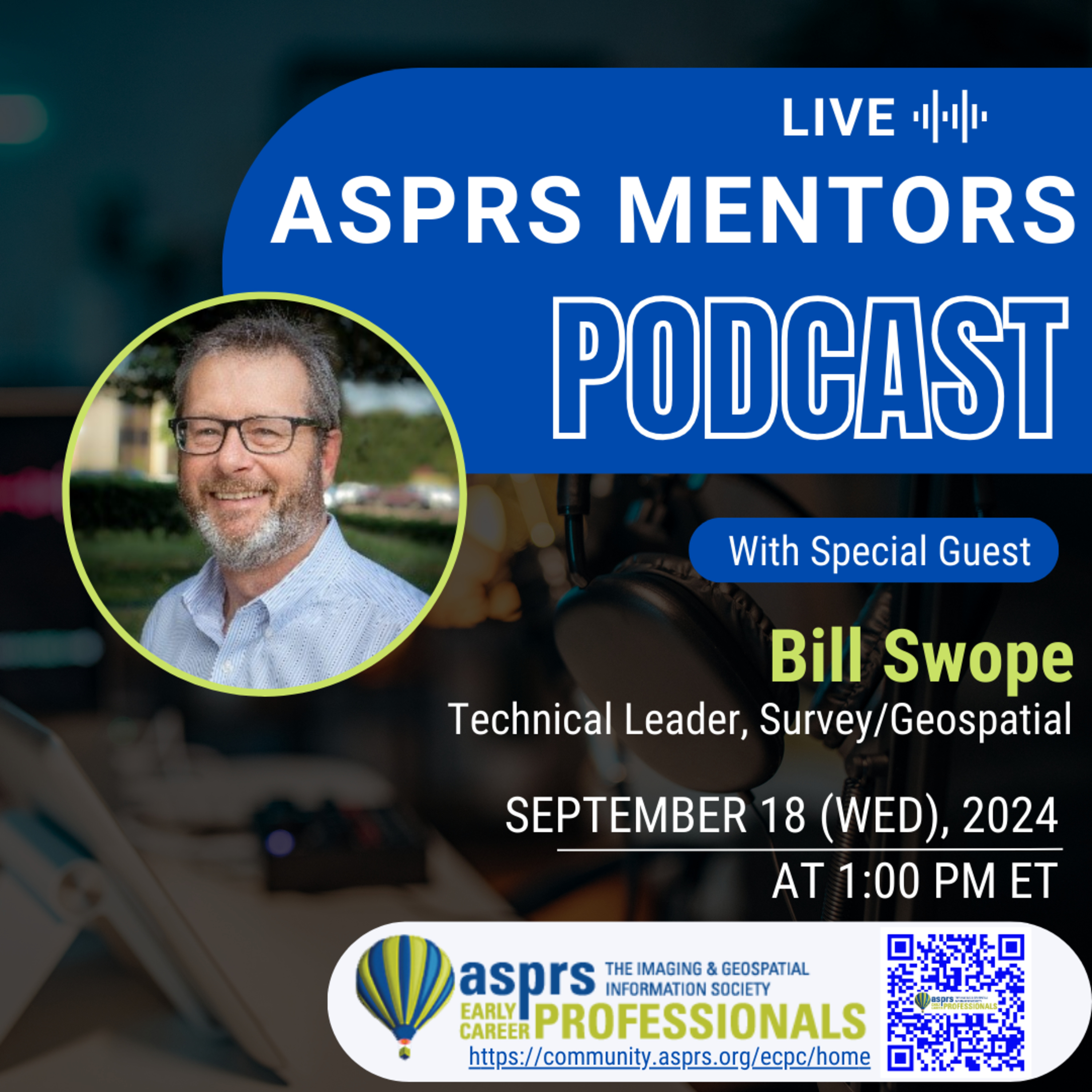
ASPRS Mentors PodcastASPRS ECPC Mentors Podcast - Episode 27, Bill Swope
Bill is a Survey Technical Leader at Halff and a Certified Photogrammetrist through the American Society for Photogrammetry and Remote Sensing (ASPRS). With over 17 years of experience in the photogrammetric industry, Bill is highly skilled in large scale aerial photogrammetry data collection and processing. Additionally, Bill is well versed in aerial lidar data collection and processing; and mobile and terrestrial-based lidar. He has held various roles within ASPRS, such as Director of the Professional Practice Division and President of the Gulf South Region, of which he was a founding member in 2021. Bill advises the North Central Texas Aerial Robotics...
2024-10-0949 min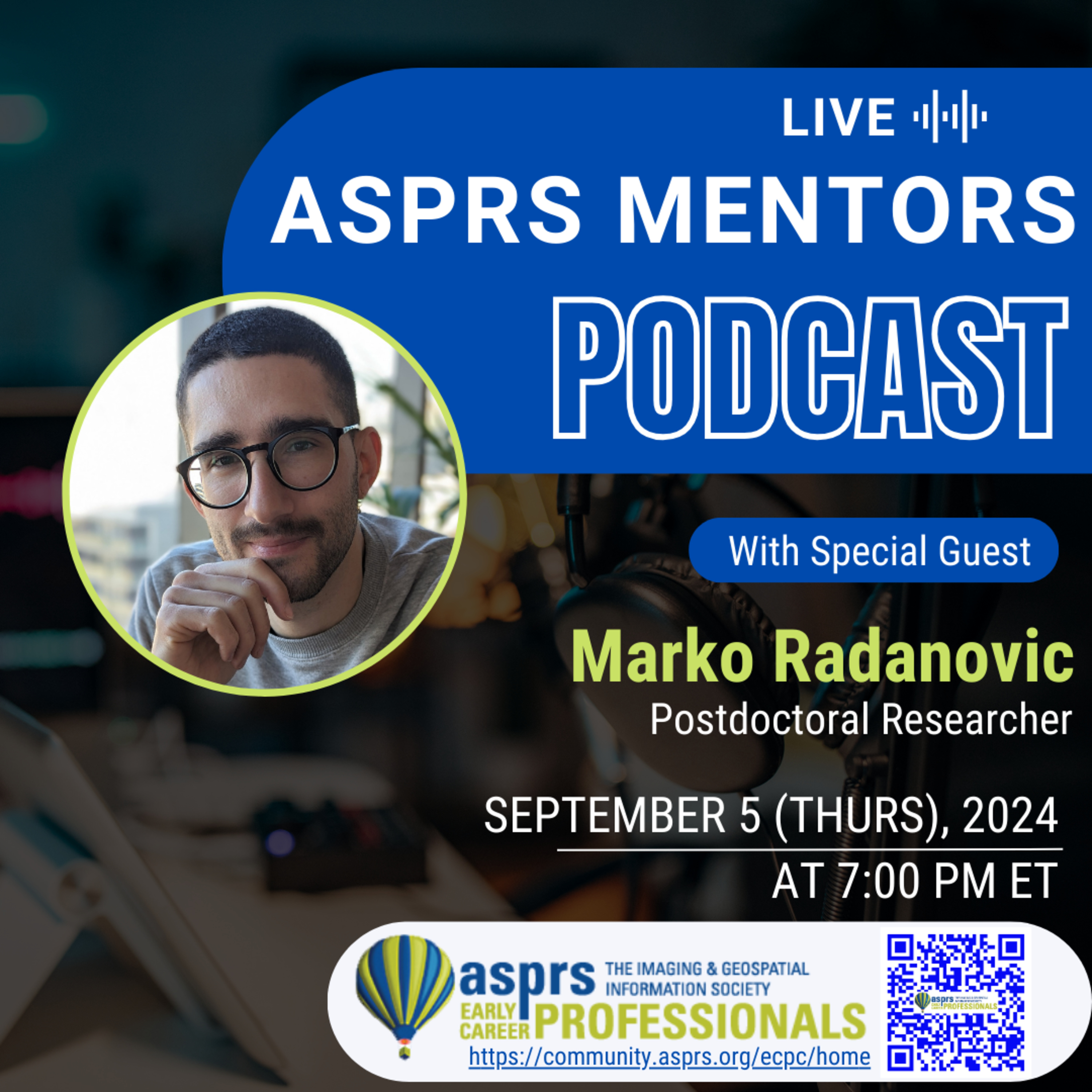
ASPRS Mentors PodcastASPRS ECPC Mentors Podcast - Episode 26, Marko RadanovicMarko is an early career researcher who has been studying and working in the field of geomatics since 14 years old. Born and raised in Zagreb, Croatia, Marko moved to Melbourne in late 2019 after being awarded a full scholarship to undertake his PhD at the University of Melbourne, Department of Infrastructure Engineering. His areas of expertise include reality capturing, Mixed Reality localisation, Remote Sensing, and spatial data integration, and he is actively investigating how Machine and Deep Learning can be used to resolve challenges in those fields. Marko’s PhD work proposing innovative use of Deep Learning solutions in localization an...
2024-10-0159 min
ASPRS Mentors PodcastASPRS ECPC Mentors Podcast - Episode 25, Matthew Byrd
Matthew Byrd is a visionary entrepreneur, advisor, and speaker, focused on advanced technologies and innovation across the built environment. His professional journey began in geospatial services, and his entrepreneurial spirit led him to establish Nexus 3D Consulting in 2016, a company that quickly became a global leader in geospatial and reality capture services. Nexus 3D’s growth led to its acquisition by Allen &
Company in 2023, and formed into Allen 3D in 2024. Matthew has advised and supported projects alongside companies like ExxonMobil, Tesla, Microsoft, Amazon, Micron, Albertsons, AECOM, HDR, Department of Defense, FBI, and many more.
In 2020 Matthew fo...
2024-09-101h 06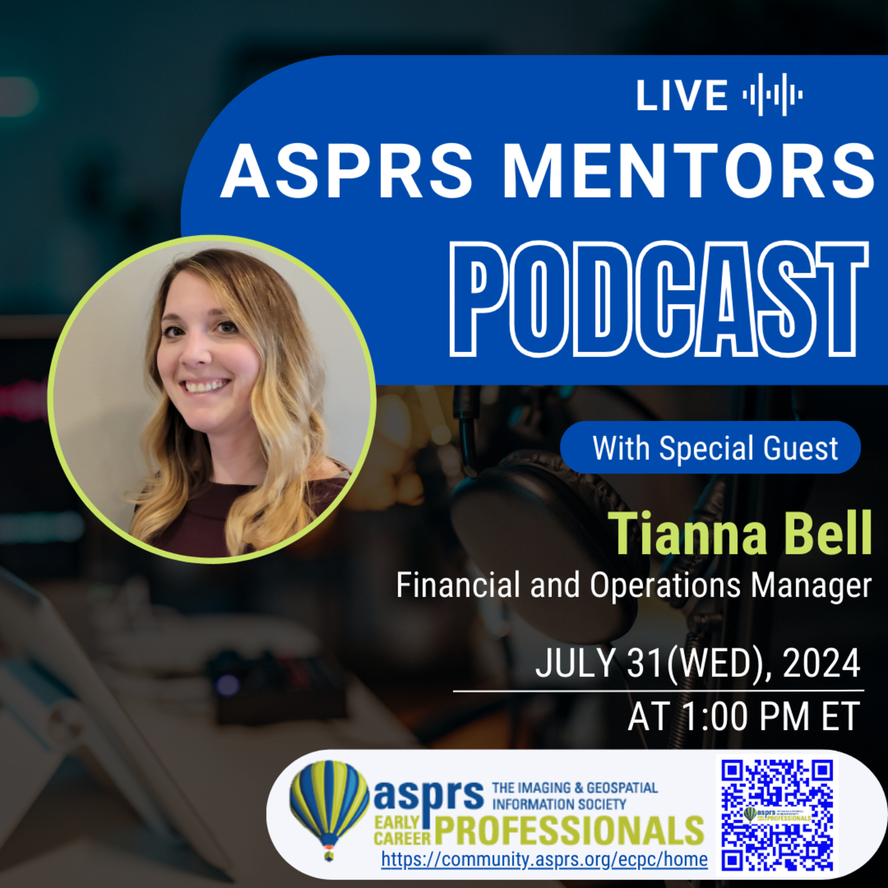
ASPRS Mentors PodcastASPRS ECPC Mentors Podcast - Episode 24, Tianna BellTianna is the Faculty Administrator in the Faculty of Graduate Studies and Research at the University of Regina. She also teaches as a casual instructor at Saskatchewan Polytechnic. She holds a Bachelor of Business Administration in Finance and two master's degrees: one in public administration and the other in business administration. She is passionate about finance and believes that a strong understanding of it is essential for achieving success both personally and professionally.
This podcast is hosted by the ASPRS Early Career Professional Council Officers, Greg Stamnes and Jordan Hicks.
Learn more about the American
Society for...
2024-08-0648 min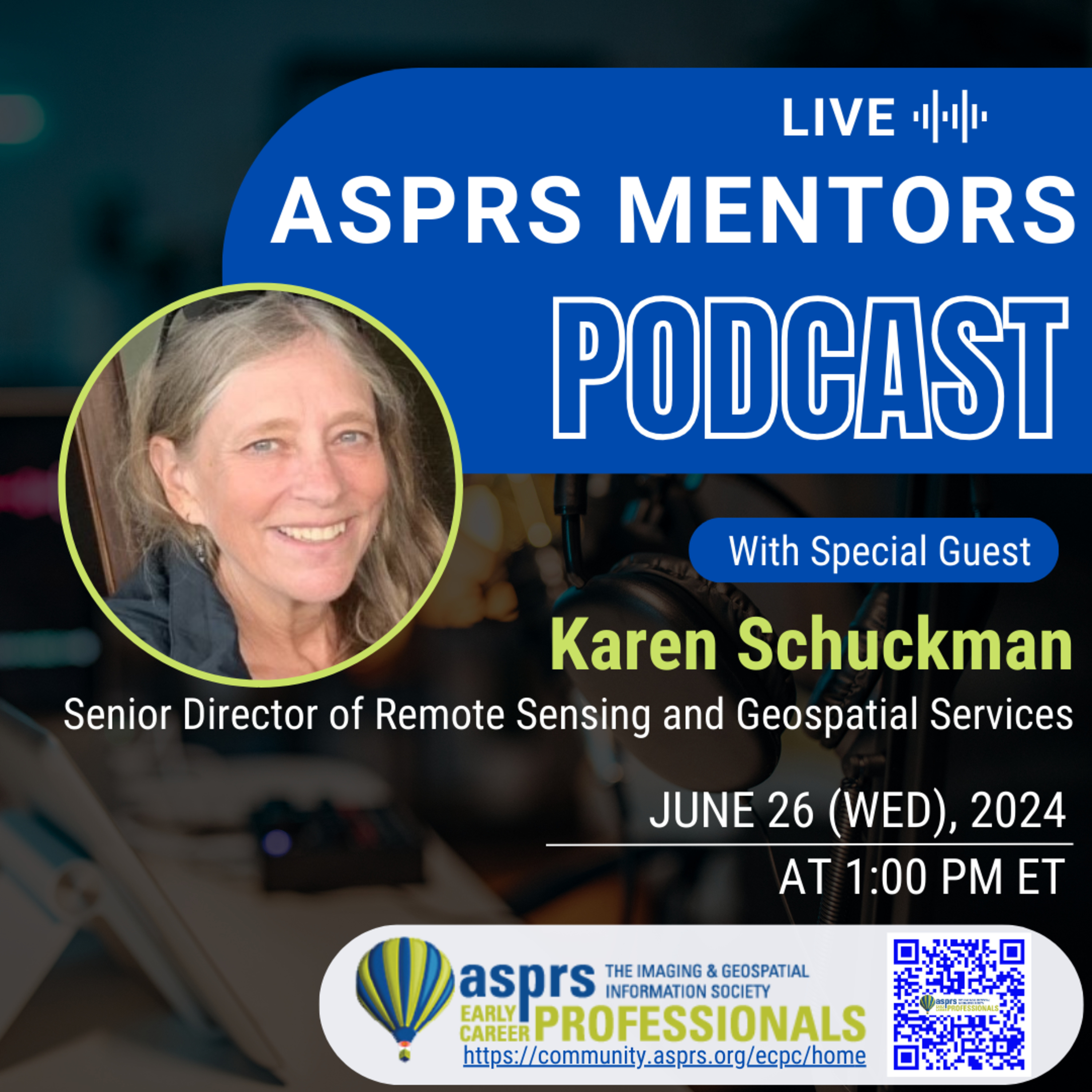
ASPRS Mentors PodcastASPRS ECPC Mentors Podcast - Episode 20, Karen SchuckmanMs. Karen Schuckman is the Senior Director of Remote Sensing and Geospatial Services at RRC Companies, a leader in the international renewable energy industry. She is an Adjunct Associate Teaching Professor of Geography at Penn State University, where for 17 years she was the Lead Faculty for the Graduate Certificate in Remote Sensing and Earth Observation. She also serves as the Executive Director of the American Society for Photogrammetry and Remote Sensing. She holds an MS in Geospatial Information Systems from Penn State University, is an ASPRS Certified Photogrammetrist, ASPRS Certified Mapping Scientist – Lidar, and Professional Land Surveyor.
Th...
2024-08-0658 min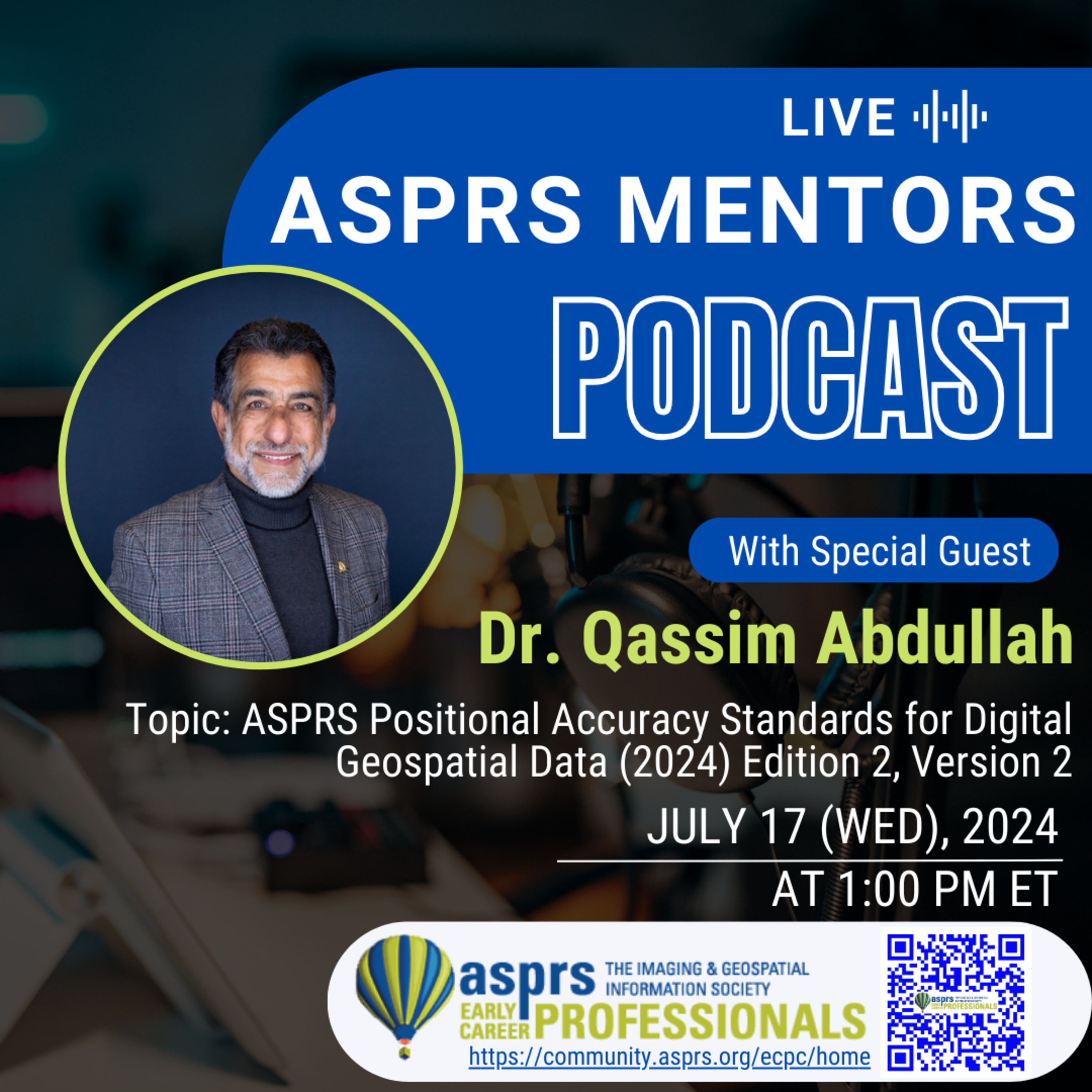
ASPRS Mentors PodcastASPRS ECPC Mentors Podcast - Episode 23, Dr Qassim AbdullahThis episode will be joined by special guest, Dr. Qassim Abdullah to discuss the ASPRS Positional Accuracy Standards for Digital Geospatial Data (2024) Edition 2, Version 2.
*To download the complete Standards, visit https://www.asprs.org/homefeatured/asprs-approves-edition-2-version-2-of-the-asprs-positional-accuracy-standards-for-digital-geospatial-data-2024.html
The Standards are available in hardcopy format and can be purchased from the ASPRS Bookstore, www.asprs.org.
Dr. Qassim Abdullah is an achieved scientist with more than 45 years of combined industrial, research and development (R&D), and academic experience in analytical photogrammetry, digital remote sensing, and civil and surveying engineering. Dr. Abdullah obtained his doctorate and master degrees in...
2024-07-2845 min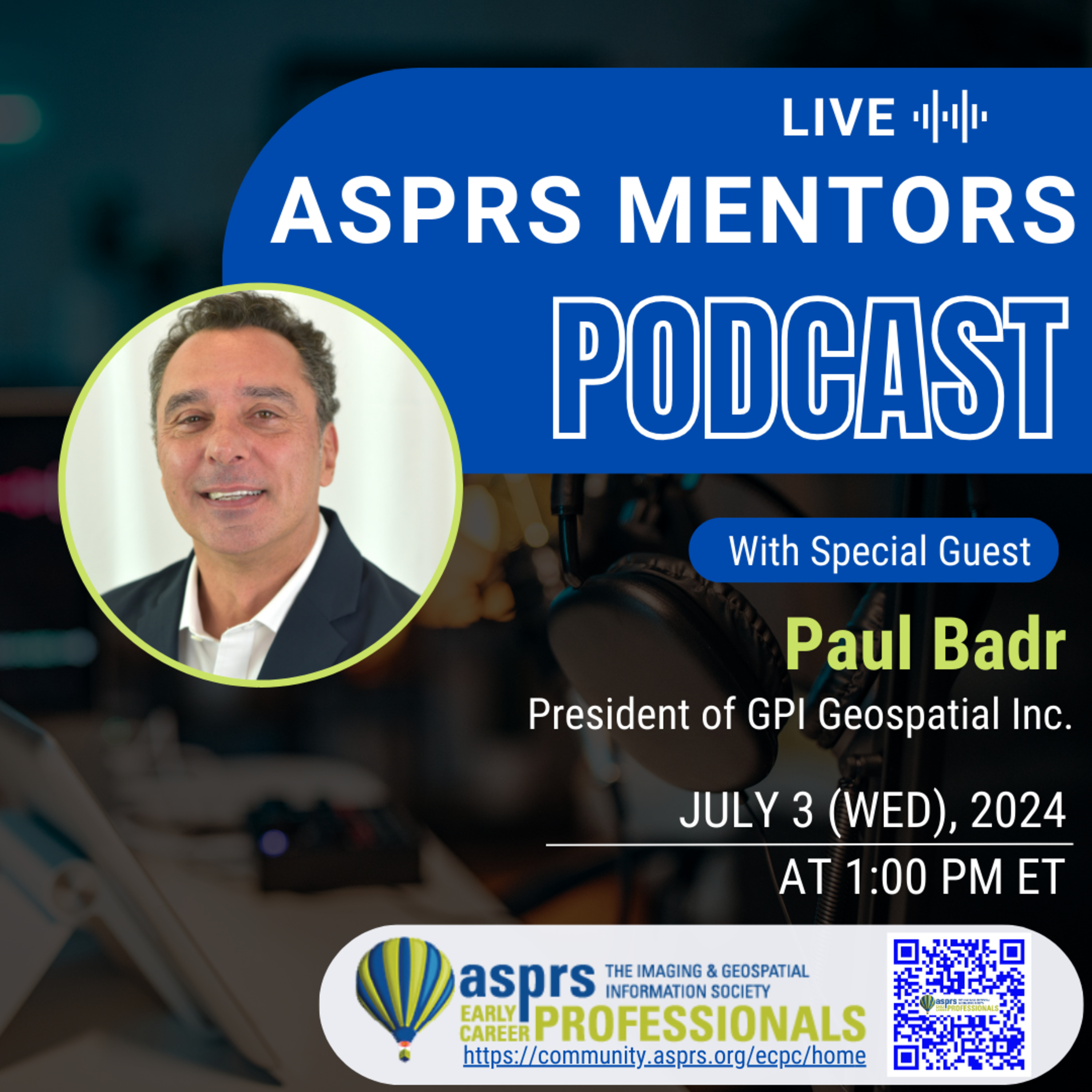
ASPRS Mentors PodcastASPRS Mentors Podcast - Episode 21, Paul BadrAs the President of GPI Geospatial Inc., Paul has successfully grown GPI’s geospatial division into a highly sought-after and respected surveying operation in the eastern United States. Paul is well-versed in all facets of the survey industry, from conventional land surveying to cutting edge mobile and aerial lidar technologies. Paul manages, leads, and advises his diverse team of over 150 surveying professionals and is responsible for the division’s profitability, sales performance, training initiatives, technical operations, and administrative functions. Beyond managerial responsibilities, Paul oversees staff requirements, adherence to state board regulations, strategic planning, business development, business growth, quality control, clie...
2024-07-1545 min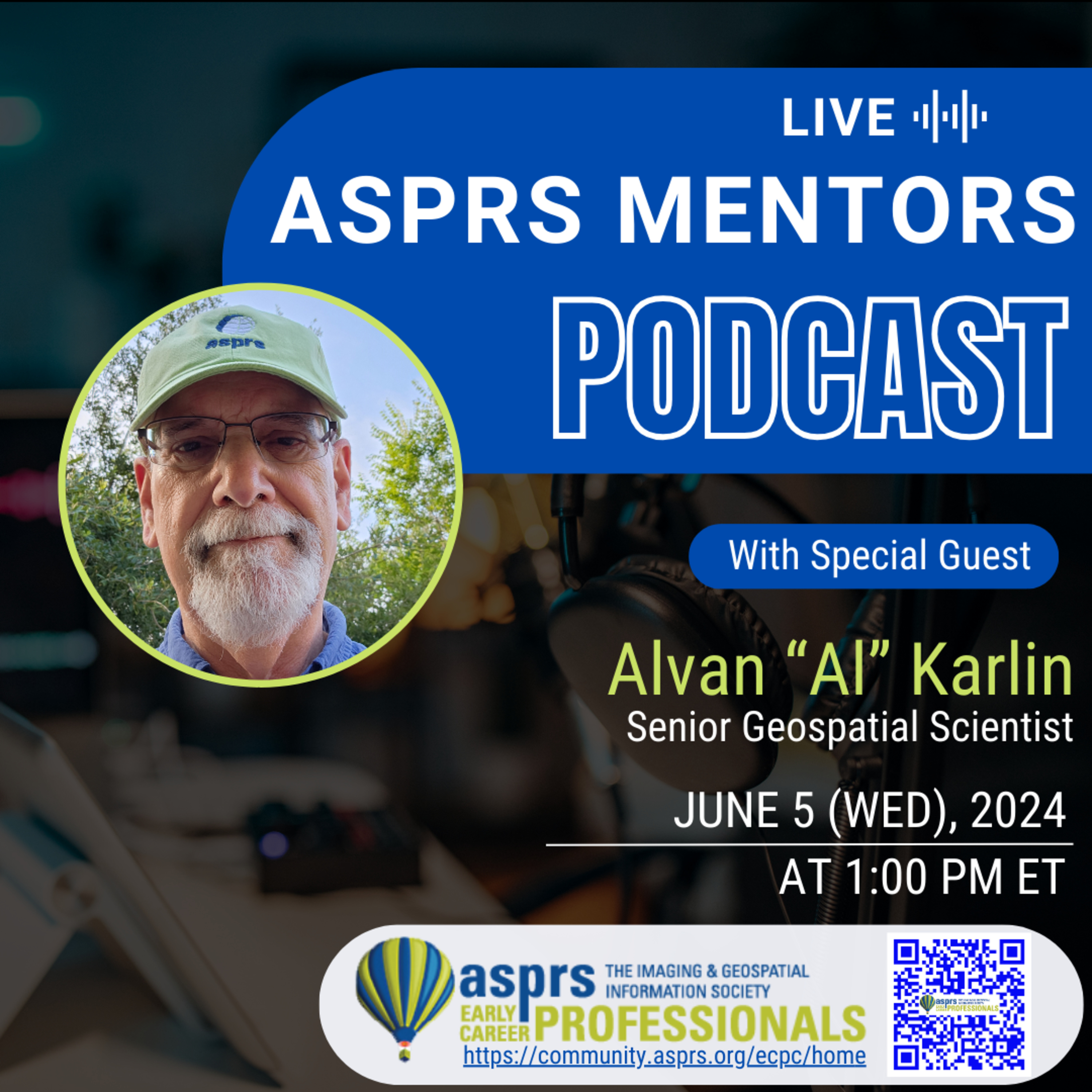
ASPRS Mentors PodcastASPRS ECPC Mentors Podcast - Episode 19, Alvan "Al" KarlinAlvan “Al” Karlin, Ph.D., CMS-L, GISP is a senior geospatial scientist at Dewberry, formerly from the Southwest Florida Water Management District (SWFWMD), where he managed lidar-related projects and Geographic Watershed Information System/Arc Hydro database development in cooperation with the Watershed Management Program. With Dewberry, he serves as a consultant on hydrology, topography, and imagery projects. He is currently the vice president of the ASPRS. In his spare time, he enjoys chasing after salamanders, frogs, lizards, and snakes, as well as, growing tomatoes in his backyard garden.
This podcast is hosted by the ASPRS Early Career Profe...
2024-07-1551 min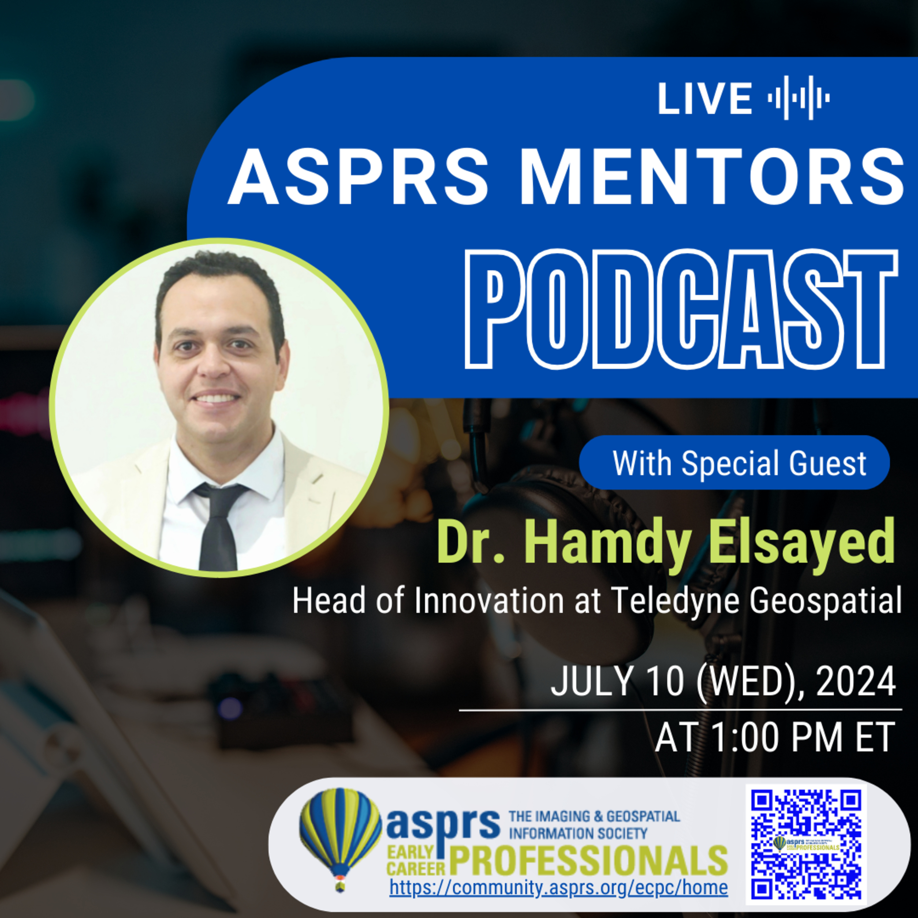
ASPRS Mentors PodcastASPRS ECPC Podcast - Episode 22, Dr. Hamdy ElsayedDr. Elsayed is a distinguished figure in the geospatial industry, currently serving as the Head of Innovation at Teledyne Geospatial in Toronto, Canada. With nearly two decades of experience, Dr. Elsayed has carved out a reputation as a leader in high-tech domains, including Artificial Intelligence (AI), lidar and camera sensor systems, lidar manufacturing, photogrammetry, and lidar data acquisition and processing.Dr. Elsayed's educational background is both diverse and impressive. He holds a bachelor's degree in electrical engineering from Alexandria University, a master’s degree in IT Business Management from The British University in Dubai, and a PhD in Geomatics En...
2024-07-1559 minPodcast304. Geo Week and Reality Capture Network Announce Strategic Partnership; RCN will Host a Dedicated Conference Track at Geo Week in DenverGeo Week and Reality Capture Network Announce Strategic Partnership
Reality Capture Network will host a dedicated conference track at Geo Week in Denver, Colorado
Portland, Maine – Wednesday, July 10, 2024 —The Organizers of Geo Week have announced a strategic partnership to bring a Reality Capture Network (RCN) education track to Geo Week in Denver, Colorado, February 10 to 12, 2025. Geo Week is the leading geospatial, 3D, and built world tradeshow and conference. The Reality Capture Network produces the RCN Podcast and R-CON, an annual event cultivating expert industry knowledge from the brightest innovators in architecture, engineering, construction, surveying, and mapping.
2024-07-1006 min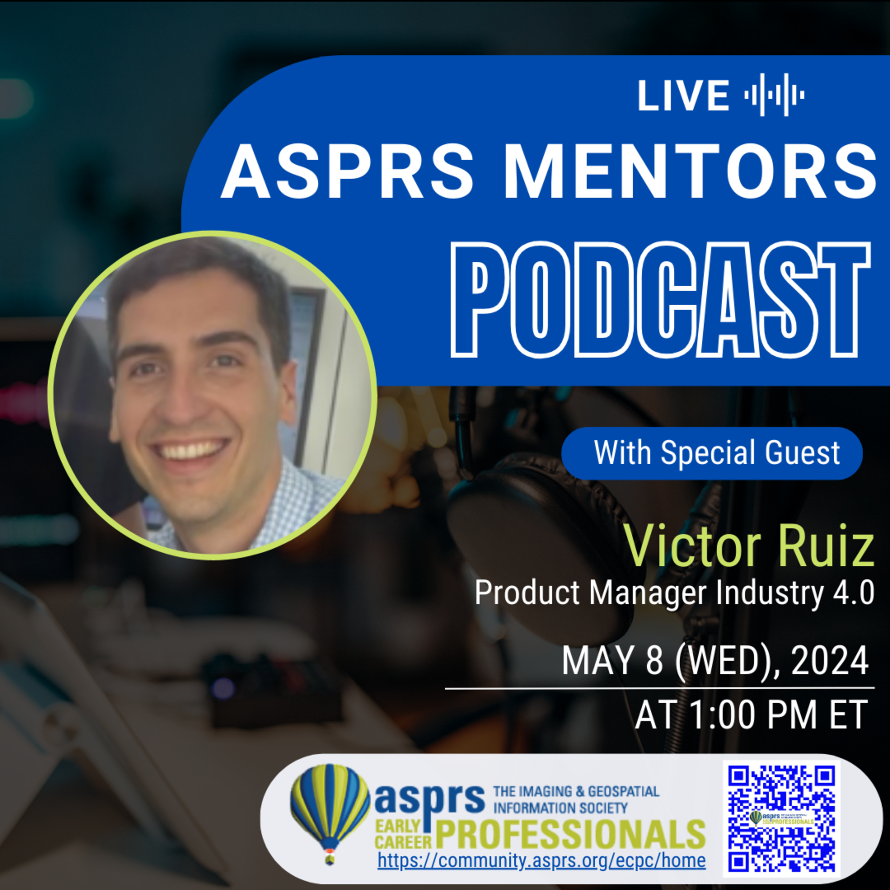
ASPRS Mentors PodcastASPRS ECPC Mentors Podcast - Episode 18, Victor RuizVictor is a Spanish Geomatics Engineer based in Western Canada currently working as Product Manager at Cintoo, leading Industry 4.0 Roadmap and implementations. With 15+ years of experience in technology delivery, Victor has been a driving force in the geomatics sector, utilizing advanced technology for reality capture projects across Europe and North America. For half of his career, he has focused on optimizing geospatial datasets through cloud-based solutions, providing asset visualization, facilitating cloud-based collaboration, and developing digital twin solutions for strategic pursuits and projects on a global scale. Victor brings enthusiasm for innovation and driving project success.
This podcast is hosted...
2024-05-1754 min
ASPRS Mentors PodcastASPRS ECPC Mentors Podcast - Episode 17, Dr. Francois G. F. SmithDr. Smith currently holds the position of Distinguished Member of Technical Staff at Maxar Intelligence Inc. He began working at the South Carolina Dept of Natural Resources while studying at the University of SC under John R. Jensen in the mid 90’s. At DNR he specialized in deriving land cover, bathymetry, and mapping and monitoring specific habitats from satellite and airborne imagery. Upon completion of a Ph.D. in Remote Sensing from the Geography program, he was hired at EarthSat in 1999, a small remote sensing company in the Washington D.C. area which was then purchased by MDA, and ev...
2024-05-171h 06
ASPRS Mentors PodcastASPRS ECPC Mentors Podcast - Episode 16, Mike Zoltek & Danielle BlanchardHave you ever thought about getting certified with ASPRS as a Photogrammetrist, Mapping Scientist, or Technologist? Do you want to distinguish yourself amongst peers and open doors to future opportunities? Do you have questions about the ASPRS certification process?
If you answered yes, watch this episode, with special guests Mike Zoltek, PLS, CP, GISP, CFedS, PMP and Danielle Blanchard for a deep dive on all things ASPRS certification.
This podcast is hosted by the ASPRS Early Career Professional Council Officers, Greg Stamnes and Jordan Hicks.
Learn more about the American Society for Photogrammetry and Remote Sensing...
2024-05-1753 min
ASPRS Mentors PodcastASPRS ECPC Mentors Podcast - Episode 15, Dr. Riadh MunjyDr. Munjy is a professor emeritus from California State University, Fresno, and an expert in accident reconstruction using photogrammetry, aerial triangulation, close-range photogrammetry, digital terrain mapping, Geographic Information Systems (GIS), mapping sensors modeling and calibration, photogrammetric algorithm development, soft copy photogrammetry, and Unmanned Aerial Systems (UAS) mapping.
Dr. Munjy has been a member of the ASPRS since 1978, has contributed significantly to the development of the Positional Accuracy Standards for Digital Geospatial Data, and has received numerous ASPRS and academic awards.
This podcast is hosted by the ASPRS Early Career Professional Council Officers, Greg Stamnes and Jordan Hicks.
2024-05-171h 01
ASPRS Mentors PodcastASPRS ECPC Mentors Podcast - Episode 14, Farrah Etcheverry
Farrah is a surveyor in training and co-owner of Etcheverry Land Surveying, based out of northern Arizona. Farrah is currently a senior at East Tennessee State University where she is studying Land Surveying and Mapping. Farrah has spent the last many years working alongside her father, Martin (PLS) doing a wide range of survey work both in her home state of Arizona and in Hawaii. She is a founding member of Arizona’s new Young Surveyors Network and is passionate about education and advocacy for young surveyors. She has worked hard to begin important conversations about inclusivity in the fi...
2024-05-1749 min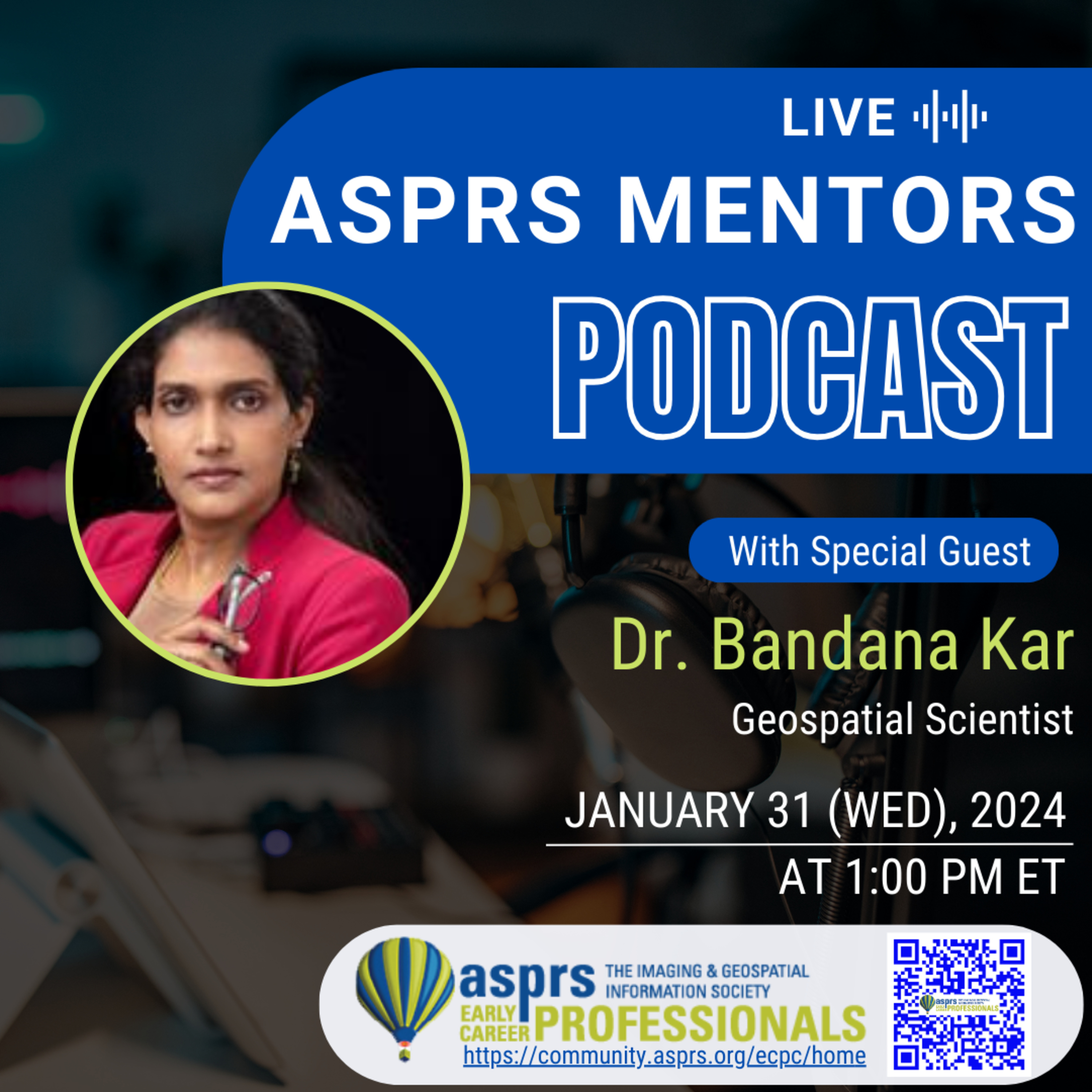
ASPRS Mentors PodcastASPRS ECPC Mentors Podcast - Episode 13, Bandana KarBandana Kar is a geospatial scientist with 15+ years of experience (academia, national laboratory) and has received $12+ million in funding to develop risk-informed solutions to improve energy and climate resilience of communities and cities. As a fellow, she contributed to the OSTP’s Subcommittee on Social and Behavioral Sciences’ Science Says Document on Hazard and Uncertainty Communication and Blueprint for the Use of Social and Behavioral Science to Advance Evidence-Based Policymaking.
She was a 2009 NSF’s Enabling the Next Generation of Hazards and Disasters Researchers fellow and 2019 Emerging Scholar Award recipient (American Association of Geographers). She is the President-Elect, American Societ...
2024-05-1738 min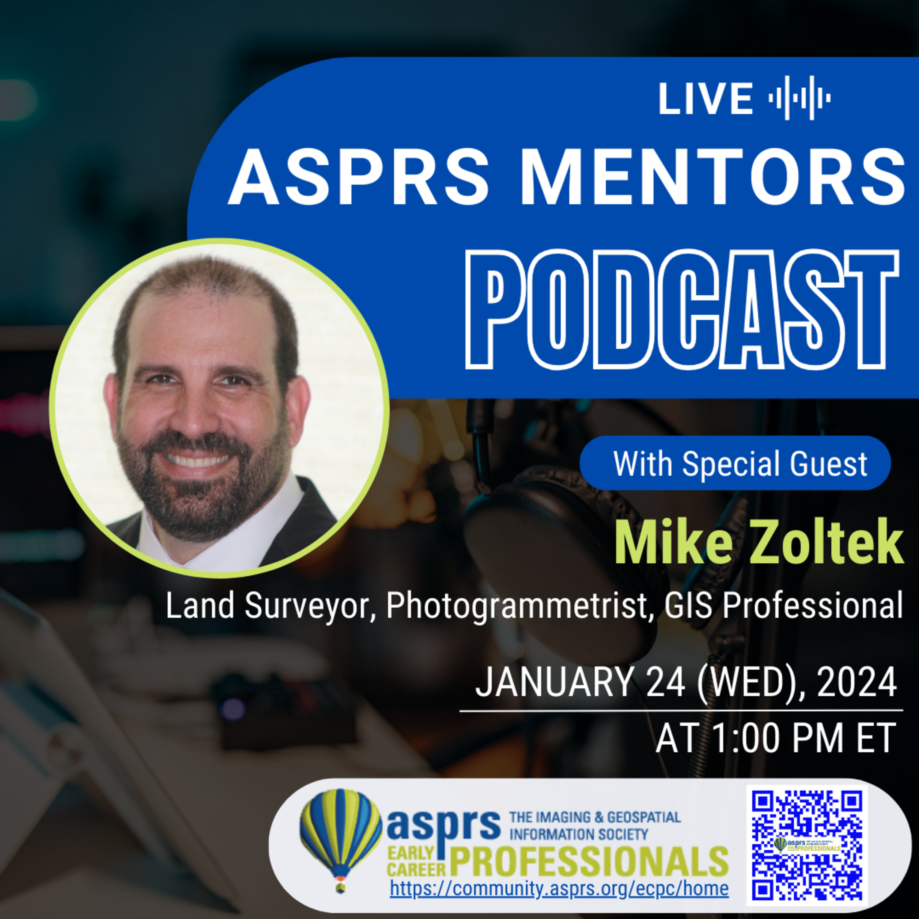
ASPRS Mentors PodcastASPRS ECPC Mentors Podcast - Episode 12, Mike Zoltek
Mike Zoltek, PLS, CP, GISP, CFedS, PMP is a land surveyor, photogrammetrist, and GIS professional with over 30 years of geospatial experience. As the National Geospatial Program Director at GPI Geospatial, Inc (GPI), Mike is responsible for the coordination, execution, and supervision of projects for local, state, federal, DOT, and private clients. He brings to clients a comprehensive background in surveying and mapping, which includes data collection and processing, project management, and QA/QC coordination.
A licensed surveyor who holds active Surveying/Photogrammetry registrations in 26 states Mike has extensive experience in a variety of Surveying & Mapping tasks for Departments of...
2024-05-1743 min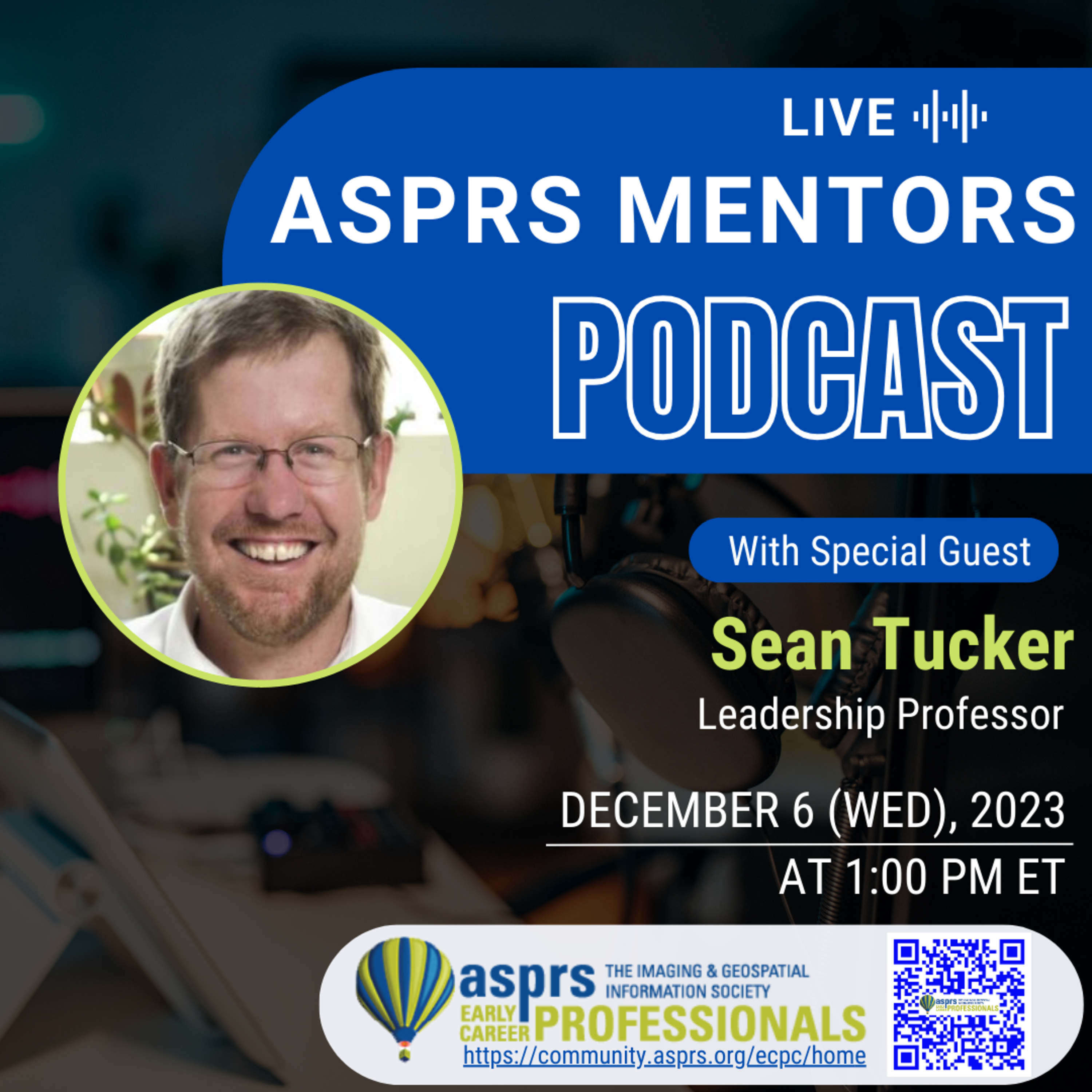
ASPRS Mentors PodcastASPRS ECPC Mentors Podcast - Episode 11, Sean TuckerSean is a Professor in the Faculty of Business Administration at the University of Regina and a Sessional Lecturer in the School for Population and Public Health at UBC. He teaches and researches leadership.
This podcast is hosted by the ASPRS Early Career Professional Council Officers, Youssef Kaddoura and Greg Stamnes.
Learn more about the American Society for Photogrammetry and Remote Sensing (ASPRS)!
Website: https://www.asprs.org
LinkedIn: https://www.linkedin.com/company/asprs
Facebook: https://www.facebook.com/ASPRS.org
ASPRS - Early Career Professionals Council (ECPC)
Website: https://community.asprs.org/ecpc
Link...
2024-05-1755 min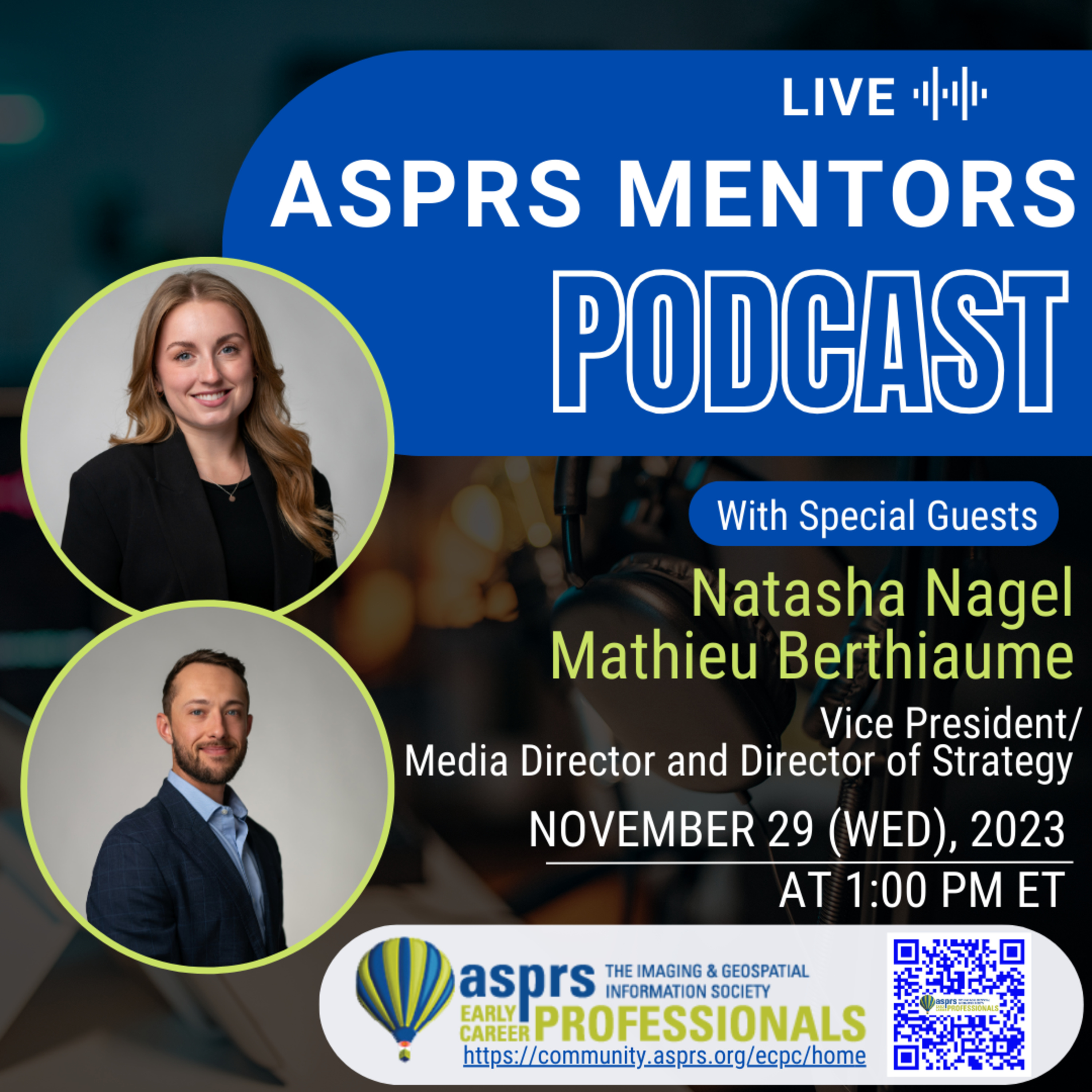
ASPRS Mentors PodcastASPRS ECPC Mentors Podcast - Episode 10, Natasha Nagel & Mathieu BerthiaumeNatasha brings an extensive educational background in psychology and marketing. As Media Director, she has been the driving force behind creating media strategies with impact. Client-driven and passionate about learning,
she makes sure that the complex world of media is presented in a simple way that makes sense. She’s passionate about improving community
well-being through strategic partnerships with media vendors.
With a passion for blending business acumen with creative strategies, Matt really has the one-two punch. He holds a Bachelor’s degree in
Business Administration from the University of Regina, complemented by a Project Management Professional (PMP) designation that...
2024-05-1759 min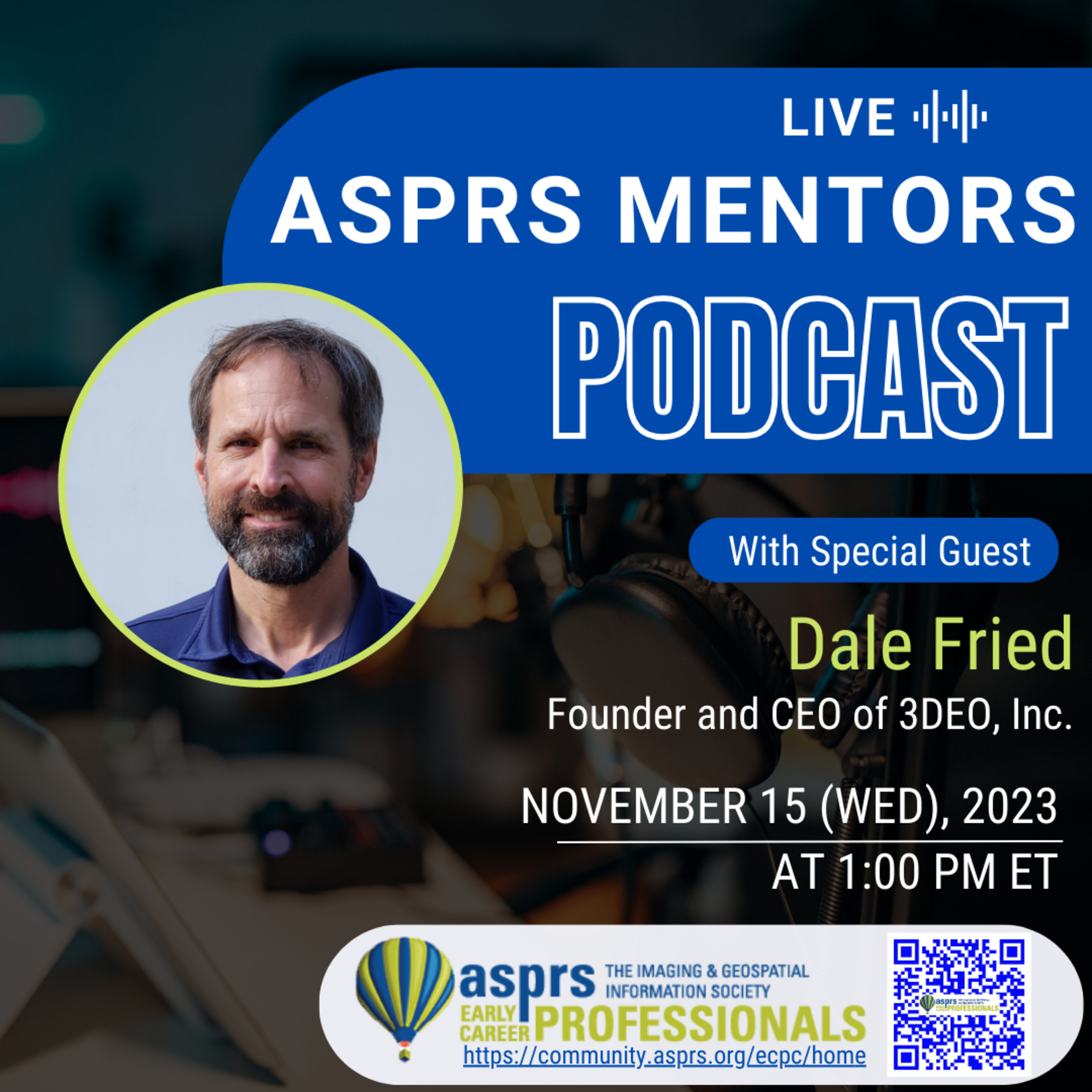
ASPRS Mentors PodcastASPRS ECPC Mentors Podcast - Episode 9, Dale FriedDale Fried is the founder and CEO of 3DEO, Inc., an MIT spinout company whose mission is to bring the power of Geiger-mode lidar technology into widespread use. After a decade developing advanced lidars at MIT Lincoln Lab, Dr. Fried founded 3DEO in 2014 and has been growing the company organically with a highly skilled and dedicated team of scientists and engineers.
This podcast is hosted by the ASPRS Early Career Professional Council Officers, Youssef Kaddoura and Greg Stamnes.
Learn more about the American Society for Photogrammetry and Remote Sensing (ASPRS)!
Website: https://www.asprs.org
LinkedIn: ht...
2024-05-1745 min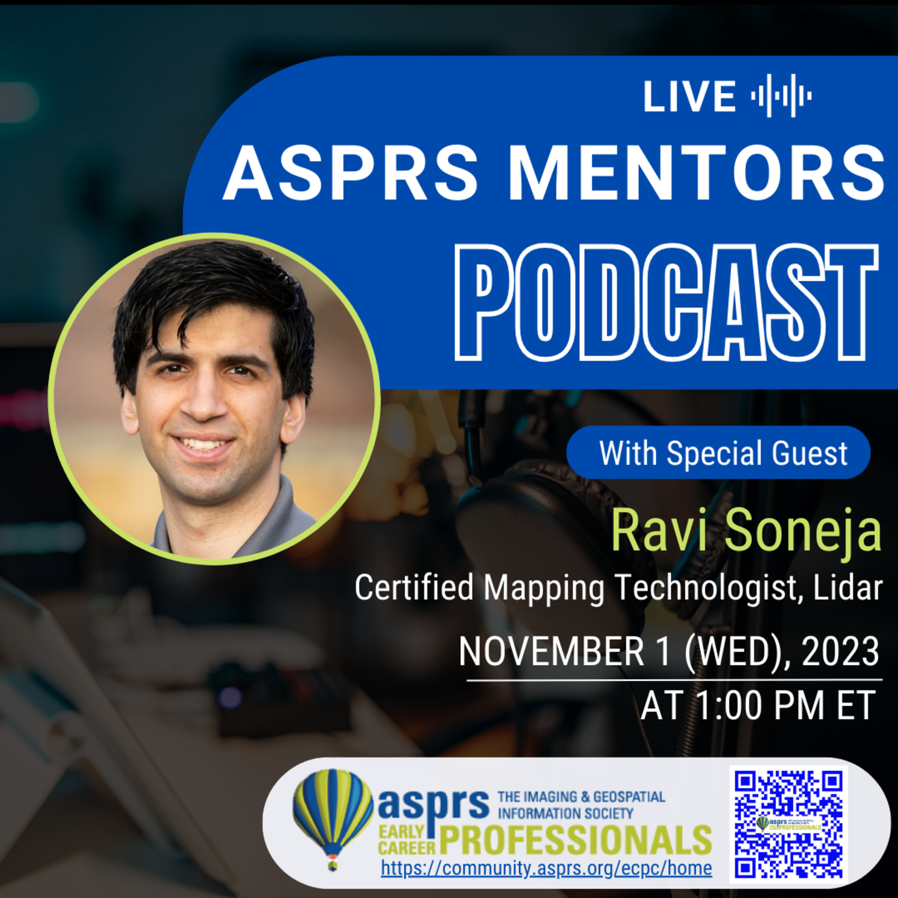
ASPRS Mentors PodcastASPRS ECPC Mentors Podcast - Episode 8, Ravi SonejaRavi is based in Raleigh, NC and highly experienced in the acquisition and processing of airborne lidar particularly with unmanned airborne vehicles or drones. He has worked on a wide variety of mapping projects utilizing an understanding of USGS Lidar Base Specifications as well as ASPRS Positional Accuracy Standards (2014). Ravi has extensive experience in acquisition planning, survey control configuration, lidar & imagery acquisition, lidar calibration, pre/post-processing, and final deliverables. Ravi is highly invested in continual improvement through R&D efforts to push the boundaries and set new standards for data acquisition and quality. Ravi is a Certified Mapping Technologist...
2024-05-1747 min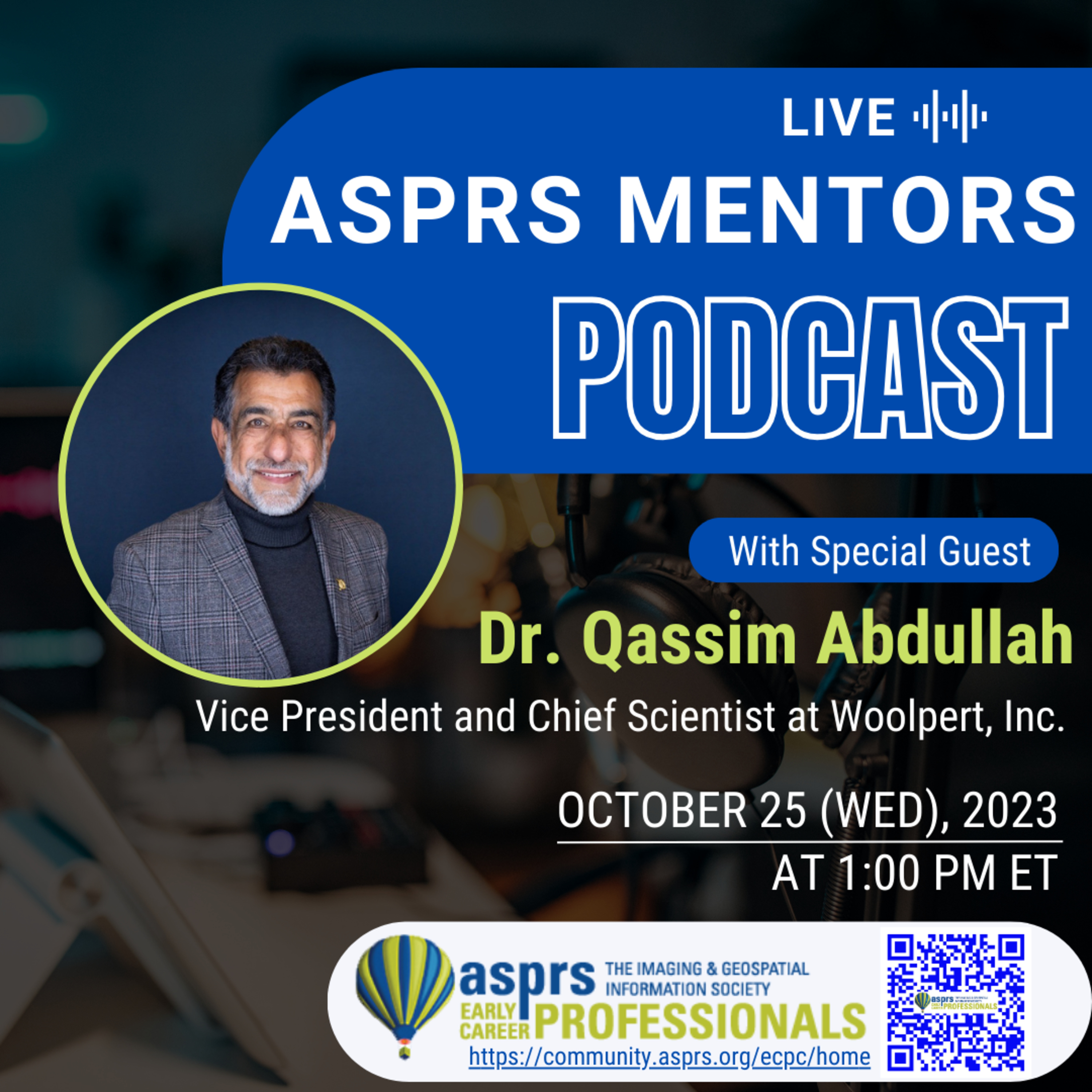
ASPRS Mentors PodcastASPRS ECPC Mentors Podcast - Episode 7, Dr. Qassim AbdullahDr. Qassim Abdullah is an accomplished scientist with more than 40 years of combined industrial, research and development, and academic experience in analytical photogrammetry, digital remote sensing, and civil and surveying engineering. Currently, Qassim is a lead research scientist and a member of the Woolpert Labs team. His latest accomplishments include evaluating and introducing the Geiger and single photon lidar to the geospatial industry and leading Woolpert research activities in the field of Unmanned Aerial System (UAS), its sensor calibration, and its workflow development. Qassim publishes a monthly column “Mapping Matters,” in the American Society for Photogrammetry and Remote Sensing (ASPR...
2024-05-1740 min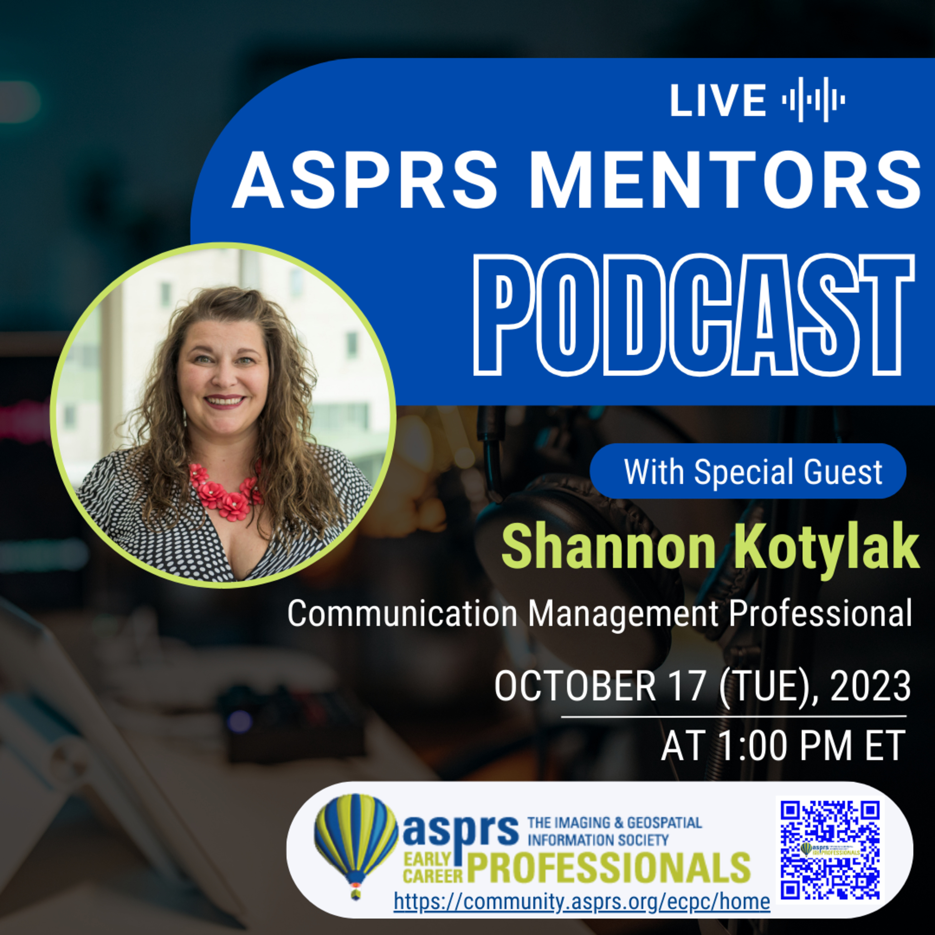
ASPRS Mentors PodcastASPRS ECPC Mentors Podcast - Episode 6, Shannon KotylakShannon has been in the communications and marketing field for almost two decades (obviously having started as a child), and she currently brings her love of Oxford commas and em dashes to Saskatchewan Polytechnic where she is a Program Head of their Bachelor of Applied Management (BAMgt) program and an instructor in Communication and Marketing. She is also certified as a Communication Management Professional® through the GCCC and is always willing to talk to others about the process. She holds a Master's degree in Administration, specializing in organizational leadership which has helped to hone her strategic focus and solution-oriented t...
2024-05-1733 min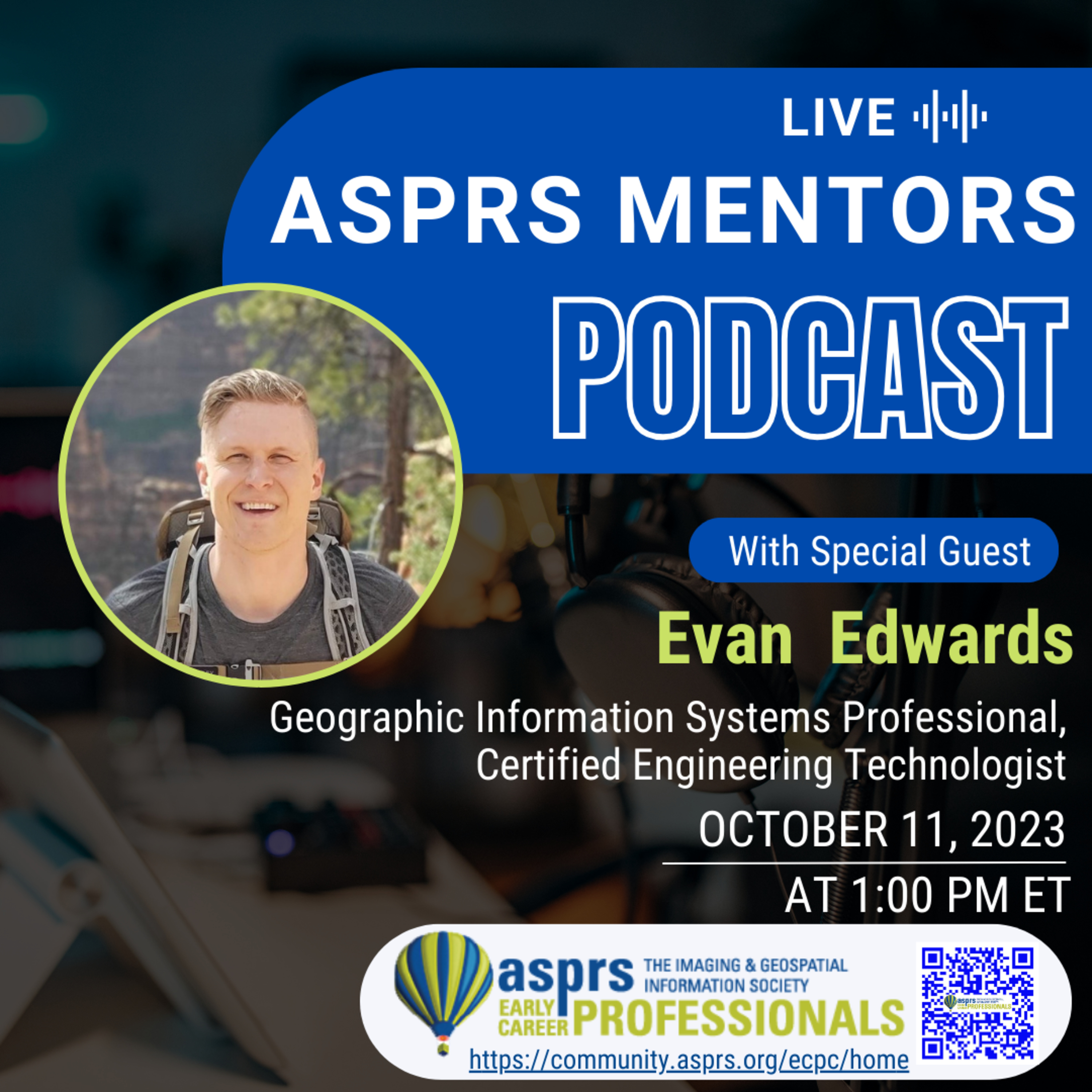
ASPRS Mentors PodcastASPRS ECPC Mentors Podcast - Episode 5, Evan EdwardsEvan Edwards has 15 years of experience managing and creating GIS products. He has worked with Government, Defense, Engineering, Surveying and Pipeline organizations. He obtained his B.A. in Geomatics from Carleton University in Ottawa. Currently working for Trans Mountain, Evan's main focus within the GIS realm has shifted to system architecture, database administration, Enterprise GIS deployment, ETL automation and pipeline referencing. Evan is a Certified Engineering Technologist with the Alberta Association of Science and Engineering Technology (ASET) and GIS Professional with the GIS Certification Institute (GISCI). Evan is also a new member of ASPRS and looking forward to contributing...
2024-05-1730 min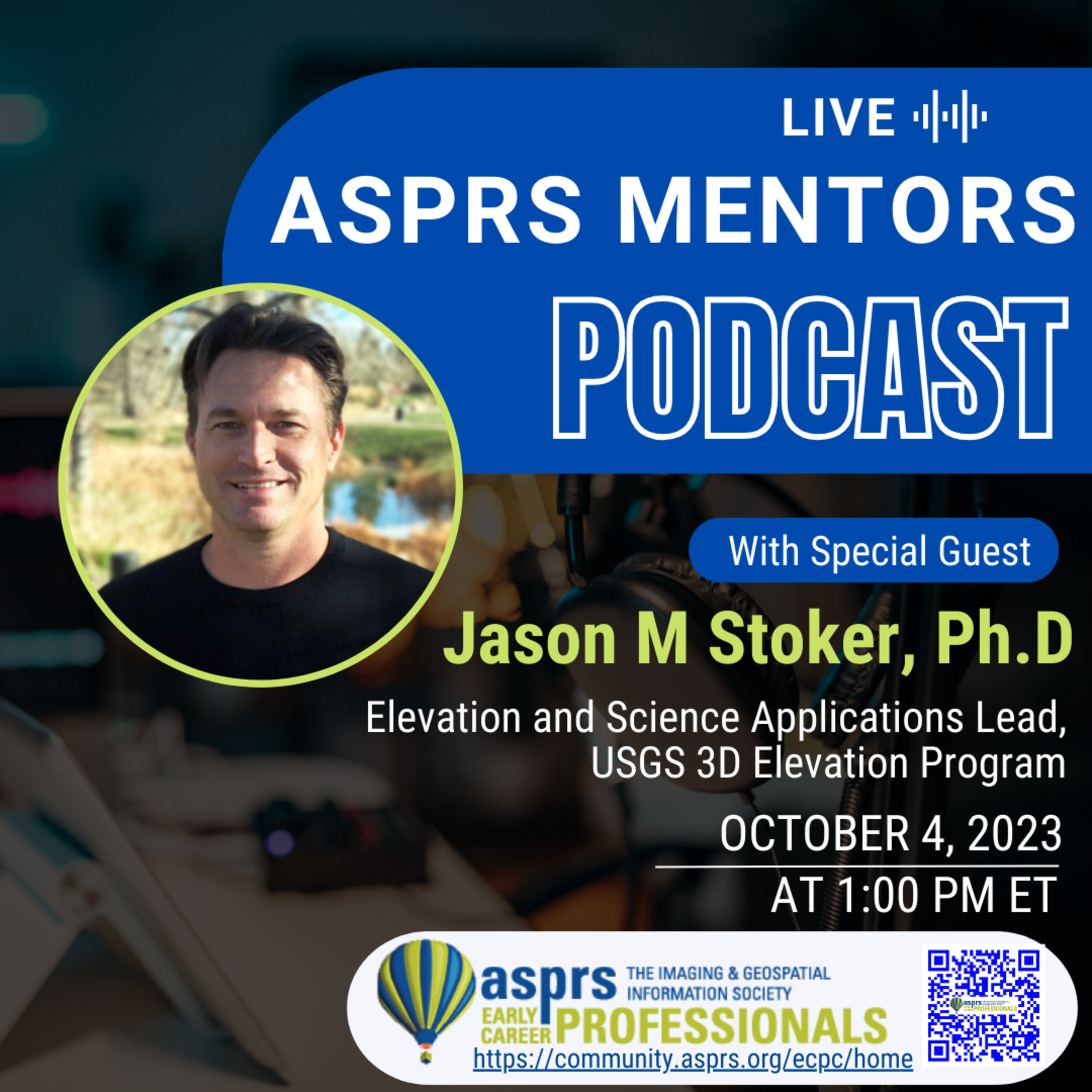
ASPRS Mentors PodcastASPRS ECPC Mentors Podcast - Episode 4, Jason StokerDr. Jason Stoker oversees strategic planning, development and coordination of the 3D Elevation Program and science and application related data, tools, and services. Jason provides technical expertise, prepares roadmaps, and plans for elevation products and services, and helps determine the long-term vision for 3DEP products and services.
This podcast is hosted by the ASPRS Early Career Professional Council Officers, Youssef Kaddoura and Greg Stamnes.
Learn more about the American
Society for Photogrammetry and Remote Sensing (ASPRS)!
Website: https://www.asprs.org
LinkedIn: https://www.linkedin.com/company/asprs
Facebook: https://www.facebook.com/ASPRS.org...
2024-05-1734 min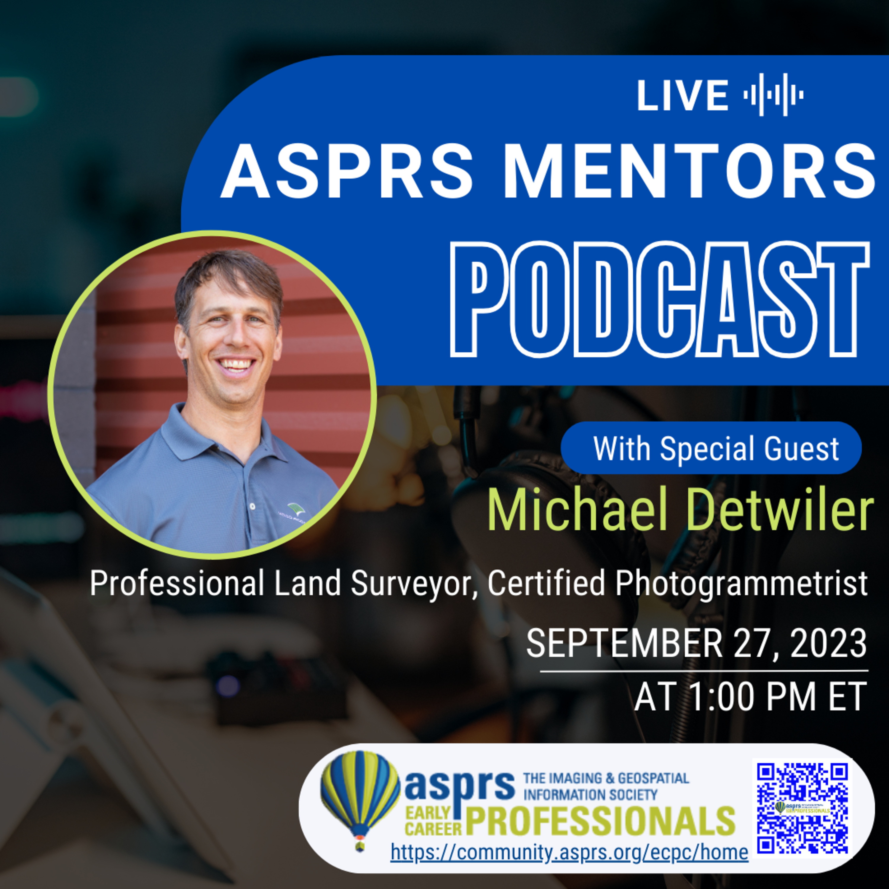
ASPRS Mentors PodcastASPRS ECPC Mentors Podcast - Episode 3, Michael DetwilerMichael Detwiler has worked in the land surveying and geospatial profession for 20 years, working in the private sector on projects ranging from land development, mining, transportation, and utility infrastructure. Michael is a Professional Land Surveyor and Certified Photogrammetrist, having performed aerial mapping projects by airplane, helicopter, and drone in about half of the U.S. States as well as Europe, the Middle East, and Australia. Initially earning a B.S. in Geography from the University of Arizona, 10 years later deciding to do it all over again and earn an M.S. in Geomatics from the University of Florida. Michael...
2024-05-1737 min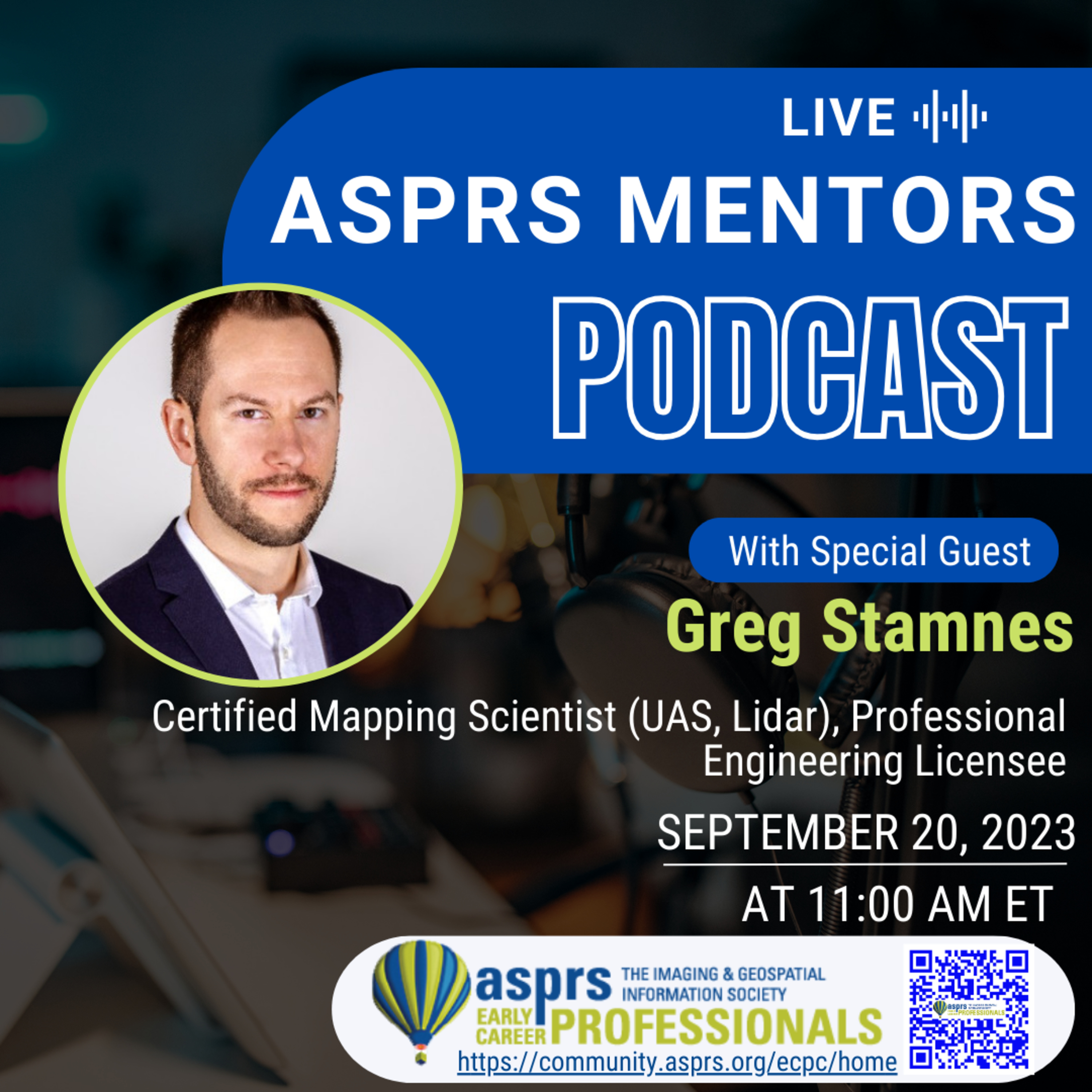
ASPRS Mentors PodcastASPRS ECPC Mentors Podcast - Episode 2, Greg StamnesGreg is an Applied Science Technologist, Certified Mapping Scientist (UAS, Lidar), and Engineering Licensee based in Saskatoon, SK, Canada. He currently works as the Informatics Manager for the Water Security Agency of Saskatchewan. His career path began in the CAD program in Moose Jaw’s Saskatchewan Polytechnic but after 2 semesters of computer work, he decided to transition to the geomatics program to experience the great outdoors. After a work term in North West Alberta that included ATV’s and frequently narrowly being consumed by bears, he knew geomatics was a perfect fit. Since completing his diploma in geomatics Greg has...
2024-05-1731 min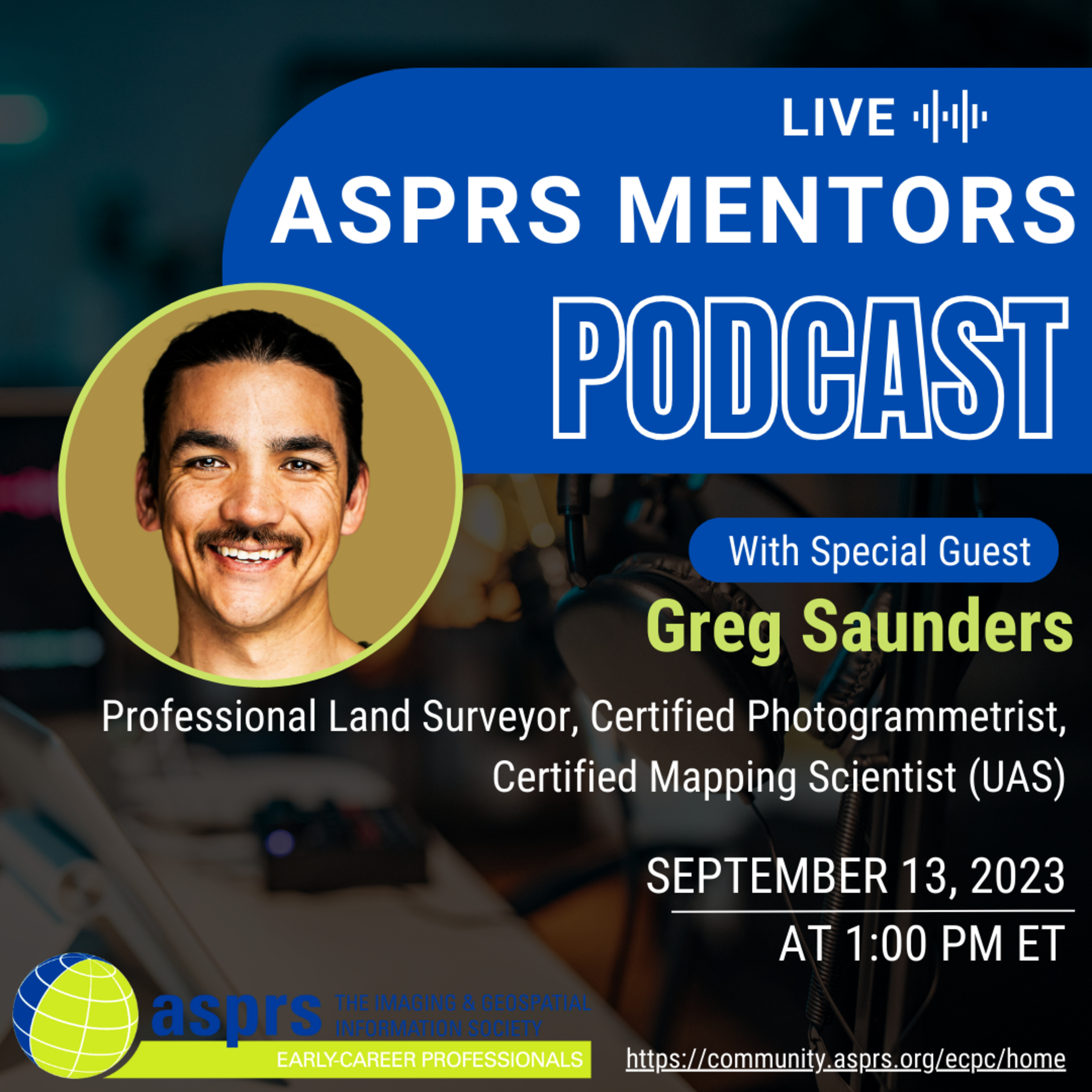
ASPRS Mentors PodcastASPRS ECPC Mentors Podcast - Episode 1, Greg SaundersGreg is a Professional Licensed Surveyor in the state of Nevada, Certified Photogrammetrist, and Certified Mapping Scientist (UAS). He currently works as at DOWL as a Remote Sensor and Surveyor. His career path started with obtaining Bachelor’s of Science in Geological Engineering from the University of Nevada Reno. From there he completed a Masters of Science in Geohazards from the University of Oslo, Norway. His thesis focused on monitoring landslide prone areas with photogrammetric methods. This led him to a job at the Nevada Department of Transportation where he worked to help build a UAV mapping program off th...
2024-05-1740 min
Your Drone Questions. Answered.YDQA: Ep 42 - "Is mm level accuracy possible when surveying railroad tracks with a drone?"Welcome back to another episode of "Your Drone Questions Answered" with John Dickow from Drone Launch Academy. Today's question comes from a client dealing with construction near railway lines, seeking precise measurements to ensure track stability during excavation. The client currently uses Trimble Total Station devices and wonders if drones could provide the required millimeter-level accuracy. Zachary Riddell, Southwest Business Development Manager and Certified Mapping Specialist at Cooper Aerial, joins the discussion.Zachary shares insights into the challenges of achieving millimeter accuracy with drones due to factors like motion, sensor limitations, and airborne GPS. He emphasizes...
2023-12-2709 minThe GeoholicsEpisode 159 - Bill Swope, CP & Cody Condron, RPLS, PLS, CP, CMSIf you like to hear really smart people (excluding PS & DD) with common sense (including PS & DD) talk about all facets of mapping...this episode is for you! The guys were joined this week by Bill Swope, CP the Geospatial & Survey Business Development Manager at Halff Associates, Inc. AND Cody Condron, RPLS, PLS, CP, CMS (new record for professional acronyms) the Regional Practice Leader for Texas Land Surveying at KCI Technologies, Inc. Some of the topics discussed include ASPRS, mapping standards, "no rules for tools", different types of photogrammetry, keeping up with technology and understanding its limitations and taming...
2023-01-241h 36Podcast160. All Systems Launched – Geo Week 2023 Announces Five Strategic Event Partnerships | Feb. 13-15, 2022 | DenverPortland, Maine, USA – Tuesday, December 13, 2022 - Organizers of Geo Week, the premier event that champions the coming together of geospatial technologies and the built world, have announced five strategic partnerships established for the 2023 event.
As part of this collaboration, the following will actively participate in Geo Week, taking place February 13-15, 2023, in Denver, Colorado, USA:
1. ASPRS (American Society for Photogrammetry and Remote Sensing)
2. ISPRS (International Society for Photogrammetry and Remote Sensing)
3. MAPPS (Management Association for Private Photogrammetric Surveyors)
4. USIBD (United States Institute for Building Documentation), and
5. WGIC (The World Geospatial Industry Council...
2022-12-1310 min
Digitalizados#61 Fotogrametría y programación del cerebroGustavo Olague es investigador del Centro de Investigación Científica y de Educación Superior de Ensenada. Gustavo nos comparte su experiencia en reconocimiento de patrones, computación genética y evolutiva y el concepto de “Brain programming” que su equipo ha acuñado. Basado en estas técnicas Gustavo ha realizado importantes contribuciones en fotogrametría por medio de la transformación proyectiva y la geometría no euclidiana. Igualmente, Gustavo nos comparte la relación entre la evolución artificial y la teleología.Gustavo Olague (Senior Member, IEEE) nació en Chihuahua, México, en 1969. Ob...
2022-11-041h 07Podcast62. GeoWeek 2022 Brings the Geospatial and Built Worlds Together In-Person, Exceeds ExpectationsGeo Week 2022 Brings the Geospatial and Built Worlds Together In-Person, Exceeds Expectations
Nearly 1,900 professionals gathered in-person; show floor completely sold out
Denver, Colorado, Tuesday, February 15, 2022: Geospatial and built world professionals gathered last week for Geo Week, held February 6-8, 2022 at the Colorado Convention Center in Denver.
Geo Week is the coming together of former stand-alone events AEC Next Technology Expo & Conference, International Lidar Mapping Forum, and SPAR 3D Expo & Conference, and powerful partnership events including ASPRS Annual Conference, MAPPS Annual Conference and USIBD Annual Symposium.
Geo Week had a sold-out exhibit hall floor featuring...
2022-02-1507 min
The "SmallsCast" PodcastThe Smalls are attending GEO WEEK!Listen in as your host Just Nate and host DK discuss all the great and exciting things going on at GEO WEEK up in Denver, CO.
About Geo Week
Imagine a single powerhouse event that champions the coming together of geospatial technologies and the built environment. Where professionals from a range of disciplines network and gain insight into the increasing confluence of their worlds. Where cutting-edge technology offers new possibilities, improved efficiencies, and better outcomes. And where education opens the door to the future just ahead.
AEC Next Technology Expo & Conference, International Lidar...
2022-02-0714 minPodcast37. Geo Week Exhibit Floor Sold Out: Live Event Going Forward Feb 6-8, 2022Geo Week 2022 Exhibit Floor is Sold Out & Live Event Going Forward Feb 6-8, 2022 in Denver
140+ geospatial and built world technology solutions providers to exhibit at Geo Week
PORTLAND, MAINE – USA – Monday, January 24, 2022 – Organizers of Geo Week, the single powerhouse event that champions the coming together of geospatial technologies and the built world, have announced that the show floor is officially sold out.
An impressive list of more than 140+ exhibitors from around the globe will exhibit at the 2022 event, which will take place in person February 6th – 8th, 2022 at the Colorado Convention Center, Denver CO.
“Afte...
2022-01-2411 min
A VerySpatial Podcast | Discussions on Geography and Geospatial TechnologiesA VerySpatial Podcast - Episode 676News: GEOINT News: NGA plans annual reassessment of commercial remote sensing NRO issues BAA call for commercial remote sensing technologies Preview of NASA'a VIPER Lunar Rover Vautrin Lud Geography Prize goes to geographer from the National University of Singapore Topic: Geo certificates revisited GeoEdC Certification NatGeo Certification ASPRS Certifications GISP Certification GeoINT Certification RGS Chartered Geographer Events: DH2022: 25-29 July, Tokyo
2021-10-2253 minA VerySpatial Podcast | Discussions on Geography and Geospatial TechnologiesA VerySpatial Podcast - Episode 676News: GEOINT News: NGA plans annual reassessment of commercial remote sensing NRO issues BAA call for commercial remote sensing technologies Preview of NASA'a VIPER Lunar Rover Vautrin Lud Geography Prize goes to geographer from the National University of Singapore Topic: Geo certificates revisited GeoEdC Certification NatGeo Certification ASPRS Certifications GISP Certification GeoINT Certification RGS Chartered Geographer Events: DH2022: 25-29 July, Tokyo
2021-10-2253 min
A VerySpatial Podcast | Discussions on Geography and Geospatial TechnologiesA VerySpatial Podcast - Episode 661News: Perseverance! India launches Amazonia 1 satellite for Brazil Canon built a smallsat for advertising (and research) Atlas of the Human Planet iOS beta gets crowdsourced info QGIS 3,18 released ArcGIS platform GeoWeek 2022 Advisory board Next step in (counter)Ligado stuff Cool Stuff http://radio.garden/ Events corner NCGIS 2021 presentations up on YouTube soon ASPRS 2021: March 29-April 2, virtual GISPro 2021: 3-6 Oct, Baltimore, Abstracts due March 31
2021-03-0138 minA VerySpatial Podcast | Discussions on Geography and Geospatial TechnologiesA VerySpatial Podcast - Episode 661News: Perseverance! India launches Amazonia 1 satellite for Brazil Canon built a smallsat for advertising (and research) Atlas of the Human Planet iOS beta gets crowdsourced info QGIS 3,18 released ArcGIS platform GeoWeek 2022 Advisory board Next step in (counter)Ligado stuff Cool Stuff http://radio.garden/ Events corner NCGIS 2021 presentations up on YouTube soon ASPRS 2021: March 29-April 2, virtual GISPro 2021: 3-6 Oct, Baltimore, Abstracts due March 31
2021-03-0138 min
3DMetrica | Rilievi e TopografiaEP107 - Quanti GCP per un rilievo aerofotogrammetrico? - con Mirko SaponaroQuanti GCP servono per un rilievo aerofotogrammetrico?
È una domanda frequente.
E la risposta non è banale.
Ne parliamo in questa puntata insieme a Mirko Saponaro, del Politecnico di Bari, commentando e scorrendo un articolo che ha pubblicato e riguarda proprio il legame tra l'accuratezza di un rilievo aerofotogrammetrico/Structure from Motion e il numero di GCP (Ground Control Point) usati nell'ottimizzazione dell'allineamento della nuvola sparsa.
Ecco qui sotto alcune risorse che Mirko mi ha condiviso.
ASPRS 2015:
https://www.asprs.org/a/society/committees/standards/Positional_Accuracy_Standards.pd...
2020-09-2959 min
A VerySpatial Podcast | Discussions on Geography and Geospatial TechnologiesA VerySpatial Podcast - Episode 643News: China introduces Terry-Cotta SpaceX Dragon successfully launches manned mission and docks with ISS China launches multiple satellites, including Gaofen-9 remote sensing satellite Largest and oldest Mayan monument discovered Topic: Kevin Ring of Cesium talks about the development of CesiumJS and the recent release of Cesium OSM Buildings Cool Stuff: NAACP: A Century in the Fight for Freedom Talking About Race Events Corner: ASPRS 2020 going virtual:June 22-25 ENVI Analytics Symposium: August 25-27 Commercial UAV Expo Americas going virtual: Sept 15-17 Applied Geography Conference: October 18-20 - Ab...
2020-06-0937 minA VerySpatial Podcast | Discussions on Geography and Geospatial TechnologiesA VerySpatial Podcast - Episode 643News: China introduces Terry-Cotta SpaceX Dragon successfully launches manned mission and docks with ISS China launches multiple satellites, including Gaofen-9 remote sensing satellite Largest and oldest Mayan monument discovered Topic: Kevin Ring of Cesium talks about the development of CesiumJS and the recent release of Cesium OSM Buildings Cool Stuff: NAACP: A Century in the Fight for Freedom Talking About Race Events Corner: ASPRS 2020 going virtual:June 22-25 ENVI Analytics Symposium: August 25-27 Commercial UAV Expo Americas going virtual: Sept 15-17 Applied Geography Conference: October 18-20 - Ab...
2020-06-0937 min
Harnessing Aerial - Drone PodcastDrone Based LiDAR vs Photogrammetry- Industry Use Cases, Equipment Considerations, & More with Dan Hubert of MODUSQuestions- (1:20) Tell us about your background in Aviation and UAVs from your time in the Navy & Army. (6:04) What does your company MODUS specialize in? (8:30) What is LiDAR and how does it work? (11:18) What industries are you seeing Drone Based LiDAR being used in? (15:50) What are the key factors you should be considering when acquiring a LiDAR sensor? (18:05) What are some scenarios that LiDAR is best to use over photogrammetry? (23:00) Is the added cost of LiDAR worth it if you are currently using ground control points...
2020-05-2736 min
The Orbital Mechanics PodcastEpisode 253: LacklusterSpaceflight news— Artemis-1 Orion tests complete (spacenews.com) (americaspace.com) — Ships to KSC March 23 (twitter.com/NASAKennedy) — Cubesat ridealongs (en.wikipedia.org)Short & Sweet— L3Harris wins NASA contract for LISA observatory. (nasa.gov) (Our interview on the LISA Pathfinder: theorbitalmechanics.com)— Long March 7A is unsuccessful. (spaceflightnow.com)— SpaceX launches Darksat, with lackluster results. (spacenews.com) (arxiv.org) (PDF: arxiv.org)Questions, comments, corrections— ICPS, not IUS (twitter.com/Jeff_Snively)— From the intro: OneWeb considers bankruptcy (bloomberg.com)This...
2020-03-2442 min
A VerySpatial Podcast | Discussions on Geography and Geospatial TechnologiesA VerySpatial Podcast - Episode 633News: CES2020 Here's 3D models help cars Concerns about satellite constellations impacting astronomy Landsat 9 sensors ready, launch at the end of 2020 Topic: Why you should understand coding and programming (even if you aren't planning to) Web Corner: Turn by turnables Events Corner: Hexagon Tour & Live GeoWeek 2020 - ASPRS, ILMF, & MAPPS GISPro 2020
2020-01-1444 minA VerySpatial Podcast | Discussions on Geography and Geospatial TechnologiesA VerySpatial Podcast - Episode 633News: CES2020 Here's 3D models help cars Concerns about satellite constellations impacting astronomy Landsat 9 sensors ready, launch at the end of 2020 Topic: Why you should understand coding and programming (even if you aren't planning to) Web Corner: Turn by turnables Events Corner: Hexagon Tour & Live GeoWeek 2020 - ASPRS, ILMF, & MAPPS GISPro 2020
2020-01-1444 minSue – VerySpatialA VerySpatial Podcast – Episode 531A VerySpatial Podcast
Shownotes – Episode 531
8 November 2015
Topics include: New journals, Landsat 7, and ISS anniversary
Click to directly download MP3
http://traffic.libsyn.com/avsp/AVSP_Episode530.mp3
Click for the detailed shownotes
Music
Mirror by Robin Mitchell
Discussion topics
Historic meeting between China and Taiwan
China now has two child policy for all
US Congress introduces Internet pipeline improvement bill
Toyota investing $1 billion in AI research in US
World’s Largest Offshore Wind Farm to be built in UK
AIG Now Sells Drone Insurance
IBM to acquire Weather.com
...
2015-11-0900 minSue – VerySpatialA VerySpatial Podcast – Episode 527A VerySpatial Podcast
Shownotes – Episode 527
13 September 2015
Topics: National Geographic, new mapping tools, and more UAS news
Click to directly download MP3
http://traffic.libsyn.com/avsp/AVSP_Episode527.mp3
Click for the detailed shownotes
Music
Paris to London, and back by Dazie Mae
Discussion topics
National Geographic (not Society) bought by Rupert Murdoch
Trimble’s new acquisitions
—Vianova
—Spatial Dimension
NGA’s public GEOINT site on the Arctic
FAA UAS Executives named
California governor does not sign UAS bill
EPA’s new environmental justice mapping tool
Census Business Builder tool...
2015-09-1700 min
A VerySpatial Podcast | Discussions on Geography and Geospatial TechnologiesA VerySpatial Podcast - Episode 503Main topic: Interviews with KCI and eRing from NCGIS Conference. News: Census, ASPRS, GDC, QGIS, and more.
2015-03-0840 minA VerySpatial Podcast | Discussions on Geography and Geospatial TechnologiesA VerySpatial Podcast - Episode 503Main topic: Interviews with KCI and eRing from NCGIS Conference. News: Census, ASPRS, GDC, QGIS, and more.
2015-03-0840 minA VerySpatial Podcast | Discussions on Geography and Geospatial TechnologiesA VerySpatial Podcast - Episode 197Main Topic: Jeff Holden on Whrrl. News: Broadband, Galileo, and ASPRS.
2009-04-2745 minA VerySpatial Podcast | Discussions on Geography and Geospatial TechnologiesA VerySpatial Podcast - Episode 197Main Topic: Jeff Holden on Whrrl. News: Broadband, Galileo, and ASPRS.
2009-04-2745 minA VerySpatial Podcast | Discussions on Geography and Geospatial TechnologiesA VerySpatial Podcast - Episode 165Main Topic: JL and Dylan of Google on spatial data partnership. News: ASPRS Foundation, Mio, and deCarta
2008-09-1430 minA VerySpatial Podcast | Discussions on Geography and Geospatial TechnologiesA VerySpatial Podcast - Episode 165Main Topic: JL and Dylan of Google on spatial data partnership. News: ASPRS Foundation, Mio, and deCarta
2008-09-1430 minA VerySpatial Podcast | Discussions on Geography and Geospatial TechnologiesA VerySpatial Podcast - Episode 65Main: How real is real enough. News: SLAM, NYC Film Mashup and ASPRS Certification
2006-10-1643 minA VerySpatial Podcast | Discussions on Geography and Geospatial TechnologiesA VerySpatial Podcast - Episode 65Main: How real is real enough. News: SLAM, NYC Film Mashup and ASPRS Certification
2006-10-1643 min