Shows

Hacker News RecapJanuary 26th, 2026 | After two years of vibecoding, I'm back to writing by handThis is a recap of the top 10 posts on Hacker News on January 26, 2026. This podcast was generated by wondercraft.ai (00:30): After two years of vibecoding, I'm back to writing by handOriginal post: https://news.ycombinator.com/item?id=46765460&utm_source=wondercraft_ai(01:56): France Aiming to Replace Zoom, Google Meet, Microsoft Teams, etc.Original post: https://news.ycombinator.com/item?id=46767668&utm_source=wondercraft_ai(03:23): Television is 100 years old todayOriginal post: https://news.ycombinator.com/item?id=46766188&utm_source=wondercraft_ai(04:50): Fedora Asahi...
2026-01-2715 minLe Quotidien Automatisé - Édition Hacker NewsActualités Hacker News du 26 janv. 2026Bienvenue à 'Le Quotidien Automatisé - Édition Hacker News', votre source ultime pour une expérience quotidienne d'actualités optimisée et perspicace.
Merci de soutenir ce podcast en visitant nos sponsors:
- Investissez comme les professionnels avec StockMVP - https://www.stock-mvp.com/?via=ron
- Créez n’importe quel formulaire, sans code, avec Fillout. 50 % de crédits supplémentaires à l’inscription - https://try.fillout.com/the_automated_daily
- Consensus: IA pour la recherche. Obtenez un mois gratuit - https://get.consensus.app/automated_daily
Sujets du...
2026-01-2610 minThe Automated DailyActualités Hacker News du 26 janv. 2026Bienvenue à 'The Automated Daily', votre source ultime pour une expérience quotidienne d'actualités optimisée et perspicace.
Merci de soutenir ce podcast en visitant nos sponsors:
- Investissez comme les professionnels avec StockMVP - https://www.stock-mvp.com/?via=ron
- Créez n’importe quel formulaire, sans code, avec Fillout. 50 % de crédits supplémentaires à l’inscription - https://try.fillout.com/the_automated_daily
- Consensus: IA pour la recherche. Obtenez un mois gratuit - https://get.consensus.app/automated_daily
Sujets du jour:
-Ondes...
2026-01-2610 minEl Diario Automatizado - Edición Hacker NewsNoticias de Hacker News de 26 ene 2026Bienvenido a 'The Automated Daily', tu fuente definitiva para una experiencia diaria de noticias optimizada y perspicaz.
Por favor, apoya este pódcast visitando a nuestros patrocinadores:
- Invierte como los profesionales con StockMVP - https://www.stock-mvp.com/?via=ron
- Consensus: IA para la investigación. Obtén un mes gratis - https://get.consensus.app/automated_daily
- Crea cualquier formulario, sin código, con Fillout. 50% de créditos adicionales por registrarte - https://try.fillout.com/the_automated_daily
Temas de hoy:
-Onda...
2026-01-2613 minThe Automated DailyNoticias de Hacker News de 26 ene 2026Bienvenido a 'The Automated Daily', tu fuente definitiva para una experiencia diaria de noticias optimizada y perspicaz.
Por favor, apoya este pódcast visitando a nuestros patrocinadores:
- Invierte como los profesionales con StockMVP - https://www.stock-mvp.com/?via=ron
- Consensus: IA para la investigación. Obtén un mes gratis - https://get.consensus.app/automated_daily
- Crea cualquier formulario, sin código, con Fillout. 50% de créditos adicionales por registrarte - https://try.fillout.com/the_automated_daily
Temas de hoy:
-Onda...
2026-01-2613 minThe Automated DailyHacker News for Jan 26, 2026Welcome to 'The Automated Daily', your ultimate source for a streamlined and insightful daily news experience.
Please support this podcast by checking out our sponsors:
- Invest Like the Pros with StockMVP - https://www.stock-mvp.com/?via=ron
- Consensus: AI for Research. Get a free month - https://get.consensus.app/automated_daily
- Build Any Form, Without Code with Fillout. 50% extra signup credits - https://try.fillout.com/the_automated_daily
Support The Automated Daily directly:
Buy me...
2026-01-2614 minThe Automated Daily - Hacker News EditionHacker News for Jan 26, 2026Welcome to 'The Automated Daily', your ultimate source for a streamlined and insightful daily news experience.
Please support this podcast by checking out our sponsors:
- Invest Like the Pros with StockMVP - https://www.stock-mvp.com/?via=ron
- Consensus: AI for Research. Get a free month - https://get.consensus.app/automated_daily
- Build Any Form, Without Code with Fillout. 50% extra signup credits - https://try.fillout.com/the_automated_daily
Support The Automated Daily directly:
Buy me...
2026-01-2614 min
KDE Express. Comunidad y Software LibreFeliz año 2026 con amor de PhoronixPrimer episodio del año que empieza como acabo, lleno de noticias y un buen recopilatorio. Hablamos de lo más viso en Phoronix, del Fundraising de KDE, 30 razones por las que amar KDE, actualizaciones presentes y futuras y MPV como invitado FLOSS general.
Si no ves nada tras esta linea, es que tu app no sabe leer bien el feed RSS, avisales o prueba otra ;)
Artículo original con los enlaces en https://kdeexpress.gitlab.io/64/
KDE ocupa 17 de las 20 noticias más vistan en Phoronix en 2025
Plasma 6.4 cierra un bug con 18 años y...
2026-01-0912 min
GitHub Daily TrendGitHub - maplibre/maplibre-gl-js: MapLibre GL JS - Interactive vector tile maps in the browserMapLibre GL JS - Interactive vector tile maps in the browser - maplibre/maplibre-gl-js
2026-01-0405 min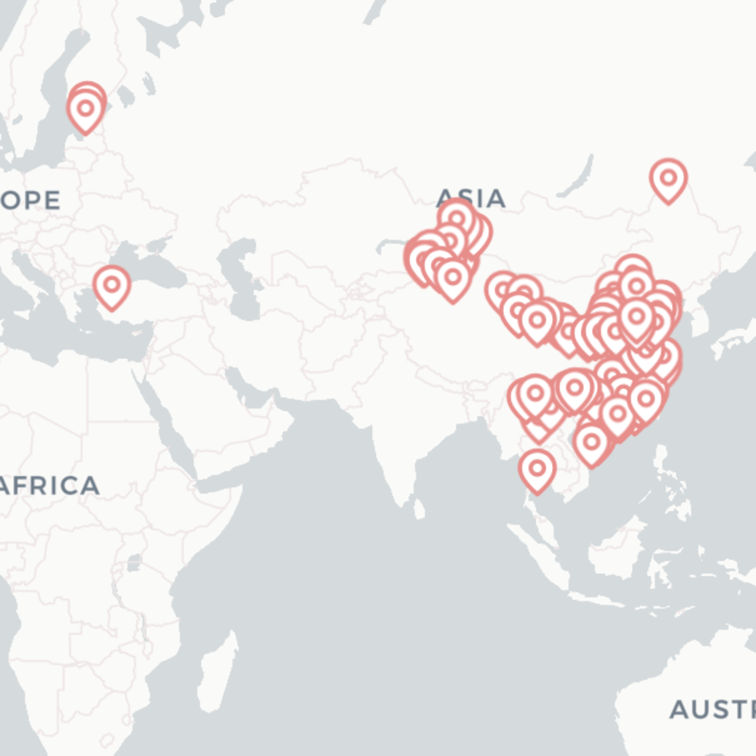
给我整 growgen给我整个地图今天是来到塔林的第二年开学典礼前一天,提前录下这一周的内容。话题挺多,主要集中在技术探索和个人网站优化:🌀 流式加载与 NDJSON回忆起 10 年前实习时第一次接触 SSE / 流式传输。 最近尝试用 NDJSON 模拟流式加载,把瀑布流页面的数据逐条展示。 优点:用户体验更平滑。 缺点:实现复杂,最后一行处理、错误重试都要额外逻辑。 感悟:文字/JSON 层面的流式传输发展有限,但 音视频/广告分发 其实一直在快速进化。🌍 城市地图可视化让 AI 逐年帮忙总结博客中出现的城市,并映射到地图。 使用 Maplibre GL + ReactMapGL(开源免 token),替代了 Mapbox。 难点:城市名 → 经纬度,需要额外解析,最后还是依赖了 Google API。 结果:把自己十多年的旅行足迹直观展示在世界地图上。 待优化:性能瓶颈,构建时间 6–8 分钟,地图页加载过大。🗂️ 静态文件存储(DAM)采用 Cloudinary 管理网站的静态资源(图片、3D 文件等)。 好处: 版本管理 动态生成不同尺寸、加水印 免费额度足够个人使用 比传统 Git LFS 更灵活,感觉像是“进化后的网盘”。🧱 瀑布流布局探索原生 CSS Masonry 仍是实验性功能,不适合正式使用。 尝试过多个库:Masonry.js:绝对定位,兼容性好但不支持 SSR/SEO。 Material Design 实现:依赖 Flex/Grid,每次加载时会抖动。 React-Block:解决了抖动问题,但打包方式老旧(CommonJS)。 结论:React-Block 效果最好,推荐使用。🔄 Astro Page View Transition三年前因 Astro 的 PageView Transition 功能从 Gatsby 迁移,但当时功能不完善。 最近重新尝试,发现:API 与 Astro 3.0 时完全不同。 现在支持 MPA + SPA 的优雅降级,但本质仍是单页式逻辑(prefetch + innerHTML 替换)。 React 岛内的组件动画无法无缝结合。 感悟:很多看似炫酷的技术,深入后发现底层其实很朴素。 仍计划完成这一功能,实现当初对自己的承诺。📌 总结技术探索:流式加载、NDJSON、Masonry 布局、Astro 动画。 产品迭代:旅行地图可视化、Cloudinary 静态资源管理。 个人感受:很多技术“看起来很酷”,真正理解后才发现其简单本质。 👣 新学年、新阶段,迎接在塔林的第二年。
2025-08-2928 min
Chaos Computer Club - recent audio-only feedDie Demokratisierung digitaler Karten (froscon2025)Digitales Mapping wurde lange Zeit von kommerziellen Anbietern dominiert, die durch Kosten, Komplexität und Bedenken hinsichtlich des Datenschutzes Barrieren geschaffen haben. In diesem Vortrag wird Protomaps vorgestellt, ein Open-Source-Projekt, das die Art und Weise, wie Webkarten bereitgestellt und genutzt werden, neu definiert.
Durch die Verwendung des innovativen PMTiles-Formats - ein Single-File-Format für Vektorkacheln - macht Protomaps eine komplexe Serverinfrastruktur überflüssig, reduziert gleichzeitig die Bandbreitennutzung und verbessert die Leistung. Wir werden untersuchen, wie diese Technologie die Kartografie demokratisiert, indem sie selbst gehostete Karten ohne API-Schlüssel, Nutzungsquoten oder wiederkehrende Kosten zugänglich macht. In der Präsentation werden Impleme...
2025-08-1726 minChaos Computer Club - recent events feed (high quality)Die Demokratisierung digitaler Karten (froscon2025)Digitales Mapping wurde lange Zeit von kommerziellen Anbietern dominiert, die durch Kosten, Komplexität und Bedenken hinsichtlich des Datenschutzes Barrieren geschaffen haben. In diesem Vortrag wird Protomaps vorgestellt, ein Open-Source-Projekt, das die Art und Weise, wie Webkarten bereitgestellt und genutzt werden, neu definiert.
Durch die Verwendung des innovativen PMTiles-Formats - ein Single-File-Format für Vektorkacheln - macht Protomaps eine komplexe Serverinfrastruktur überflüssig, reduziert gleichzeitig die Bandbreitennutzung und verbessert die Leistung. Wir werden untersuchen, wie diese Technologie die Kartografie demokratisiert, indem sie selbst gehostete Karten ohne API-Schlüssel, Nutzungsquoten oder wiederkehrende Kosten zugänglich macht. In der Präsentation werden Impleme...
2025-08-1726 minChaos Computer Club - recent events feed (low quality)Die Demokratisierung digitaler Karten (froscon2025)Digitales Mapping wurde lange Zeit von kommerziellen Anbietern dominiert, die durch Kosten, Komplexität und Bedenken hinsichtlich des Datenschutzes Barrieren geschaffen haben. In diesem Vortrag wird Protomaps vorgestellt, ein Open-Source-Projekt, das die Art und Weise, wie Webkarten bereitgestellt und genutzt werden, neu definiert.
Durch die Verwendung des innovativen PMTiles-Formats - ein Single-File-Format für Vektorkacheln - macht Protomaps eine komplexe Serverinfrastruktur überflüssig, reduziert gleichzeitig die Bandbreitennutzung und verbessert die Leistung. Wir werden untersuchen, wie diese Technologie die Kartografie demokratisiert, indem sie selbst gehostete Karten ohne API-Schlüssel, Nutzungsquoten oder wiederkehrende Kosten zugänglich macht. In der Präsentation werden Impleme...
2025-08-1726 minChaos Computer Club - recent events feedDie Demokratisierung digitaler Karten (froscon2025)Digitales Mapping wurde lange Zeit von kommerziellen Anbietern dominiert, die durch Kosten, Komplexität und Bedenken hinsichtlich des Datenschutzes Barrieren geschaffen haben. In diesem Vortrag wird Protomaps vorgestellt, ein Open-Source-Projekt, das die Art und Weise, wie Webkarten bereitgestellt und genutzt werden, neu definiert.
Durch die Verwendung des innovativen PMTiles-Formats - ein Single-File-Format für Vektorkacheln - macht Protomaps eine komplexe Serverinfrastruktur überflüssig, reduziert gleichzeitig die Bandbreitennutzung und verbessert die Leistung. Wir werden untersuchen, wie diese Technologie die Kartografie demokratisiert, indem sie selbst gehostete Karten ohne API-Schlüssel, Nutzungsquoten oder wiederkehrende Kosten zugänglich macht. In der Präsentation werden Impleme...
2025-08-1726 min
MUG-JP Space#015 / 2025-06のMapLibreアップデート・Geospatial雑談MUG-JPの紹介MapLibreの紹介MapLibreのアップデートGeospatial雑談
2025-07-191h 04
Syntax - Tasty Web Development Treats916: I got fired, what should I focus on?In this potluck episode of Syntax, Wes and Scott answer your questions about maintaining popular open-source projects, where to start after a layoff, impostor syndrome, Scott’s recording setup, whether a computer science degree is still worth it in the age of AI, and more!Show Notes
00:00 Welcome to Syntax!
00:44 Brought to you bySentry.io
04:16 How to maintain a successful NPM package
08:03 What to do in Denver while attending Laracon
11:18 How to branch out and learn new frameworks while balancing work life and family
15:55 Built-in state management vs external state managementFull Stack App Build | Travel Log w...
2025-07-0258 min
KodsnackFördelar med Liechtenstein, med Svante RichterFredrik snackar med Svante Richter som berättar om sitt projekt Maps.black - det enklaste sättet att självhosta och använda fria och öppna kartor. Vore det inte fint att kunna ha en komplett världskarta som man lätt kunde lägga på och använda från ett SD-kort? Men, hur lyckas man med det? Hur sätter man ihop en kartlösning? Och vad behöver man göra för att lyckas hosta den? Oväntat lite, är svaret! (Svantes servrar får däremot jobba en del för att sätta ihop k...
2025-07-0155 minMUG-JP Space#014 / 2025-05のMapLibreアップデート・Geospatial雑談MUG-JPの紹介MapLibreの紹介MapLibreのアップデートGeospatial雑談
2025-06-281h 10
Linux LadsEpisode 143: Fairly De-Googled
Conor and Mike are on their own, discussing Conor's newest acquisitions - Fairphone 5 and Fairbuds XL.
Episode edited by Jake Bauer - thanks!
You can find our episodes on YouTube
Discussion
Fairphone 5
Fairbuds XL
CalyxOS
iodéOS
Droid-ify
Aurora Store
DAVx⁵
MapLibre
Futo keyboard
Breezy Weather
Curve
microG
Sunup
Fairphone 5 with /e/OS
Nextcloud
Fairbuds Android app
Contact Us...
2025-06-0420 minMUG-JP Space#013 / 2025-04のMapLibreアップデート・Geospatial雑談MUG-JPの紹介MapLibreの紹介MapLibreのアップデートGeospatial雑談
2025-05-271h 13
Syntax - Tasty Web Development Treats904: React vs Svelte × Windsurf Worth $3B × Typescript as Const × Layout Shift Tricks × MoreIn this potluck episode of Syntax, Wes and CJ answer your questions about OpenAI’s $3B Windsurf acquisition, the evolving role of UI in an AI-driven world, why good design still matters, React vs. Svelte, and more! Show Notes 00:00 Welcome to Syntax! Devs Night Out
02:35 OpenAI acquires Windsurf for $3B Windsurf
Ep 870: Windsurf forked VS Code to compete with Cursor. Talking the future of AI + Coding
05:20 What is the future of UI now that AI is such a heavy hitter? 08:45 Handling spam submissions on websites Cloudflare Turnstile
14:18 Duplicating HTML for desktop and mobile websites? 17:03 Is it okay to us...
2025-05-2151 minMUG-JP Space#012 / 2025-04のMapLibreアップデート・Geospatial雑談MUG-JPの紹介MapLibreの紹介MapLibreのアップデートGeospatial雑談
2025-04-211h 08
Software SessionsBrandon Liu on ProtomapsBrandon Liu is an open source developer and creator of the Protomaps basemap project.
We talk about how static maps help developers build sites that last, the PMTiles file format, the role of OpenStreetMap, and his experience funding and running an open source project full time.
Protomaps
Protomaps
PMTiles (File format used by Protomaps)
Self-hosted slippy maps, for novices (like me)
Why Deploy Protomaps on a CDN
User examples
Flickr
Pinball Map
Toilet Map
Related projects
OpenStreetMap (Dataset protomaps is based on)
Mapzen (Former company that released details on what...
2025-04-0659 minChaos Computer Club - recent events feed (low quality)Ableitung von Rasterkarten aus Vector Tiles für basemap.de (fossgis2025)Für die Produktion der Rasterkarten von basemap.de wird die Open-Source-Software "VT Raster Converter" entwickelt, mit der Vector-Tiles-Karten in Rasterbilder konvertiert werden können. Der Vortrag gibt einen Überblick über die Software und deren Nutzung in Verbindung mit dem MapProxy. Es werden die Erfahrungen und Herausforderungen in der Produktion der basemap.de Rasterkarten mittels Vektor-Raster-Konvertierung erläutert.
Der Kartendienst basemap.de stellt amtliche Karten u. a. in Form von Vector Tiles bereit. Da nicht alle Kartenanwendungen in der Lage sind Vector Tiles einzubinden, werden auch Rasterkarten-Dienste von basemap.de angeboten. Um die Pflege der Style-Konfigurationen zu vereinfachen und das Karte...
2025-03-2823 minChaos Computer Club - recent events feed (high quality)Ableitung von Rasterkarten aus Vector Tiles für basemap.de (fossgis2025)Für die Produktion der Rasterkarten von basemap.de wird die Open-Source-Software "VT Raster Converter" entwickelt, mit der Vector-Tiles-Karten in Rasterbilder konvertiert werden können. Der Vortrag gibt einen Überblick über die Software und deren Nutzung in Verbindung mit dem MapProxy. Es werden die Erfahrungen und Herausforderungen in der Produktion der basemap.de Rasterkarten mittels Vektor-Raster-Konvertierung erläutert.
Der Kartendienst basemap.de stellt amtliche Karten u. a. in Form von Vector Tiles bereit. Da nicht alle Kartenanwendungen in der Lage sind Vector Tiles einzubinden, werden auch Rasterkarten-Dienste von basemap.de angeboten. Um die Pflege der Style-Konfigurationen zu vereinfachen und das Karte...
2025-03-2823 minChaos Computer Club - recent audio-only feedAbleitung von Rasterkarten aus Vector Tiles für basemap.de (fossgis2025)Für die Produktion der Rasterkarten von basemap.de wird die Open-Source-Software "VT Raster Converter" entwickelt, mit der Vector-Tiles-Karten in Rasterbilder konvertiert werden können. Der Vortrag gibt einen Überblick über die Software und deren Nutzung in Verbindung mit dem MapProxy. Es werden die Erfahrungen und Herausforderungen in der Produktion der basemap.de Rasterkarten mittels Vektor-Raster-Konvertierung erläutert.
Der Kartendienst basemap.de stellt amtliche Karten u. a. in Form von Vector Tiles bereit. Da nicht alle Kartenanwendungen in der Lage sind Vector Tiles einzubinden, werden auch Rasterkarten-Dienste von basemap.de angeboten. Um die Pflege der Style-Konfigurationen zu vereinfachen und das Karte...
2025-03-2823 minChaos Computer Club - recent events feedAbleitung von Rasterkarten aus Vector Tiles für basemap.de (fossgis2025)Für die Produktion der Rasterkarten von basemap.de wird die Open-Source-Software "VT Raster Converter" entwickelt, mit der Vector-Tiles-Karten in Rasterbilder konvertiert werden können. Der Vortrag gibt einen Überblick über die Software und deren Nutzung in Verbindung mit dem MapProxy. Es werden die Erfahrungen und Herausforderungen in der Produktion der basemap.de Rasterkarten mittels Vektor-Raster-Konvertierung erläutert.
Der Kartendienst basemap.de stellt amtliche Karten u. a. in Form von Vector Tiles bereit. Da nicht alle Kartenanwendungen in der Lage sind Vector Tiles einzubinden, werden auch Rasterkarten-Dienste von basemap.de angeboten. Um die Pflege der Style-Konfigurationen zu vereinfachen und das Karte...
2025-03-2823 minMUG-JP Space#011 / 2025-03のMapLibreアップデート・Geospatial雑談○Meetup Japan #04○アップデート個人スポンサーの増加MLT - MapLibre Tilesmaplibre-local-glyphsMapLibre iOS SDKのカスタムレイヤーflutter-maplibre○Geospatial雑談chiitiler v1.15.0AWSのblogにベクトルタイルとかAIエージェントの話
2025-03-271h 01Chaos Computer Club - recent events feedOnline-Karten für die Verkehrswende mit OpenData und FOSS (fossgis2025)Mit OpenData und freier/open-source Software lässt sich eine Online-Kartenanwendung bauen, mit der sich die Straßenraumaufteilung der Stadt Kiel darstellen und untersuchen lässt. Damit kann diese Online-Karte ein weiteres Werkzeug im Kampf für eine Verkehrswende sein.
Aus der kritischen Kartographie wissen wir, dass Karten Machtinstrumente sind. Sie lassen sich im Rahmen von bspw. Gegenkarten / Counter-Maps damit auch nutzen, Gegenmacht aufzubauen bzw. alternative Bilder unserer Umwelt zu schaffen. Anhand eines Beispiels aus Kiel zeigt der Vortrag, wie sich mit OpenData und freier/open-source Software eine Online-(3D-)Karte erstellen lässt, mit dem sich die Aufteilung des Straß...
2025-03-2725 minChaos Computer Club - recent events feed (high quality)Online-Karten für die Verkehrswende mit OpenData und FOSS (fossgis2025)Mit OpenData und freier/open-source Software lässt sich eine Online-Kartenanwendung bauen, mit der sich die Straßenraumaufteilung der Stadt Kiel darstellen und untersuchen lässt. Damit kann diese Online-Karte ein weiteres Werkzeug im Kampf für eine Verkehrswende sein.
Aus der kritischen Kartographie wissen wir, dass Karten Machtinstrumente sind. Sie lassen sich im Rahmen von bspw. Gegenkarten / Counter-Maps damit auch nutzen, Gegenmacht aufzubauen bzw. alternative Bilder unserer Umwelt zu schaffen. Anhand eines Beispiels aus Kiel zeigt der Vortrag, wie sich mit OpenData und freier/open-source Software eine Online-(3D-)Karte erstellen lässt, mit dem sich die Aufteilung des Straß...
2025-03-2725 minChaos Computer Club - recent audio-only feedOnline-Karten für die Verkehrswende mit OpenData und FOSS (fossgis2025)Mit OpenData und freier/open-source Software lässt sich eine Online-Kartenanwendung bauen, mit der sich die Straßenraumaufteilung der Stadt Kiel darstellen und untersuchen lässt. Damit kann diese Online-Karte ein weiteres Werkzeug im Kampf für eine Verkehrswende sein.
Aus der kritischen Kartographie wissen wir, dass Karten Machtinstrumente sind. Sie lassen sich im Rahmen von bspw. Gegenkarten / Counter-Maps damit auch nutzen, Gegenmacht aufzubauen bzw. alternative Bilder unserer Umwelt zu schaffen. Anhand eines Beispiels aus Kiel zeigt der Vortrag, wie sich mit OpenData und freier/open-source Software eine Online-(3D-)Karte erstellen lässt, mit dem sich die Aufteilung des Straß...
2025-03-2725 minChaos Computer Club - recent events feed (low quality)Online-Karten für die Verkehrswende mit OpenData und FOSS (fossgis2025)Mit OpenData und freier/open-source Software lässt sich eine Online-Kartenanwendung bauen, mit der sich die Straßenraumaufteilung der Stadt Kiel darstellen und untersuchen lässt. Damit kann diese Online-Karte ein weiteres Werkzeug im Kampf für eine Verkehrswende sein.
Aus der kritischen Kartographie wissen wir, dass Karten Machtinstrumente sind. Sie lassen sich im Rahmen von bspw. Gegenkarten / Counter-Maps damit auch nutzen, Gegenmacht aufzubauen bzw. alternative Bilder unserer Umwelt zu schaffen. Anhand eines Beispiels aus Kiel zeigt der Vortrag, wie sich mit OpenData und freier/open-source Software eine Online-(3D-)Karte erstellen lässt, mit dem sich die Aufteilung des Straß...
2025-03-2725 minChaos Computer Club - recent events feedDer Wuppertaler Weg vom Geoportal zum Digitalen Zwilling (fossgis2025)Die Stadt Wuppertal realisiert in einem bis Ende 2026 laufenden Förderprojekt einen Urbanen Digitalen Zwilling (UDZ), den "DigiTal Zwilling". In diesem Vortrag werden sie softwaretechnischen Herausforderungen und Lösungsansätze bei der Entwicklung der Anwendungskomponenten zum DigiTal Zwilling vorgestellt. Insbesondere entsteht eine generische Anwendung, die den Erwartungen an einen UDZ gerecht werden soll, aber auch die klassischen Anwendungsfälle eines kommunalen Geoportals bedienen soll.
Der DigiTal Zwilling ist ein „System of Systems“. Insbesondere umfasst er eine Reihe an Open Source Web-Applikationen, die den DigiTal Zwilling für die Nutzerinnen und Nutzer erschließen. Diese Applikationen werden unter https://github.com/digital-tw...
2025-03-2725 minChaos Computer Club - recent audio-only feedDer Wuppertaler Weg vom Geoportal zum Digitalen Zwilling (fossgis2025)Die Stadt Wuppertal realisiert in einem bis Ende 2026 laufenden Förderprojekt einen Urbanen Digitalen Zwilling (UDZ), den "DigiTal Zwilling". In diesem Vortrag werden sie softwaretechnischen Herausforderungen und Lösungsansätze bei der Entwicklung der Anwendungskomponenten zum DigiTal Zwilling vorgestellt. Insbesondere entsteht eine generische Anwendung, die den Erwartungen an einen UDZ gerecht werden soll, aber auch die klassischen Anwendungsfälle eines kommunalen Geoportals bedienen soll.
Der DigiTal Zwilling ist ein „System of Systems“. Insbesondere umfasst er eine Reihe an Open Source Web-Applikationen, die den DigiTal Zwilling für die Nutzerinnen und Nutzer erschließen. Diese Applikationen werden unter https://github.com/digital-tw...
2025-03-2725 minChaos Computer Club - recent events feed (low quality)Der Wuppertaler Weg vom Geoportal zum Digitalen Zwilling (fossgis2025)Die Stadt Wuppertal realisiert in einem bis Ende 2026 laufenden Förderprojekt einen Urbanen Digitalen Zwilling (UDZ), den "DigiTal Zwilling". In diesem Vortrag werden sie softwaretechnischen Herausforderungen und Lösungsansätze bei der Entwicklung der Anwendungskomponenten zum DigiTal Zwilling vorgestellt. Insbesondere entsteht eine generische Anwendung, die den Erwartungen an einen UDZ gerecht werden soll, aber auch die klassischen Anwendungsfälle eines kommunalen Geoportals bedienen soll.
Der DigiTal Zwilling ist ein „System of Systems“. Insbesondere umfasst er eine Reihe an Open Source Web-Applikationen, die den DigiTal Zwilling für die Nutzerinnen und Nutzer erschließen. Diese Applikationen werden unter https://github.com/digital-tw...
2025-03-2725 minChaos Computer Club - recent events feed (high quality)Der Wuppertaler Weg vom Geoportal zum Digitalen Zwilling (fossgis2025)Die Stadt Wuppertal realisiert in einem bis Ende 2026 laufenden Förderprojekt einen Urbanen Digitalen Zwilling (UDZ), den "DigiTal Zwilling". In diesem Vortrag werden sie softwaretechnischen Herausforderungen und Lösungsansätze bei der Entwicklung der Anwendungskomponenten zum DigiTal Zwilling vorgestellt. Insbesondere entsteht eine generische Anwendung, die den Erwartungen an einen UDZ gerecht werden soll, aber auch die klassischen Anwendungsfälle eines kommunalen Geoportals bedienen soll.
Der DigiTal Zwilling ist ein „System of Systems“. Insbesondere umfasst er eine Reihe an Open Source Web-Applikationen, die den DigiTal Zwilling für die Nutzerinnen und Nutzer erschließen. Diese Applikationen werden unter https://github.com/digital-tw...
2025-03-2725 minChaos Computer Club - recent events feed (high quality)Vektor Tiles für Karten mit Echtzeitdaten (fossgis2025)Vektorkacheln sind eine effiziente Art, um Karten mit grossen Mengen an Echtzeitdaten bereitzustellen.
IoT-Anwendungen oder Karten mit Wetter-, Verkehrs- oder anderen Live-Daten benötigen ein
kompaktes Format zur Übertragung aktualisierter Daten. Vektorkacheln mit ihren leistungsfähigen
Styling-Möglichkeiten werden von diversen JavaScript-Kartenviewern unterstützt.
Dieser Vortrag zeigt, wie man Echtzeitdaten mit MapLibre und OpenLayers darstellen kann. Auf der
Serverseite wird [BBOX](https://www.bbox.earth/) verwendet, um Kacheln aus einer
PostGIS-Datenbank bereitzustellen.
Licensed to the public under https://creativecommons.org/licenses/by/4.0/
about this event: https://pretalx.com/fossgis2025/talk/HEWMUB/
2025-03-2624 minChaos Computer Club - recent events feedVektor Tiles für Karten mit Echtzeitdaten (fossgis2025)Vektorkacheln sind eine effiziente Art, um Karten mit grossen Mengen an Echtzeitdaten bereitzustellen.
IoT-Anwendungen oder Karten mit Wetter-, Verkehrs- oder anderen Live-Daten benötigen ein
kompaktes Format zur Übertragung aktualisierter Daten. Vektorkacheln mit ihren leistungsfähigen
Styling-Möglichkeiten werden von diversen JavaScript-Kartenviewern unterstützt.
Dieser Vortrag zeigt, wie man Echtzeitdaten mit MapLibre und OpenLayers darstellen kann. Auf der
Serverseite wird [BBOX](https://www.bbox.earth/) verwendet, um Kacheln aus einer
PostGIS-Datenbank bereitzustellen.
Licensed to the public under https://creativecommons.org/licenses/by/4.0/
about this event: https://pretalx.com/fossgis2025/talk/HEWMUB/
2025-03-2624 minChaos Computer Club - recent audio-only feedVektor Tiles für Karten mit Echtzeitdaten (fossgis2025)Vektorkacheln sind eine effiziente Art, um Karten mit grossen Mengen an Echtzeitdaten bereitzustellen.
IoT-Anwendungen oder Karten mit Wetter-, Verkehrs- oder anderen Live-Daten benötigen ein
kompaktes Format zur Übertragung aktualisierter Daten. Vektorkacheln mit ihren leistungsfähigen
Styling-Möglichkeiten werden von diversen JavaScript-Kartenviewern unterstützt.
Dieser Vortrag zeigt, wie man Echtzeitdaten mit MapLibre und OpenLayers darstellen kann. Auf der
Serverseite wird [BBOX](https://www.bbox.earth/) verwendet, um Kacheln aus einer
PostGIS-Datenbank bereitzustellen.
Licensed to the public under https://creativecommons.org/licenses/by/4.0/
about this event: https://pretalx.com/fossgis2025/talk/HEWMUB/
2025-03-2624 minChaos Computer Club - recent events feed (low quality)Vektor Tiles für Karten mit Echtzeitdaten (fossgis2025)Vektorkacheln sind eine effiziente Art, um Karten mit grossen Mengen an Echtzeitdaten bereitzustellen.
IoT-Anwendungen oder Karten mit Wetter-, Verkehrs- oder anderen Live-Daten benötigen ein
kompaktes Format zur Übertragung aktualisierter Daten. Vektorkacheln mit ihren leistungsfähigen
Styling-Möglichkeiten werden von diversen JavaScript-Kartenviewern unterstützt.
Dieser Vortrag zeigt, wie man Echtzeitdaten mit MapLibre und OpenLayers darstellen kann. Auf der
Serverseite wird [BBOX](https://www.bbox.earth/) verwendet, um Kacheln aus einer
PostGIS-Datenbank bereitzustellen.
Licensed to the public under https://creativecommons.org/licenses/by/4.0/
about this event: https://pretalx.com/fossgis2025/talk/HEWMUB/
2025-03-2624 minChaos Computer Club - recent events feed (low quality)Wie MapLibre und Vektorkarten die Welt übernehmen (fossgis2025)Vektorbasierte Karten sind die Zukunft! Oder vielleicht sogar schon die Gegenwart? In diesem Vortrag werden beide Perspektiven beleuchtet! Bart spricht aus der Perspektive der Entwicklung von MapLibre, und gibt einen Einblick in den neuesten Stand. Just erzählt von seinen Erfahrungen als Benutzer der MapLibre-Stack um vektorbasierte Karten zu gestalten.
Bart Louwers, der seit zwei Jahren Maintainer von MapLibre Native ist, gibt ein Update über spannende neue Entwicklungen bei MapLibre. In der C++-Version von MapLibre stehen jetzt nicht nur eine, sondern zwei neue Rendering-Backends zur Verfügung (Vulkan und Metal). Seit Version 5.0.0 unterstützt MapLibre Web zudem die Darstellung der...
2025-03-2622 minChaos Computer Club - recent audio-only feedWie MapLibre und Vektorkarten die Welt übernehmen (fossgis2025)Vektorbasierte Karten sind die Zukunft! Oder vielleicht sogar schon die Gegenwart? In diesem Vortrag werden beide Perspektiven beleuchtet! Bart spricht aus der Perspektive der Entwicklung von MapLibre, und gibt einen Einblick in den neuesten Stand. Just erzählt von seinen Erfahrungen als Benutzer der MapLibre-Stack um vektorbasierte Karten zu gestalten.
Bart Louwers, der seit zwei Jahren Maintainer von MapLibre Native ist, gibt ein Update über spannende neue Entwicklungen bei MapLibre. In der C++-Version von MapLibre stehen jetzt nicht nur eine, sondern zwei neue Rendering-Backends zur Verfügung (Vulkan und Metal). Seit Version 5.0.0 unterstützt MapLibre Web zudem die Darstellung der...
2025-03-2622 minChaos Computer Club - recent events feed (high quality)Wie MapLibre und Vektorkarten die Welt übernehmen (fossgis2025)Vektorbasierte Karten sind die Zukunft! Oder vielleicht sogar schon die Gegenwart? In diesem Vortrag werden beide Perspektiven beleuchtet! Bart spricht aus der Perspektive der Entwicklung von MapLibre, und gibt einen Einblick in den neuesten Stand. Just erzählt von seinen Erfahrungen als Benutzer der MapLibre-Stack um vektorbasierte Karten zu gestalten.
Bart Louwers, der seit zwei Jahren Maintainer von MapLibre Native ist, gibt ein Update über spannende neue Entwicklungen bei MapLibre. In der C++-Version von MapLibre stehen jetzt nicht nur eine, sondern zwei neue Rendering-Backends zur Verfügung (Vulkan und Metal). Seit Version 5.0.0 unterstützt MapLibre Web zudem die Darstellung der...
2025-03-2622 minChaos Computer Club - recent events feedWie MapLibre und Vektorkarten die Welt übernehmen (fossgis2025)Vektorbasierte Karten sind die Zukunft! Oder vielleicht sogar schon die Gegenwart? In diesem Vortrag werden beide Perspektiven beleuchtet! Bart spricht aus der Perspektive der Entwicklung von MapLibre, und gibt einen Einblick in den neuesten Stand. Just erzählt von seinen Erfahrungen als Benutzer der MapLibre-Stack um vektorbasierte Karten zu gestalten.
Bart Louwers, der seit zwei Jahren Maintainer von MapLibre Native ist, gibt ein Update über spannende neue Entwicklungen bei MapLibre. In der C++-Version von MapLibre stehen jetzt nicht nur eine, sondern zwei neue Rendering-Backends zur Verfügung (Vulkan und Metal). Seit Version 5.0.0 unterstützt MapLibre Web zudem die Darstellung der...
2025-03-2622 minMUG-JP Space#010 / 2025-02のMapLibreアップデート・Geospatial雑談MapLibreのアップデート情報○スポンサーの話○GL JS 日本語フォントの問題 縦書きフォント 開発環境のはなし GL JSのGLコンテキストへのアクセス方法○Native Rustのはなし react-native-maplibreのはなし ○イベント FOSS4G Hokkaido 2024 + State of the Map Japan 2024 OSC東京 FOSS4G 2026 Hiroshima toggle BirdView #01
2025-02-251h 10Chaos Computer Club - recent events feed (high quality)Android Auto (Flitsmeister) (hackerhotel2025)How to make an Android App for Android Auto, a demo of the MapLibre sample app, and stories about Flitsmeister.
FrankkieNL has worked on the Android Auto (and Automotive) version of the Flitsmeister app.
This navigation app uses MapLibre to render a map on the Car screen.
During this talk, we will discuss how this works and how you can create your own Android Auto-based app.
Licensed to the public under http://creativecommons.org/licenses/by/4.0
about this event: https://pretalx.hackerhotel.nl/2025/talk/ZQ3RYV/
2025-02-1446 minChaos Computer Club - recent events feedAndroid Auto (Flitsmeister) (hackerhotel2025)How to make an Android App for Android Auto, a demo of the MapLibre sample app, and stories about Flitsmeister.
FrankkieNL has worked on the Android Auto (and Automotive) version of the Flitsmeister app.
This navigation app uses MapLibre to render a map on the Car screen.
During this talk, we will discuss how this works and how you can create your own Android Auto-based app.
Licensed to the public under http://creativecommons.org/licenses/by/4.0
about this event: https://pretalx.hackerhotel.nl/2025/talk/ZQ3RYV/
2025-02-1446 minChaos Computer Club - recent events feed (low quality)Android Auto (Flitsmeister) (hackerhotel2025)How to make an Android App for Android Auto, a demo of the MapLibre sample app, and stories about Flitsmeister.
FrankkieNL has worked on the Android Auto (and Automotive) version of the Flitsmeister app.
This navigation app uses MapLibre to render a map on the Car screen.
During this talk, we will discuss how this works and how you can create your own Android Auto-based app.
Licensed to the public under http://creativecommons.org/licenses/by/4.0
about this event: https://pretalx.hackerhotel.nl/2025/talk/ZQ3RYV/
2025-02-1446 minChaos Computer Club - recent audio-only feedAndroid Auto (Flitsmeister) (hackerhotel2025)How to make an Android App for Android Auto, a demo of the MapLibre sample app, and stories about Flitsmeister.
FrankkieNL has worked on the Android Auto (and Automotive) version of the Flitsmeister app.
This navigation app uses MapLibre to render a map on the Car screen.
During this talk, we will discuss how this works and how you can create your own Android Auto-based app.
Licensed to the public under http://creativecommons.org/licenses/by/4.0
about this event: https://pretalx.hackerhotel.nl/2025/talk/ZQ3RYV/
2025-02-1446 min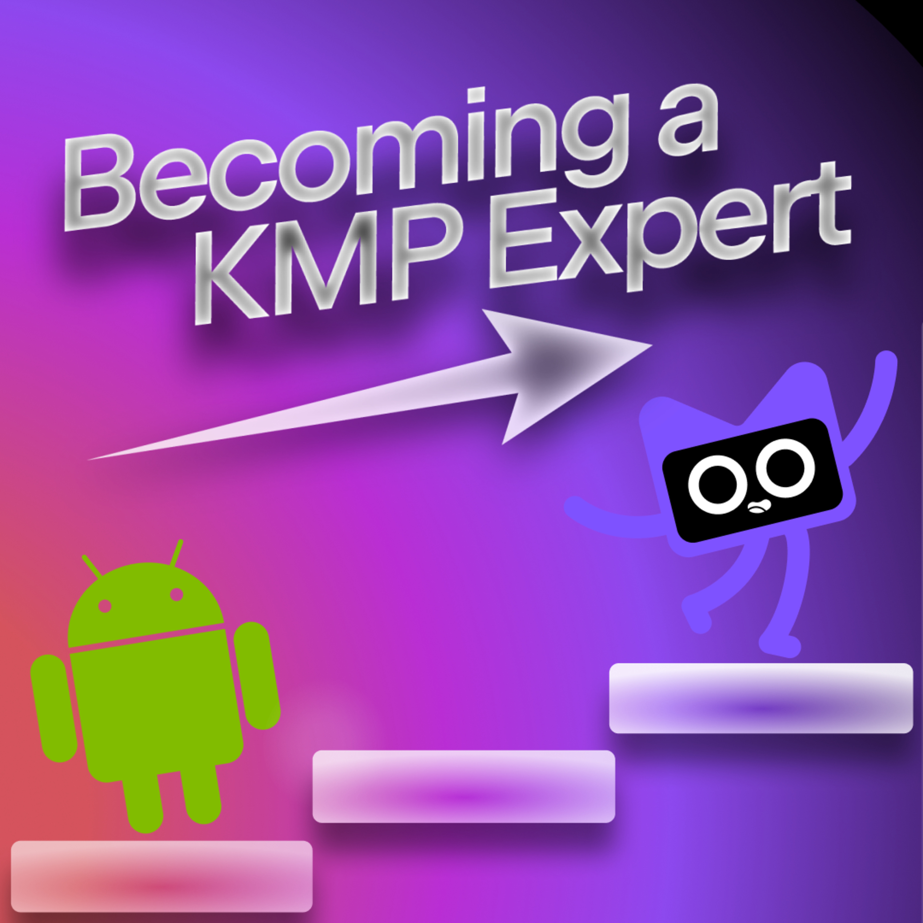
Talking KotlinBecoming a KMP ExpertSebastian and Pamela discuss what it means to be an expert in Kotlin Multiplatform, with the help of a panel of experts! Learn about why it's interesting to dive deep into a certain technology, recommendations on how to learn advanced topics, and general advice on how to get the most out of using KMP.SKIEKMP libraries: whyoleg/cryptography-kotlinInteresting code to explore: JetBrains/kotlin Kotlin/kotlinx-datetime Kotlin/kotlinx-io Kotlin/kotlinx.coroutines Cartesian product by Jake Get an invite!Ecosystem wishlist: wasmJs support in SQLDelight Compose Multiplatform support in MapLibre
2025-01-2352 minMUG-JP Space#009 / 2025-01のMapLibreアップデート・Geospatial雑談※一部音声が乱れている箇所がございます、ご了承ください。
2025-01-21にXスペースにて開催
トピック
・MUG-JPの紹介
・MapLibreの紹介
・Maplibreの2025-01アップデート
・MapLibre GL JS v5
・MapLibre Native
・Martin
・その他Geospatial雑談
・FOSS4G Hokkaido / State of the Map Japan
・svelte-maplibre-gl
・bbox server
・QGISのmacOSビルド
・wherobots
・生成AI
2025-01-211h 08
GeomobLuke Seelenbinder: MapLibreSteven sits down with Luke Seelenbinder, CEO and Founder of Stadia Maps. They share a lively conversation on the different ways technology, society and geo intersect; the evolution of Stadia Maps and some of the inherent challenges to serving maps as a service. The other main topic of conversation is Luke's work on MapLibre, a community-driven open-source map rendering SDK. Expect a deep dive into themes such as the importance of community contribution, the complexities of managing open source projects and the risks of feature bloat. Technical, varied and engaging, this episode is a good one!
Show...
2025-01-1253 min2024-12-261h 19The New Stack PodcastMapLibre: How a Fork Became a Thriving Open Source ProjectWhen open source projects shift to proprietary licensing, forks and new communities often emerge. Such was the case with MapLibre, born from Mapbox’s 2020 decision to make its map rendering engine proprietary. In conjunction with All Things Open 2024, Seth Fitzsimmons, a principal engineer at AWS and Tarus Balog, principal technical strategist for open source at AWS shared that this engine, popular for its WebGL-powered vector maps and dynamic customization features, was essential for organizations like BMW, The New York Times, and Instacart. However, Mapbox’s move disappointed its open-source user base by tying the upgraded Mapbox GL JS library to p...
2024-12-0525 minChaos Computer Club - recent events feedHow to develop your own style of OpenMapTiles with your favorite editor? (sotm2024)This presentation introduces how to develop your own style of OpenMapTiles for MapLibre GL from scratch with *your favorite editor*.
- Introduce of OpenMapTiles schema.
- Introduce of Charites to use your favorite editor.
- Introduce of other tools to compile JSON format for MapLibre GL.
This presentation describes with how to use command line tools to create MapLibre GL style.
I recommend to use UNIX based operation system or Raspberry Pi.
The editors supports VS Code, Emacs, or Vim.
Creative Commons Attribution 3.0 Unported https://creativecommons.org/licenses/by/3.0/
about this event: https://2024.stateofthemap.org/sessions/NHZVNW/
2024-09-0824 minChaos Computer Club - recent audio-only feedHow to develop your own style of OpenMapTiles with your favorite editor? (sotm2024)This presentation introduces how to develop your own style of OpenMapTiles for MapLibre GL from scratch with *your favorite editor*.
- Introduce of OpenMapTiles schema.
- Introduce of Charites to use your favorite editor.
- Introduce of other tools to compile JSON format for MapLibre GL.
This presentation describes with how to use command line tools to create MapLibre GL style.
I recommend to use UNIX based operation system or Raspberry Pi.
The editors supports VS Code, Emacs, or Vim.
Creative Commons Attribution 3.0 Unported https://creativecommons.org/licenses/by/3.0/
about this event: https://2024.stateofthemap.org/sessions/NHZVNW/
2024-09-0824 minChaos Computer Club - recent events feed (high quality)How to develop your own style of OpenMapTiles with your favorite editor? (sotm2024)This presentation introduces how to develop your own style of OpenMapTiles for MapLibre GL from scratch with *your favorite editor*.
- Introduce of OpenMapTiles schema.
- Introduce of Charites to use your favorite editor.
- Introduce of other tools to compile JSON format for MapLibre GL.
This presentation describes with how to use command line tools to create MapLibre GL style.
I recommend to use UNIX based operation system or Raspberry Pi.
The editors supports VS Code, Emacs, or Vim.
Creative Commons Attribution 3.0 Unported https://creativecommons.org/licenses/by/3.0/
about this event: https://2024.stateofthemap.org/sessions/NHZVNW/
2024-09-0824 minChaos Computer Club - recent events feed (low quality)How to develop your own style of OpenMapTiles with your favorite editor? (sotm2024)This presentation introduces how to develop your own style of OpenMapTiles for MapLibre GL from scratch with *your favorite editor*.
- Introduce of OpenMapTiles schema.
- Introduce of Charites to use your favorite editor.
- Introduce of other tools to compile JSON format for MapLibre GL.
This presentation describes with how to use command line tools to create MapLibre GL style.
I recommend to use UNIX based operation system or Raspberry Pi.
The editors supports VS Code, Emacs, or Vim.
Creative Commons Attribution 3.0 Unported https://creativecommons.org/licenses/by/3.0/
about this event: https://2024.stateofthemap.org/sessions/NHZVNW/
2024-09-0824 min
Developer VoicesMultiplatform Maps Built As Layers on Rust (with Ian Wagner)Mapping is a hugely complex task to take on. Even if you moved as much of the data-management as you can out to 3rd-party services, you’d still have a tonne of work to do weaving together map tiles, routing information, GPS data, points of interest, search and more. And as if that wasn’t enough, you’d probably want that software to work on a whole range of platforms, so you have to build something that works on iOS, Android and more. It’s little wonder that the space is dominated by a few closed-source projects owned by huge com...
2024-08-211h 01
Project GeospatialFOSS4GNA 2023 | MapLibre Native Upgrade: A modular rendering architecture for the futureSummary:
MapLibre Native underwent a significant upgrade to address technical debt and compatibility issues, specifically related to the transition from OpenGL ES to Apple's Metal rendering SDK. The upgrade was driven by a collaborative effort involving multiple contributors, including Stamen, AWS, and the MapLibre community. The project aimed to modularize the renderer, with a focus on achieving multi-SDK support, particularly for Metal. The primary goals included transitioning to direct metal rendering, moving certain operations to the GPU, addressing threading issues, and enhancing shader and layer management.
Highlights:
MapLibre Native underwent a major upgrade to address technical debt and compatibility...
2023-11-1628 min
Project GeospatialFOSS4GNA 2023 | The future of Vector Tiles elevation 3D arrays, ADAS - Yuri AstrakhanSummary
Yuri Astrakhan, co-founder of Map Libre, discusses the project's evolution from a fork of Mapbox to a community-driven initiative covering data generation, packaging, visualization, and more. The Map Libre ecosystem includes projects like Map Libre GJS, Map Libre RS, and Martin, a tile server supporting various formats. Yuri emphasizes the importance of community involvement, stability, and the challenges of maintaining both native C++ and JavaScript/TypeScript codebases. The talk explores Map Libre's achievements, goals, and advanced features like 3D terrain, contour maps, and future plans for Map Vector Tiles (MVT) with enhanced capabilities.
Highlights
🗺️ Yuri Astrakhan presents Map Libre...
2023-11-1622 min
Project GeospatialFOSS4G NA 2023 | Open Source Mapping Library Shoot Out - Courtney Yatteau & George OwenHighlights
🌐 Courtney and George compare four open-source web mapping libraries in a shootout, covering strengths, weaknesses, and unique features.
🚀 The presentation includes a high-level comparison, performance analysis, and conclusions.
👥 Courtney is a developer advocate at Esri, while George is a product engineer at Esri, both emphasizing open source.
Library Comparisons:
🗺️ Mapping Support: All libraries support 2D maps, with MapLibre and Cesium also supporting 2.5D and 3D maps.
📊 Data and Layer Support: WebGL is fully supported by MapLibre and Cesium. Various data types are supported, with Leaflet having the smallest file size.
🎨 Styling Data: Vector tiles are fully supported by MapLibre and Cesium...
2023-11-1525 minThe MapScaping Podcast - GIS, Geospatial, Remote Sensing, earth observation and digital geographyFelt - Upload Anything felt.com is a browser-based mapping tool and its also a reminder that just because we have always done web mapping one way it doesn’t mean it always has to be done that way.
For example, Felt lets you upload anything! That's a bold promise, you can upload anything you want and we will figure it out on the back end.
Felt is also the first and only flagship sustaining member of the QGIS project, they are supporting the development of an open-source tiling engine, called Tippecanoe.
They also support protomaps and the...
2023-07-1939 minGeospatial Tech and ToolsFelt – Upload AnythingIn this episode of the Mapscaping Podcast, we had the pleasure of speaking with Sam Hashemi, the CEO and co-founder of Felt, a browser-based mapping tool that is making waves in the geospatial community. Felt is not just another mapping tool; it's a platform that's revolutionizing the way we interact with geospatial data, thanks to its unique "upload anything" feature.
The "Upload Anything" Feature:
Felt's "upload anything" button is a game-changer. It allows users to upload any data without specifying the type, and the system figures out the data on the backend. This feature sets...
2023-07-1939 minChaos Computer Club - archive feedLegendenbilder aus Vector-Tile-Styles ableiten (fossgis2023)Mit der auf MapLibre basierenden Open-Source-Anwendung "vt-legend" können Legendenbilder anhand eines Vector-Tile-Styles und einer zugehörigen Legendenkonfiguration abgeleitet werden. Der Vortrag gibt einen kurzen Einblick in die Funktionalitäten und Konfigurationsmöglichkeiten der Anwendung.
Über den Kartendienst basemap.de werden deutschlandweite, amtliche Karten zur kostenfreien Nutzung im Vektor- und Rasterformat angeboten. Als Zeichenerklärung für den Dienst werden Legendenbilder bereitgestellt. Die dafür entwickelte Webanwendung "vt-legend" erstellt aus einem Vector-Tile-Style und einer Legendenkonfiguration mit MapLibre GL JS ein Legendenbild. Durch die Konfiguration kann gesteuert werden, welche Layer aus der Styledatei in der Legende aufgeführt werden und wie deren Dar...
2023-03-1605 minChaos Computer Club - archive feedMapComponents - Aktuelle Entwicklungen des React-Komponenten-Frameworks (fossgis2023)Das GIS Komponenten Framework MapComponents wurde Ende 2021 als Open Source Projekt auf Github veröffentlicht. In den letzten Monaten hat sich viel getan. Neben einer Vielzahl neuer Konponenten mit spannenden Funktionen wurden bereits erste Projekte mit MapComponents umgesetzt. Der Vortrag stellt das Projekt und die aktuellsten Entwicklungen und Features vor. Außerdem gibt er einen Ausblick auf die Backend-Komponenten, die mit Python umgesetzt werden.
MapComponents ist die Plattform zum Aufbau innovativer, schlanker Geo-IT-Lösungen mit aktueller Web- und GIS-Technologie. Anwendungen werden auf Desktop-Systemen als klassische Browserlösung betrieben uns lassen sich auf mobilen Geräten als Progressive Web Apps installieren.
Ein K...
2023-03-1520 minChaos Computer Club - archive feedOSM and indoor data (sotm2022)OpenIndoor is an open source SaaS that uses OpenStreetMap indoor data to display a 3D graphical rendering of building interiors. The resulting map offers a gamified experience to meet different types of needs: indoor navigation, data representation, immersive tour etc.
We will discuss how we use the available open data and the Maplibre engine to address these different use cases.
about this event: https://2022.stateofthemap.org/sessions/HEKRDY/
2022-08-2125 minChaos Computer Club - archive feedmaplibre-rs: Cross-platform Map Rendering using Rust (sotm2022)Digital maps are ubiquitous tools in our everyday life. In the early 90s, the idea of browsing the world digitally and visiting any place was groundbreaking. The first solution to this problem is known as "TerraVision", which was breathtaking. Today, the idea of exploring your surroundings using digital maps has become normal.
But how do these maps work? In this talk, I want to provide an overview of the foundations of digital mapping solutions. Differences between maps which use vector data and rasterized satellite imaginary will be outlined. Furthermore, a new and open-source map renderer called maplibre-rs will be presented...
2022-08-1916 minChaos Computer Club - archive feedOSM Carto as vector tiles (sotm2022)Presentation of the work we've done to adapt the OSM Carto style to vector tiles. We will take you through the making-of the cartography, step by step, scale by scale.
Available on MapTiler Cloud (https://cloud.maptiler.com/maps/openstreetmap/), the style will be integrated into the next version of the OpenMapTiles project.
We will also show you how to use this style in QGIS and how to display it on 3D maps with MapLibre.
about this event: https://2022.stateofthemap.org/sessions/3EREXZ/
2022-08-1931 minChaos Computer Club - archive feedWorld in Vectors - Cross-platform Map Rendering using Rust (MCH2022)Digital maps are ubiquitous tools in our everyday life. In the early 90s, the idea of browsing the world digitally and visiting any place was groundbreaking. The first solution to this problem is known as "TerraVision", which was breathtaking at that time. Today, the idea of exploring your surroundings using digital maps has become pretty normal.
But how do these maps work? In this talk, I want to provide an overview of the foundations of digital mapping solutions. Differences between maps which use vector data and rasterized satellite imaginary will be outlined. Furthermore, a new and open-source map renderer called...
2022-07-2421 minAsdfPaketdebakelVi snackar om helgens debakel där utvecklaren bakom faker.js och colours.js bestämde sig för att medvetet förstöra paketen i någon form av protest. Det leder bland annat in på diskussioner om ägandeskap över sin egen kod, att bli bannad från GitHub, sociala medier-poesi och open source-finansiering.
Dessutom en hel del om log4j och säkerhetsluckan log4shell, Mozillas “bad guy moment” samt korthuset som vi kallar npm-paket.
Om du gillar podden blir vi väldigt glada för en liten recension i iTunes, prenumeration på Spotify eller om d...
2022-01-1429 min
The AWS Developers PodcastEpisode 020 - AWS Amplify Geo with Harshita DaddalaIn this episode, Emily and Dave chat with Harshita Daddala, Sr. Product Manager -
Technical at Amazon Web Services. Harshita covers her career path at Amazon, the benefits of
AWS Amplify for developers, and the recent launch of the AWS Amplify Geo library for
JavaScript. Amplify Geo enables developers to quickly add location-aware features to their
frontend web and mobile applications. It includes a set of abstracted client libraries built
on top of Amazon Location Service, pre-integrated map UI components (based on the popular
MapLibre open-source library) aa well as an Amplify Command Line Interface (CLI) tool that
supports provisioning...
2021-11-1921 min
The WP MinuteSuccess in WordPressThanks Pressable for supporting the podcast! What hosting should feel like...nothing! https://pressable.com/wpminute Its the WP Minute!
This episode is brought to you by Search WP. Improve WordPress search by visiting SearchWP.com
You know the drill, everything I mention here will be linked up in the newsletter and the blog post. Checkout thewpminute.com for the links.
Sshh…no major acquisitions this week.
WordPress 5.8 is slated for release on July 20. In just over a month, many users will get their first experience of the tem...
2021-06-2303 min