Shows

TechEyeSpyTrimble and the New Space Age Investment CaseIn this episode, we take a close look at Trimble and ask whether this quiet precision technology company could deserve more attention from investors. Using Artemis II and the return of serious space ambition as a starting point, we explore a business that sits just outside the obvious aerospace names but still operates in a world shaped by accuracy, positioning, mapping, field systems, logistics, and the growing connection between software and the physical economy.This is a full SWOT analysis of Trimble, covering the company’s strengths, weaknesses, opportunities, and threats in clear, investor focused language. We lo...
2026-04-1128 min
Let's Be Civil: An Infrastructure PodcastSock Talks at TRB: Trimble's Jeff Blanton Tells Us What the Industry is Still Doing the Hard WayTrimble's Jeff Blanton joins Sock Talks to talk about what the industry is still doing the hard way and what the future of integrated construction inspection looks like. He also shares details on how Trimble is bringing augmented reality to construction with Trimble SiteVision.Learn more about SiteVision at https://geospatial.trimble.com/en/products/software/trimble-sitevision.
2026-01-1311 minPoint Taken Podcast by TrimbleBeyond the point cloud: Solving customer problems with reality captureJoin us as we dive into the world of reality capture with Alex Okscin, product manager at Trimble. Discover how this technology, which started with 3D laser scanning, now encompasses many sensors and workflows to bridge the gap between the physical and digital worlds. Alex explains the key technologies involved, the importance of minimizing communication errors, and the practical steps in a successful scanning process.
0:00 - Intro
1:29 - Defining reality capture
2:11 - Reality capture as the new geospatial
3:38 - The goal of reality capture: faster answers through better communication
5:19...
2025-12-0429 min
The New Automation Mindset: AI + Automation + IntegrationWhy Trimble’s VP of Technology Innovation Embraces Chaos while Reducing FrictionIn this episode of The New Automation Mindset, Markus Zirn is joined by Aviad Almagor, VP of Technology Innovation at Trimble, to speak about how the nearly 50-year-old company is integrating predictive and generative AI into its global operations. They explore how Trimble went from using ML for infrastructure analysis to deploying GenAI-powered agents across design, product development, and internal workflows. Aviad shares real-world examples of some of the innovations his team leads and discusses what makes AI pilots succeed or fail.—Guest BioAviad Almagor is a product and technology innovation leader wi...
2025-10-2246 min
Positioning Technologies PodcastTrimble MX60 vs MX90 Specs Comparison, Suitable applications and Software Suites.
Trimble's suite of geospatial software and hardware. Trimble Business Center (TBC) is highlighted as a comprehensive CAD software for survey data processing from various sources. Trimble MX software focuses on organizing and sharing mobile mapping data, while the Trimble MX60 and MX90 represent high-end mobile mapping systems offering advanced scanning and imaging capabilities. All products are integrated within a field-to-finish workflow, emphasizing efficient data management and delivery. The descriptions include technical specifications, features, and compatible hardware.
2024-12-0213 min
Positioning Technologies PodcastTrimble Geospatial - Survey with confidence at every turn.Trimble Geospatial provides high-precision geospatial technology solutions. Their offerings include a wide range of hardware such as total stations, GNSS systems, and laser scanners, as well as software for field and office use and cloud-based collaboration tools. These technologies are used across various industries including surveying, mapping, transportation, and mining to collect, analyze, and visualize spatial data. The company emphasizes accuracy, efficiency, and confidence in its products, showcasing customer success stories and resources to support users. Their website also highlights various applications of their technology in different sectors.
2024-11-2127 minPositioning Technologies PodcastTrimble, a technology company, is committed to building a sustainable future.Trimble, a technology company, is committed to building a sustainable future. The company integrates sustainability into its operations and products, focusing on building resilience, empowering people, and leading with integrity. Trimble also works to achieve sustainable outcomes in the industries it serves, including construction, transportation, and geospatial. Their sustainability efforts include reducing emissions, promoting diversity and inclusion, and supporting philanthropic causes. Trimble also invests in companies that are developing sustainable solutions.
2024-11-1922 minPositioning Technologies PodcastTrimble Geospatial Partner Program.The Trimble Geospatial Partner Program is an initiative that allows businesses to leverage Trimble's precision positioning technology to develop unique customer solutions. By integrating with Trimble's software development kits, partners can access and utilize Trimble's GNSS receivers, optical instruments, and other devices to create industry-specific workflows. Trimble provides marketing support, global reach, and collaboration opportunities to help partners promote and distribute their solutions. To be eligible for the program, applicants must demonstrate a clear customer need, have a dedicated team member to interact with Trimble, and be able to articulate the value of the proposed joint solution.
2024-11-1907 minPositioning Technologies PodcastTrimble - global leader in construction, transportation, and geospatial technology.Trimble is a global leader in construction, transportation, and geospatial technology. The company offers a wide range of solutions that help customers improve efficiency and profitability. Trimble’s offerings cover a variety of industries including construction, geospatial, transportation, government, and natural resources. The company is committed to using technology to build stronger and more equitable communities and partners with other businesses to ensure seamless connectivity for collaborative work. Trimble highlights its commitment to innovation and customer satisfaction by featuring testimonials from satisfied clients.
2024-11-1918 minPositioning Technologies PodcastConnection between mobile mapping systems and satellite signals, even in challenging environments.Trimble Geospatial, a company specializing in geospatial technology, focusing on the importance of maintaining a strong connection between mobile mapping systems and satellite signals, even in challenging environments like urban canyons and areas with dense tree cover. The article highlights the challenges faced by mobile mapping systems due to obstructions and the dynamic nature of their movement. It then introduces Trimble ProPoint technology, a solution designed to overcome these hurdles by enhancing GNSS processing and providing accurate and reliable data collection in previously difficult locations. The article emphasizes the benefits of ProPoint, such as improved accuracy and efficiency, and its...
2024-11-1818 minPositioning Technologies PodcastBenefits of using a connected workflow software.This excerpt from a Trimble Geospatial blog post details the benefits of a connected workflow using their suite of software. Trimble Business Center (TBC), Trimble Access (TA), and Trimble Connect work together to create a seamless data transfer process between field and office. This integration streamlines project management, reduces errors caused by outdated information, and improves communication and data sharing. The connected workspace eliminates the need for physical data transfers and facilitates access to the latest design updates for all stakeholders. By leveraging cloud technology and automatic updates, this workflow revolutionizes surveying operations, improving productivity, accuracy, and decision-making.
2024-11-1812 minPositioning Technologies Podcast5 ways Trimble is making airports faster and safer - BlogThis blog post from Trimble Geospatial that outlines five ways Trimble technology is being used to improve efficiency, safety, and precision in airports. The post details how Trimble’s advanced positioning and mapping systems are utilized for everything from runway reconstruction and pre-construction planning to pavement inspections and landing procedure accuracy. It highlights real-world case studies involving airports in countries like Spain, the UK, Luxembourg, Germany, and China, showcasing the tangible benefits of Trimble’s solutions within the aviation industry.
2024-11-1717 minPositioning Technologies PodcastTrimble Celebrates GIS Day 2024 - BlogTrimble, a company specializing in geographic information systems (GIS) and geospatial technology, highlights GIS Day, an annual event celebrating the importance of GIS, and features a downloadable poster for the occasion. The website also showcases Trimble's latest software and technologies, including Trimble Access, Trimble Inpho, and Trimble Reality Capture, which are used to enhance data collection, improve surveying accuracy, and streamline construction processes. In addition, Trimble's partnership with Locusview and its commitment to developing solutions for various industries like airports, mining, and industrial fabrication are mentioned. The text promotes Trimble's products and services while emphasizing the company's dedication to advancing...
2024-11-1712 minPositioning Technologies PodcastTrimble Cloud Based Software SolutionsTrimble offers a suite of cloud-based software solutions designed to enhance collaboration and data management for geospatial professionals. Their flagship product, Trimble Connect, is a common data environment (CDE) that allows teams to share and work on data efficiently. Trimble Reality Capture is a separate service built on top of Trimble Connect, enabling the storage and collaboration on large volumes of reality capture data such as point clouds and panoramic images. This data can be captured by a variety of sensors, including terrestrial scanners, mobile mapping systems, UAVs, and airborne LiDAR. Both Trimble Connect and Reality Capture are available through...
2024-11-1706 minPositioning Technologies PodcastTrimble Perspective Mobile - Geospatial Field SoftwareTrimble Perspective Mobile is a free field software application designed for use with the Trimble X9 3D laser scanning platform. This app allows users to control scan settings and set atmospheric corrections directly from their Android or iOS device. The app can be used independently or alongside the full-featured Trimble Perspective software on a tablet, providing a convenient and mobile solution for managing scans in challenging environments. Trimble Perspective Mobile is compatible with Trimble RealWorks and Trimble Business Center software for processing and registering data in the office.
2024-11-1716 minPositioning Technologies PodcastTrimble Perspective - Geospatial Field SoftwareTrimble Perspective is a field software program designed to be used with Trimble's 3D laser scanning systems, such as the Trimble X9 and X12. The software enables users to control their scanners in the field, register scans, and perform measurements and annotations in real-time. Perspective also allows for georeferencing projects, meaning users can orient their data to a real-world coordinate system before leaving the jobsite. Users can download the software on a tablet running Windows 11 IoT Enterprise and can access additional resources such as support documentation, webinars, and training materials through Trimble's website.
2024-11-1710 minPositioning Technologies PodcastTrimble Penmap for Android - Geospatial Field SoftwareTrimble Penmap is a mobile application designed for both surveyors and field workers that simplifies and enhances the process of collecting survey and GIS data. The app is cloud-connected, providing users with real-time GNSS accuracy using Trimble's positioning services and allowing for seamless data transfer from the field to the office via Trimble Connect. The application features a user-friendly interface, core surveying functionality, compatibility with Trimble GNSS receivers, and a dynamic feature and attribute system for streamlined data capture.
2024-11-1716 minPositioning Technologies PodcastTrimble Access SDK - Geospatial Field SoftwareThe Trimble Access Software Development Kit (SDK) is a framework that allows third-party developers to create custom applications for the Trimble Access field software. This empowers developers to create specialized applications tailored to specific workflows, enhancing efficiency and productivity in various fields. The SDK provides tools and resources to build, enhance, customize, and integrate applications, allowing developers to extend the capabilities of Trimble Access and create solutions for resale. The SDK also provides documentation, webinars, training, video tutorials, and a community forum to support developers.
2024-11-1704 minPositioning Technologies PodcastTrimble Access Tunnels - Geospatial Field SoftwareTrimble Access Tunnels is a software solution specifically designed for surveying and constructing tunnel projects. It allows users to collect data efficiently using Trimble total stations, automate tasks like staking out, and generate reports for quality control. This software provides a comprehensive approach to tunnel construction, offering features like seamless data transfer between field and office, customizable outputs, and compatibility with various Trimble hardware like total stations and data collectors. The subscription model provides users with flexible licensing and access to the latest updates.
2024-11-1714 minPositioning Technologies PodcastTrimble Access Monitoring - Geospatial Field SoftwareTrimble Access Monitoring is a field software designed for surveying and deformation monitoring. This software simplifies the process of capturing data from total stations, making site visits more efficient. It streamlines repetitive measurements, alerts surveyors to movements exceeding specified tolerances, and enables on-site data analysis. The software also works with Trimble's other products, like Trimble 4D Control and Trimble Business Center Monitoring, for comprehensive monitoring solutions.
2024-11-1727 minPositioning Technologies PodcastTrimble Access Mines - Geospatial Field SoftwareTrimble Access Mines is a field software designed for surveying and reporting on underground mining operations. It streamlines tasks like auto-staking blast holes, collars, and laser lines for drilling rigs. The software is available on a subscription basis, offering users flexibility and access to the latest updates. It features customizable reports, seamless data transfer, and integration with other Trimble products like the Trimble Business Center, Trimble TSC7, and Trimble SX12 total station.
2024-11-1716 minPositioning Technologies PodcastTrimble Access - Geospatial Field SoftwareTrimble Access is a leading field software designed for professional surveyors. It offers a comprehensive suite of tools that simplify workflows, improve efficiency, and boost accuracy. Trimble Access boasts a user-friendly design, powerful integrations, and flexible subscription plans. It is compatible with a wide range of Trimble hardware, including data collectors, GNSS systems, and total stations. The software is tailored to various industries such as roads, rail, pipelines, tunnels, monitoring, mines, and infrastructure inspection, providing specialized applications for each domain. Furthermore, a software development kit (SDK) allows third-party developers to create custom applications for Trimble Access.
2024-11-1714 minPositioning Technologies PodcastTrimble TSC5 - Geospatial HardwareThe Trimble TSC5 is a rugged, Android-based survey controller designed for daily use by surveyors. It features a 5-inch touchscreen, full keyboard, and long-lasting battery life. It is compatible with Trimble Access field software and various Trimble GNSS receivers, making it suitable for a variety of surveying tasks. The TSC5 is built to withstand harsh conditions and is designed to be user-friendly and efficient, providing surveyors with the tools they need to complete their projects accurately and effectively.
2024-11-1717 minPositioning Technologies PodcastTrimble TSC7 - Geospatial HardwareTrimble TSC7, a powerful data collector designed for surveying professionals. The TSC7 is a rugged, versatile device that combines the functionality of a tablet, laptop, and field controller. Its key features include a 7-inch multi-touch screen, long-lasting battery life, a 64-bit quad-core processor, and 8GB of RAM. The TSC7 is optimized for Trimble Access field software, allowing for streamlined surveying workflows and increased productivity. The TSC7 is designed to handle large data files and complex imagery, making it suitable for demanding surveying tasks. The text also highlights the TSC7's compatibility with other Trimble equipment, such as total stations and...
2024-11-1708 minPositioning Technologies PodcastTrimble MX90 Mobile Mapping System - Geospatial HardwareThe Trimble MX90 mobile mapping system is a powerful tool for large-scale surveying and engineering projects. The system captures high-density point clouds and immersive imagery at high speeds using its advanced LiDAR and camera capabilities. It is equipped with a state-of-the-art GNSS and inertial measurement unit for precise positioning. The Trimble MX90 integrates seamlessly with Trimble Business Center software for data processing, extraction, and sharing, streamlining workflows and enabling users to produce high-quality deliverables efficiently.
2024-11-1526 minPositioning Technologies PodcastTrimble MX7 Mobile Mapping System - Geospatial HardwareTrimble MX7 Mobile Mapping System. The system is designed for capturing 360-degree images of roads, infrastructure, and urban environments for asset management purposes. The MX7 features six 5-megapixel cameras and Trimble GNSS-inertial georeferencing technology, allowing users to collect detailed panoramic data that can be analyzed and published online using Trimble MX software. The text also includes specifications and a comparison with other Trimble mobile mapping systems.
2024-11-1517 minPositioning Technologies PodcastTrimble MX50 Mobile Mapping System - Geospatial HardwareThe Trimble MX50 is a mobile mapping system designed to capture accurate point clouds and immersive imagery for various applications. Its key features include a high-speed laser scanner with a 360-degree panoramic camera, enabling users to collect data quickly and efficiently. The MX50 boasts a range of specifications, including a high laser effective measurement rate and a 30MP spherical camera, which contribute to the system's performance and accuracy. The MX50 also integrates seamlessly with Trimble's field-to-finish workflow, streamlining data capture, processing, extraction, and sharing. The Trimble MX50 is suitable for industries like asset management, mapping, and maintenance, offering a comprehensive...
2024-11-1529 minPositioning Technologies PodcastTrimble S9 Autolock TS - Geospatial HardwareThe provided text describes the Trimble S9 Autolock total station, a high-performance surveying tool designed for demanding projects like monitoring and tunneling. This total station features Autolock technology, which automatically tracks the target prism, eliminating the need for manual aiming. The text highlights the device's advanced features like the Trimble DR Plus EDM, FineLock technology, and Trimble VISION. It also provides detailed specifications and showcases compatible data collectors, field software, and office software for streamlined workflows. Finally, the text offers links to resources such as support documentation, webinars, training, and a comparison of different Trimble Autolock total station models.
2024-11-1523 minPositioning Technologies PodcastTrimble S9 HP TS - Geospatial HardwareThe Trimble S9 HP is a high-performance robotic total station designed for demanding applications in industries like mining, tunneling, and monitoring. It offers exceptional accuracy and long range capabilities thanks to its advanced Trimble DR HP EDM technology. The S9 HP can be customized with various features, including Trimble VISION, FineLock, Long Range FineLock, and Tracklight, to meet the specific needs of individual projects. This versatile total station can be used in conjunction with a range of Trimble data collectors and field software for complete digital workflows.
2024-11-1519 minPositioning Technologies PodcastTrimble S9 TS - Geospatial HardwareTrimble Geospatial website, specifically focusing on the Trimble S9 robotic total station. It highlights the device's advanced features, such as its high-precision DR Plus EDM and various technology options like VISION, FineLock, Long Range FineLock, and Tracklight. The text further details its specifications, capabilities, and compatibility with other Trimble products, such as the Trimble Access field software and the Trimble Sentinel tracking software. The excerpt aims to showcase the Trimble S9 as a high-performance total station suitable for demanding projects in various industries like monitoring, rail, mining, and tunneling.
2024-11-1521 minPositioning Technologies PodcastS5 Autolock TS - Geospatial HardwareThe provided text is an excerpt from the Trimble Geospatial website, specifically focusing on the Trimble S5 Autolock total station. This document highlights the key features and specifications of this surveying instrument, emphasizing its accuracy, speed, and integration with other Trimble products. It also provides a comparison table outlining the key differences between the S5 Autolock and other total stations in the Trimble S-series. The text further suggests various Trimble data collectors and field software that can be used in conjunction with the S5 Autolock for complete surveying workflows.
2024-11-1410 minPositioning Technologies PodcastC5 HP TS - Geospatial HardwareThe provided text is an excerpt from the Trimble Geospatial website, specifically promoting the Trimble C5 HP total station. The text highlights the C5 HP's key features, including its high precision, rugged durability, extended battery life, and user-friendly touchscreen interface. It also emphasizes the total station's suitability for various surveying tasks, especially those requiring direct reflection measurements. The text further outlines the C5 HP's specifications, such as its accuracy, range, and weight, and provides links to additional resources and product comparisons.
2024-11-1416 minPositioning Technologies PodcastC5 TS - Geospatial HardwareThe provided text is an excerpt from the Trimble Geospatial website, specifically promoting the Trimble C5 total station. This document highlights the key features and specifications of the C5, including its accuracy, range, and user-friendly touchscreen interface. It also emphasizes the C5's integration with Trimble's software suite, such as Trimble Access and Trimble Business Center, for streamlined data management and workflow. The text concludes with information about compatible data collectors and software solutions for a complete surveying package.
2024-11-1416 minPositioning Technologies PodcastR980 GNSS - Geospatial HardwareThe provided text is from the Trimble Geospatial website and is an advertisement for the Trimble R980 GNSS system, a piece of equipment designed for land surveyors. It highlights the benefits of using this system, such as its high accuracy, robust tilt compensation, and seamless connectivity, all of which help surveyors work faster and more efficiently. It also emphasizes the system's ability to work in challenging GNSS environments, such as near trees and buildings, and provides details on its various specifications and features, including real-time kinematic precision, TIP positioning performance, and various connectivity options. The text also includes information on...
2024-11-1413 minPositioning Technologies PodcastR780 GNSS - Geospatial HardwareThe provided text is an excerpt from the Trimble Geospatial website, specifically focusing on the Trimble R780 GNSS receiver. It highlights the device's features, benefits, and specifications, emphasizing its durability, accuracy, and flexibility. The text also provides information on the receiver's configurations, licensing options, and its compatibility with other Trimble products like data collectors and field software.
2024-11-1412 minPositioning Technologies PodcastR750 Mon GNSS - Geospatial HardwareThe Trimble R750 MON is a high-precision, high-frequency GNSS receiver designed for automated monitoring projects. This device utilizes the latest Trimble technology, offering real-time kinematic precision with a high position rate. It integrates seamlessly with Trimble 4D Control software, allowing for automated data collection, analysis, and reporting. The Trimble R750 MON features a 4G LTE modem for cellular connectivity and operates in challenging GNSS environments with its Trimble ProPoint technology. This receiver provides precise data for various applications, including infrastructure monitoring, construction, and mining.
2024-11-1416 minPositioning Technologies PodcastR750 GNSS - Geospatial HardwareThe provided text is an excerpt from the Trimble Geospatial website, specifically showcasing the Trimble R750 GNSS modular receiver. This receiver is a high-precision surveying tool designed for use in a variety of applications, including surveying, construction, and agriculture. The text highlights the receiver's features and capabilities, including its real-time kinematic precision, 4G LTE connectivity, and compatibility with Trimble CenterPoint RTX corrections. It also showcases the R750's durability, its integration with various Trimble data collectors and software, and its potential to enhance productivity and accuracy for surveying professionals.
2024-11-1422 minPositioning Technologies PodcastCatalyst - Trimble Geospatial TechnologyTrimble Catalyst is a subscription-based GNSS positioning service that uses the Trimble DA2 GNSS receiver to deliver high-quality positioning data for mapping, navigation, and measurement. Users can choose different accuracy levels and purchase subscriptions based on their needs. The service works with location-enabled apps on Android or iOS devices and includes real-time correction data through the Trimble Corrections Hub (TCH). Trimble Catalyst simplifies GNSS positioning, offering flexibility, affordability, and ease of use.
2024-11-1412 minPositioning Technologies PodcastTBC Mines - Geospatial SoftwareTrimble is releasing a new subscription-based version of its Trimble Business Center software, specifically tailored for mining operations. This new product, TBC Mining, streamlines data processing for mine surveying, construction, and geotechnical activities. It offers a range of features, including automated breakline extraction, slope conformance reporting, and 3D visualization, all designed to increase efficiency and improve data analysis. The subscription model provides a centralized platform for mining data, eliminating the need for multiple software packages. The software is available through both Trimble's Geospatial and Construction channels and includes pricing options for both individual seats and educational institutions.
2024-11-1419 minPositioning Technologies PodcastFiber to the Home (FFTH) and Trimble Geospatial TechnologiesThis excerpt from an advertorial published by the FTTH Council Europe highlights the crucial role of geospatial solutions in bridging the digital divide. Trimble, a leading geospatial technology company, emphasizes how mobile mapping, GPS, and augmented reality can expedite the deployment of fiber optic networks, particularly in rural areas with sparse populations. The text showcases how these technologies streamline network planning, design, and maintenance, resulting in faster, more reliable internet connections for consumers. It also explores how the vast amount of data generated by mobile mapping can be effectively managed and used to inform better insights for project leads.
2024-11-1309 minPositioning Technologies PodcastTrimble eCognition - Geospatial SoftwareTrimble eCognition is a software program that allows users to analyze geospatial data such as satellite imagery and point clouds. The program can be used to automate data interpretation by designing custom solutions for feature extraction and change detection. The software offers features like data fusion, customized rulesets, object-based image analysis (OBIA) with AI technology, and scaled processing to accelerate data analysis and information extraction. Trimble eCognition is designed to streamline workflows for various industries and applications by providing users with valuable insights and analytics.
2024-11-1316 minPositioning Technologies PodcastTrimble Forensics Capture - Geospatial SoftwareTrimble Forensics Capture is field software designed for forensic investigators. It allows users to gather evidence in the field and seamlessly transfer it to the Trimble Forensics Reveal desktop software for in-depth analysis. The software integrates with a range of Trimble hardware products, including GNSS systems, scanners, and total stations. It offers customizable workflows and features, including point cloud georeferencing, in-field documentation, and scanner operation. Trimble Forensics Capture aims to improve the efficiency of forensic investigations by simplifying data collection and analysis.
2024-11-1313 minPositioning Technologies PodcastTrimble Forensics Reveal - Geospatial SoftwareTrimble Forensics Reveal is a software program that helps forensic investigators reconstruct crime scenes and analyze evidence. This program allows users to import drone data, create 2D and 3D diagrams and animations, and build 3D models. Trimble Forensics Reveal is part of a larger suite of Trimble products designed for the field of geospatial technology. These products provide software and hardware for professionals working in areas like surveying, mapping, and engineering. Trimble Forensics Reveal is designed to be user-friendly and offers various resources, including training videos, webinars, and a community forum.
2024-11-1308 min
Mapping The ConversationsInnovation and Geospatial Leadership with Boris SkopljakIn this insightful episode of Mapping the Conversations, host Valrie Grant sits down with Boris Skopljak, Vice
President of the Geospatial Sector at Trimble, to explore the rapidly evolving world of geospatial technology. With over two decades of experience in surveying and geoinformatics, Boris shares his journey from land surveying in Croatia to his leadership role at Trimble, where he now drives innovation across Trimble's geospatial solutions.
Together, Valrie and Boris delve into some of the most exciting developments in the industry, including:
AI & IoT in Geospatial: How artificial intelligence and the Internet of Things...
2024-11-1345 minPositioning Technologies PodcastCloud Software - GeospatialNotebook guide
Audio Overview
Cloud Software
00:00 / 06:06
Summary
Trimble offers a suite of cloud-based software solutions designed to enhance collaboration and data management for geospatial professionals. Their flagship product, Trimble Connect, is a common data environment (CDE) that allows teams to share and work on data efficiently. Trimble Reality Capture is a separate service built on top of Trimble Connect, enabling the storage and collaboration on large volumes of reality capture data such as point clouds and panoramic images. This data can be captured by a variety of sensors, including terrestrial scanners, mobile mapping systems, UAVs, and airborne LiDAR. Both Trimble...
2024-11-1206 minPositioning Technologies PodcastField Software - GeospatialTrimble Geospatial offers a range of field software designed to streamline workflows in various industries. The software caters to specific needs, including surveying, 3D laser scanning, and GIS data collection. Trimble Access is their most popular software, offering a complete solution for digital surveying workflows. Other specialized software products, such as Trimble TerraFlex for GIS asset mapping and Trimble Perspective for operating 3D scanners, cater to more specific applications. The company provides various resources and knowledge to support its users, including blog posts, customer stories, videos, and webinars.
2024-11-1224 minPositioning Technologies PodcastUtilities - Geospatial IndustriesTrimble Geospatial provides technology solutions for utility companies, helping them manage assets, respond to outages, and maintain efficient and sustainable networks. Their solutions focus on improving decision-making, enhancing safety and risk management, and increasing customer satisfaction through the use of accurate asset data and analysis. Trimble offers specialized solutions for different utility sectors like gas, electricity, water, and telecommunications, providing comprehensive support and insights for various needs.
2024-11-1205 minPositioning Technologies PodcastTransportation Infrastructure - Geospatial IndustriesTrimble Geospatial, a company specializing in geospatial solutions, offers a range of products and services designed to improve the safety, efficiency, and productivity of transportation infrastructure projects. These solutions cater to different aspects of transportation infrastructure, including roads, tunnels, rail, and bridges. Trimble's technology provides accurate data collection and analysis, enabling informed decision-making and on-time project delivery. They also have a global network of distribution partners to provide local support.
2024-11-1205 minPositioning Technologies PodcastPublic Safety & Forensics - Geospatial IndustriesTrimble Geospatial offers technology solutions for public safety and forensics, specifically for crime scene investigations and collision reconstruction. These solutions aim to streamline the collection and analysis of evidence, ensuring that data is both reliable and defensible in court. The company emphasizes its technology's ability to expedite scene clearance, improve evidence collection efficiency, and ultimately provide accurate information for investigations.
2024-11-1205 minPositioning Technologies PodcastOil & Gas - Geospatial IndustriesTrimble Geospatial, a company specializing in location-based data solutions, provides a range of services for the oil and gas industry. Their offerings encompass all stages of the oil and gas lifecycle, from upstream exploration and drilling to midstream pipeline construction and management, and downstream fuel refining and distribution. Trimble's solutions are designed to increase efficiency, reduce costs, and ensure safety through accurate and dependable data capture and delivery. They leverage technology to create digital twins of assets, allowing for better planning and minimizing downtime.
2024-11-1204 minPositioning Technologies PodcastMining - Geospatial IndustriesTrimble Geospatial offers a comprehensive suite of solutions designed to enhance efficiency and safety throughout the entire mining lifecycle. These solutions encompass exploration, design and construction, operations and processing, and remediation. Trimble’s technology enables accurate data capture, precise positioning, and streamlined workflows, ultimately helping mining companies optimize resource extraction, reduce downtime, and ensure environmental compliance.
2024-11-1204 minPositioning Technologies PodcastSurveying & Mapping - Geospatial IndustriesTrimble Geospatial provides a wide range of surveying and mapping solutions, from land ownership mapping and topographic surveying to reality capture and asset data management. These solutions are designed to improve the accuracy and efficiency of surveying work while offering real-time data and reliable support. Trimble's solutions are used for projects involving land management, construction, infrastructure development, and more. They are known for their accuracy, productivity, and reliability, ensuring that surveying professionals can deliver high-quality results.
2024-11-1209 minPositioning Technologies PodcastAccessories - Geospatial HardwaresAccessories. Trimble Geospatial offers an extensive range of accessories tailored to meet the demands of professionals working in land surveying, construction, mapping and other geospatial applications. From tribrachs to backpacks, find what you need to unlock the full potential of your Trimble equipment.
2024-11-1105 min
Tech Talks DailyHow Trimble is Reshaping Construction and Agriculture with AIAre you ready to dive deep into the transformative power of Artificial Intelligence in the most unexpected places? In today's episode, I'm thrilled to welcome Karoliina Torttila, the Director of AI at Trimble, an industrial technology company revolutionizing 'traditional' industries like construction, transportation, geospatial, and agriculture through cutting-edge AI and ML solutions. Karoliina, with her extensive experience, brings a unique perspective on how AI is not just a buzzword but a practical tool reshaping how we think about these foundational sectors. Trimble's foray into the AI realm is more than just impressive—it's a blueprint fo...
2024-02-0423 min
Mapping The ConversationsPromoting Diversity and Inclusion in the Geospatial Industry with Albert H. Anoubon MomoValrie Grant interviews Albert H. Anoubon Momo, Vice President of Emerging Markets and Funded Projects at Trimble, about his journey in the geospatial industry and his involvement in promoting diversity, equity, and inclusion (DEI). Albert discusses the lack of diversity in the industry and the pivotal moment when Trimble's CEO took a stance on DEI. He shares his role in promoting DEI within Trimble, his involvement with organizations like the National Society of Black Engineers and Cadasta, and his work with the World Geospatial Industry Council. Albert emphasizes the importance of diverse representation in shaping the future of geospatial...
2023-11-1629 min
Trimble Geospatial PodcastX9 Interviews To Be Next Trimble ScannerWe found some footage last week of a historic moment, when the X9 interviewed for the new position in our #scanning portfolio. Before the interview, the X9 graduated at the top of its class at prestigious testing campuses, including Jena, Paris and Westminster, pulling countless all-nighters and studying for endless hours.
Out of all the qualified candidates we interviewed, the X9 was the clear choice.
Welcome to the team, Trimble X9.
For more info visit: https://geospatial.trimble.com/products-and-solutions/trimble-x9
2023-05-3101 min
Trimble Geospatial PodcastTrimble Access Tips: Connecting Your Underground Utility LocatorLuke from the Trimble Access team describes how to connect Trimble Access field software to your underground utility locator, so you can store two measurements - a ground point, and the vector to your underground asset measurement.
2023-03-0300 min
Trends, Insights & Network for Geospatial Community#27 How it is possible to reduce carbon footprint by using geospatial solutions?How it is possible to reduce carbon footprint by using geospatial solutions? Guest: John Whitehead from Trimble
2023-02-2814 minTrimble Geospatial PodcastEsri and Trimble: Best practices for GNSS data collectionEsri's Field Notes Podcast hosted by Josh Clifford and D'maia Curry catch up with Dan Colbert and Jeff Ryan from Trimble about the value of high-accuracy data collection and share best practices for using GNSS receivers. They cover everything from preparing a data collection project to practical tips while working with receivers in the field.
2022-12-0130 min
Defining Boundaries with Peta CoxStephanie Michaud, Strategic Marketing Manager at TrimbleStephanie Michaud is Strategic Marketing Manager at Trimble, responsible for strategic marketing activities within the Geospatial field solutions portfolio, spanning GIS, Survey and Emerging Markets. Stephanie is my second Canadian growing up in British Columbia, while spending some time as a teen living in Ecuador to gain travel and life experience with her parent who were science teachers. She loved Math & science and wanted to do the hardest thing she could do, wanting to be an aerospace engineering. Stephanie attended the University of Calgary, and joined the Trimble Rotation Program. She is a global mentor, building relationships across business...
2022-11-1823 minTrimble Geospatial PodcastBuilding the Virtual FutureNathan Patton, the Product Marketing Manager at Trimble, highlights the range of metaverse technologies currently being used in different industries.
2022-10-1713 minTrimble Geospatial PodcastAmy Northcutt & Peta Cox: How Surveying is in Australia, The Surveyor Shortage, and the Surveying AcademyListen to Amy Northcutt, the Director of Education and Outreach at Trimble, interview Peta Cox, the National Training & Development Manager of Consulting Surveyors in Australia. They cover the Surveyor Academy program, what surveying is like in Australia, and how they are dealing with a shortage of surveyors there.
2022-09-2613 minTrimble Geospatial PodcastTrimble Dimensions+ Session Preview: "Point Cloud Solutions for Structural Analysis and Monitoring"Phillip Hendrickson will present "Point Cloud Solutions for Structural Analysis and Monitoring"
2022-09-1300 minThe Connected Construction ShowEP6 | Building Smart Communities through Diversity, Equity and InclusionIn this episode of the Connected Construction Show, our guest is Albert Momo, VP and Executive Director of Emerging Markets and Funded Projects at Trimble. Albert is the chair of the World Geospatial Industry Council (WGIC) supporting Diversity, Equity and Inclusion (DEI) goals that impact communities both near and far.
Join host Matt Sprague and co-host Lisa Ruggeri, VP of Professional Services at e-Builder, a Trimble Company as they connect the conversation for DEI across the geospatial and construction industries.
Subscribe: ConnectedConstructionShow.com
2022-09-1326 minTrimble Geospatial PodcastTrimble Dimensions+ Session Preview: "Trimble Catalyst: a Revolutionary Approach to High Accuracy GNSS"Dan Colbert and Mel Philbrook will be presenting "Trimble Catalyst: a Revolutionary Approach to High Accuracy GNSS" during Trimble Dimensions+ In November.
2022-09-1201 minTrimble Geospatial PodcastTrimble Monitoring Support and Installation OverviewHear from our Trimble Monitoring team and partners on why we love working with our customers to support their success.
2022-09-0203 minTrimble Geospatial PodcastTrimble Dimensions+ Session Preview: "Optimizing the Map in Trimble Access"Sarah Lind from Trimble will be presenting "Optimizing the Map in Trimble Access" at Trimble Dimensions+ user conference in Las Vegas, November 7-9. Register here.
2022-08-3100 minTrimble Geospatial PodcastTrimble Dimensions+ Session Preview: "Trimble Access Roads"Luke Johnson from Trimble will be presenting "Trimble Access Roads" at Trimble Dimensions+ user conference in Las Vegas, November 7-9. Register here.
2022-08-3000 minTrimble Geospatial PodcastTrimble Dimensions+ Session Preview: "Integration with Trimble Software Development Kit (SDK)"Stephanie Michaud from Trimble will be presenting "Integration with Trimble Software Development Kit (SDK)" at Trimble Dimensions+ user conference in Las Vegas, November 7-9. Register here.
2022-08-3001 minTrimble Geospatial PodcastTrimble Dimensions+ Session Preview: Least Squares Adjustment in TBC for SurveyorsRyan Swingley from Trimble will be presenting "Least Squares Adjustment in TBC for Surveyors" at Trimble Dimensions+ user conference in Las Vegas, November 7-9. Register here.
2022-08-2401 minTrimble Geospatial PodcastWhat is a Digital Twin in 60 SecondsWhat is a digital twin? Gregor Willhauck from Trimble share his definition on the MapScaping podcast, and talk about why the real-time element is so important.
2022-08-2301 minTrimble Geospatial PodcastCreating Custom Reports in TBCCurious about creating custom reports for your survey data? Listen to how's it's done in Trimble Business Center. This is an except from TBC Power Hour.
2022-08-2326 minTrimble Geospatial PodcastTrimble Dimensions+ Session Preview: "Ask the Experts: 3D Scanning"Alex Okscin from Trimble will be presenting "Ask the Experts: 3D Scanning" at Trimble Dimensions+ user conference in Las Vegas, November 7-9. Register here.
2022-08-1900 minTrimble Geospatial Podcast"Digital twins – not just a buzzword" MapScaping Podcast episode with Gregor WillhauckWe're excited to reshare a MapScaping Podcast episode called, "Digital twins – not just a buzzword" with Trimble's own Geospatial Cloud Strategist Gregor Willhauck. He shares his perspective on digital twins: what they are, what they aren't and how they're integrated in geospatial projects. The MapScaping Podcast is hosted by Daniel O'Donohue.
2022-08-1938 minTrimble Geospatial Podcast5 Surveyors Share How They Got Into SurveyingListen to 5 surveyors share how they got into surveying - ranging from the Army to following in their family's footsteps and even switching over from engineering while in school (classic!). This segment is from Geoholics Podcast episode 132, and the surveyors are: Tyler Lapointe, Austin Maxwell, Nik Schlosser, Anissa Williston and Tate Childers.
You can listen to the full Geoholics podcast episode here: https://open.spotify.com/episode/1HqhtWdgmf0xtxUmx06Teu
2022-07-0704 minTrimble Geospatial PodcastSounds only Surveyors will know part 2!Here are a list of sounds surveyors will know part 2!
2022-07-0600 min
Trimble Geospatial PodcastTrimble ClarityVisualize and share your #3D data for better collaboration. Simple. Fast. #Trimble Clarity - Start your free trial today.
2022-07-0100 minTrimble Geospatial PodcastSounds only Surveyors will knowHere are sounds Surveyors will be familiar with! You can also check out our tiktok @trimblegeospatial to see the full video.
2022-04-1300 min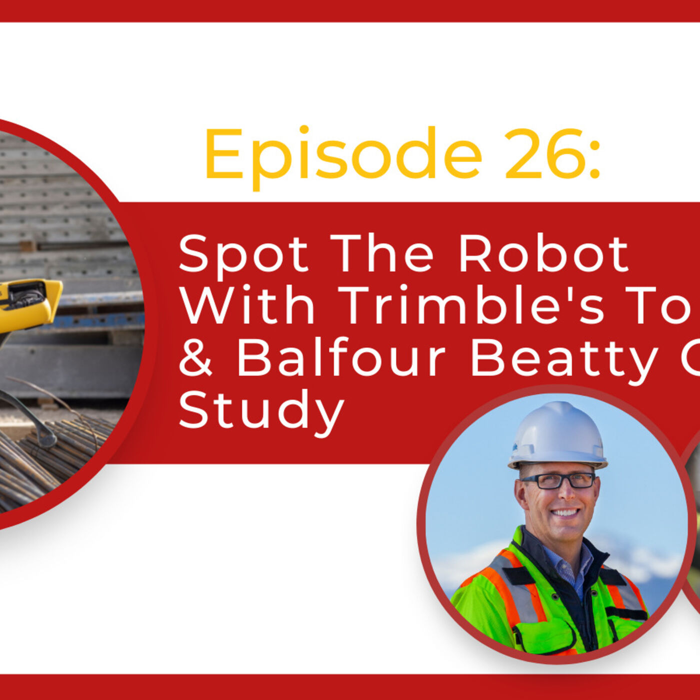
Constructive VoicesSpot The Robot With Trimble’s Top Expert & Balfour Beatty Case StudyIn Episode 26 of the Constructive Voices podcast, Henry Mc Donald speaks to David Burczyk, Construction Robotics Lead at Trimble Connected Construction, and Mark Crawford, Business Manager at Balfour Beatty, to speak about their exciting collaboration, Spot the Robot, who could be our future new co-worker on construction sites.Robotics platforms such as Spot have huge potential in making construction sites safer, more efficient and more streamlined places of work. From covering repetitive tasks on-site, mitigating health and safety risks to employees, and delivering real-time data, we could be seeing the future of construction sites unfold before our...
2022-03-2249 min
The Future of DevelopmentNathan Patton | Product Manager | Trimble | Introducing the XR10 with Hololens 2 IntegrationRecently named one of xyHt's Top 22 Young Geospatial Professionals, Nathan is a passionate product leader, seeking to deliver tangible value for customers through geospatial applications. He joined Trimble's Rotational Leadership Development Program in 2020, where he has played an instrumental role in both product development and marketing strategy. Throughout his time at Trimble, he has been responsible for managing the development of new cutting-edge products in Mixed Reality, Construction, and Design.
Prior to joining Trimble, he spent two years working as a Surveyor at Stantec Geomatics in Calgary, AB, Canada. In his time in the field, Nathan gained a broad set...
2022-02-0443 min
Investor AudioTrimble ($TRMB) BreakdownEquity Breakdown Sponsors:Masterworks: What’s the one thing in every hedge fund titan’s portfolio that you’re probably not investing in? A-R-T. In fact, 84% of ultra-high-net-worth individuals collect art according to a 2019 Deloitte survey. It makes sense—contemporary art prices rose 13.6% per year from 1995-2020 vs. 8.9% returns for the S&P 500 (with virtually no correlation). And with the total art market expected to balloon from $1.7T to $2.6T by 2026, it’s no wonder that the price of paintings has steadily risen. One New York startup is at the center of it all: They’ve fr...
2021-05-0526 minTrimble Geospatial PodcastTBC Power Hour: Field to Finish with ConfidenceIn this TBC Recap session, we'll replay one of our most popular TBC webinars that demonstrates how to take total station and GNSS site data from the field into TBC, reduce into a usable digital form, and create digital and print deliverables.
Please note this is a recording of a webinar that originally included a visual presentation.
2020-08-1958 minTrimble Geospatial PodcastTrimble X7 3D Laser Scanner: Best practices and Recommendations for a Successful First Big ProjectLearn best practices and recommendations on how to tackle a first big scanning project (more than 400 scans). Listeners will be taken through all the steps from the first demo to the final deliverables.
Please note this is a recording of a webinar that originally included a visual presentation.
2020-08-1353 minTrimble Geospatial Podcast24/7 Real-time Monitoring using GNSS DataGNSS sensors are crucial for monitoring large scale projects and areas to detect movement over time to help stakeholders make informed decisions. In this session, Trimble experts Riley Smith and Daniela Koch cover the power of using GNSS data in T4D Control to monitor critical infrastructure and surfaces for deformation. Learn how to add GNSS sensors to Trimble 4D Control Web, configure real-time vs. post-processed GNSS engines, and efficiently analyze and report on the processed data.
Please note this is a recording of a webinar that originally included a visual presentation.
2020-08-1357 minTrimble Geospatial PodcastMobile Mapping Essentials: Highway Corridors for Engineering DesignListen to our Mobile Mapping Essentials webinar recording to learn how to build highway corridors for engineering design in Trimble Business Center (TBC) using Trimble MX9 data.
Please note this is a recording of a webinar that originally included a visual presentation.
2020-08-1349 minTrimble Geospatial PodcastAugmented Reality with SiteVision and Esri GISLearn from expert Dan Colbert on how to bring your GIS data to life with Augmented Reality. Investment in Esri GIS data doesn't end in the office - bring data to the decision point with Trimble SiteVision.
Please note this is a recording of a webinar that originally included a visual presentation.
2020-08-1339 minTrimble Geospatial PodcastPoint Cloud Scale Factors - When Theory Meets Practice in TBCIt’s the best of times thanks to all sorts of instruments we have for surveying and construction. It is the worst of times because we need a solution to align all the data together. In this TBC Power Hour recording, Richard Hassler and Joe Blecha teach you how TBC integrates scanning data and conventional surveying data, delivering consistent results.
If you ever wondered why your point cloud doesn’t match with the ground control points, why it’s meters off from the supposed position, or how to transfer data in between different scanning software packages, listen and fin...
2020-08-1258 minTrimble Geospatial PodcastMobile Mapping Essentials: Considerations When Evaluating Mobile Mapping SolutionsThe purpose of this webinar was to review all aspects of investing in a Mobile Mapping solution. Listeners will get an introduction into the Trimble MX9 and general considerations such as Total Workflow, Deliverables, Software Options.
Please note this is a recording of a webinar that originally included a visual presentation.
2020-08-1255 minTrimble Geospatial PodcastTurn your Total Station into a 24-7 Monitoring SolutionThis session covers the basic components and workflows in making your total station a monitoring system. It also covers the process of connecting your total station to Trimble 4D Control using the Settop M1 communication device. Trimble experts provide best practices and share some real world experiences and challenges.
Please note this is a recording of a webinar that originally included a visual presentation.
2020-08-1255 minTrimble Geospatial PodcastTBC Power Hour: Find and Correct Common Field Data ErrorsThe TBC team and Robert Martin from Navigation Electronics Inc. review field data in the office and perform proper corrections to common mistakes made out in the field.
Please note this is a recording of a webinar that originally included a visual presentation.
2020-08-1253 minTrimble Geospatial PodcastTBC Power Hour: NGS 2022 Spatial Reference Framework ModernizationThe TBC team and Dr. Dru Smith - the National Spatial Reference System (NSRS) Modernization Manager from the National Geodetic Survey (NGS) - discuss NGS’ 2022 datum modernization efforts. In this webinar recording, Dr. Smith covers why this change is happening and the impacts it will have on surveying workflows. They also cover how you and your team can prepare, showcase resources and tools that are and will be available, and how Trimble and the TBC team can help with the transition. If you do survey or construction work in the US (or are curious about what the NGS is up...
2020-08-121h 01Trimble Geospatial PodcastOptical - Best Traverse PracticeRobert Jung, S Series Product Manager for Trimble Optical, explains how to consistently and accurately traverse.
- Improve your overall performance with your Total Station for a traverse
- Understand how to deal with different leveling from the instrument and traverse base
- Learn more how to use the instrument and accessories in the best way
Please note this is a recording of a webinar that originally included a visual presentation.
2020-08-1255 minTrimble Geospatial PodcastForensics - Ask the Experts: GNSS VS GPSDevin Kowbuz, Portfolio Manager for Trimble Forensics, explains the difference between GPS and GNSS technology. Please note this is a recording of a past "Ask the Experts" session.
2020-08-1241 minTrimble Geospatial PodcastGrid vs. Ground CoordinatesMark White from Duncan-Parnell explains Grid vs. Ground Coordinates. Please note this is a recording of a webinar that originally included a visual presentation.
2020-08-1211 minTrimble Geospatial PodcastHow to get into Scanning as a SurveyorLaser scanning has gone mainstream. It is so commonplace that the capabilities are now found in top end total stations. You are considering implementing it, but have questions: What do I do with it? Which scanner should I buy? Which software should I use? When should I use it? Does it make sense for me? How do I get started? In this session, get answers and get started in the exciting world of laser scanning!
Please note this is a recording of a webinar that originally included a visual presentation.
2020-08-121h 00
Trimble Geospatial PodcastInside the Trimble SX10 Scanning Total StationOne of the most popular sessions from Dimensions 2019. A deep dive inside the SX10 instrument covering the EDM, scanning, angle and measurement system.
Please note this is a recording of a webinar that originally included a visual presentation.
2020-08-1259 min
Trimble Geospatial PodcastWhat is a Point Cloud?Trimble experts Jason Hayes, Gregory Lepere, and Arnaud Lezennec offer their personal definitions of what a Point Cloud is, how they are used, and why they are important.
2020-08-0701 min
Trimble Geospatial PodcastSurveyor in the Wild with Lee Landman (@slugsy100)In this episode of "Surveyor in the Wild," we chat with Lee Landman (@slugsy100) about surveying on movie sets, challenges of running your own survey company, WhatsApp, TikTok and getting back to surveying in South Africa. Watch the video of our session with Lee on our Instagram page - @TrimbleGeospatial.
2020-08-0713 min
Trimble Geospatial PodcastSurveyor in the Wild with Dana Driggs (@fishinthedream406)Conversation with Dana Driggs about his life as a surveyor for an episode of our "Surveyor in the Wild" Instagram Live series. The video is available to watch on our Instagram page (@TrimbleGeospatial).
2020-08-0705 min
Trimble Geospatial PodcastSurveyor in the Wild with Amanda Allred (@amandathesurveyor)Stephanie Michaud from Trimble interviewing Amanda Allred from the US Army Corps of Engineers and Vice President of NSPS, as a part of our "Surveyor in the Wild" series.
2020-07-2726 min