Look for any podcast host, guest or anyone
Showing episodes and shows of

USGS,

Shows

Eyes on EarthEyes on EarthEyes on Earth Episode 133 – Vietnam War Bomb CratersDeclassified spy satellite imagery, distributed by the USGS EROS Center, is finding fascinating uses since being made available to the public starting in the 1990s. In this episode of Eyes on Earth, we talk with Philipp Barthelme from the University of Edinburgh, who used imagery from the declassified HEXAGON and CORONA satellites to map bomb craters and herbicide spray lines from the Vietnam War. These features appear in the black and white photos quite clearly, so Barthelme worked out machine learning methods to automatically detect them. This method can help narrow down where to search for unexploded weapons and...2025-03-1826 minFire Danger News and Info TrackerFire Danger News and Info TrackerUnleashing the Power of USGS Fire Science: Safeguarding Western Landscapes from WildfiresWildfires in the western United States have become increasingly frequent and intense, posing significant threats to communities, ecosystems, and wildlife. As these natural disasters escalate, understanding fire science becomes critical in managing and mitigating their impacts. The U.S. Geological Survey (USGS) is at the forefront of fire science research, providing essential data and tools to help combat wildfires effectively.USGS scientists are pioneering efforts to predict wildfire behavior through advanced modeling and analysis techniques. These models help forecast how fires will spread, based on various conditions such as weather patterns, topography, and vegetation types. By accurately predicting...2025-01-1604 minFire Danger News and Info TrackerFire Danger News and Info TrackerCombating Wildfires: How USGS Fire Science Tackles the Growing Threat in the Western USWildfires are a growing threat in the western United States, with their frequency and intensity escalating due to climate change and human activities. This increasing peril underscores the critical importance of fire science in combating these destructive natural events. Fire science encompasses a broad range of research areas, including fire behavior, ecology, prediction, and management strategies, all of which are essential for understanding and mitigating the impact of wildfires.One pivotal institution at the forefront of fire science research is the United States Geological Survey (USGS). The USGS Wildland Fire Science Program plays a crucial role in advancing...2025-01-0903 minFire Danger News and Info TrackerFire Danger News and Info TrackerCombating Wildfires: USGS Leads the Charge with Cutting-Edge Fire ScienceAs wildfires increasingly become a year-round threat in the western United States, the role of fire science is more crucial than ever in combatting these devastating natural events. With climate change exacerbating conditions that fuel these fires, such as prolonged drought and higher temperatures, there is a pressing need for robust scientific strategies to manage and mitigate their impacts effectively.The U.S. Geological Survey (USGS) plays a pivotal role in advancing wildfire science. By leveraging cutting-edge research and technology, USGS scientists are dedicated to understanding the dynamics of wildfires, predicting their behavior, and strategizing effective response measures...2025-01-0503 minFire Danger News and Info TrackerFire Danger News and Info TrackerCombating Wildfires with USGS Wildland Fire Science: Innovative Solutions for a Changing ClimateThe increasing frequency and intensity of wildfires in the western United States underscore the critical role of fire science in combating these destructive events. As climate change continues to exacerbate these conditions, the need for scientific research and innovative solutions is more pressing than ever. The U.S. Geological Survey (USGS) Wildland Fire Science program plays a pivotal role in this effort, providing essential data and insights to help manage and mitigate the effects of wildfires.The USGS Wildland Fire Science webpage offers a wealth of information on how USGS science is making significant strides in understanding and...2024-12-1503 minFire Danger News and Info TrackerFire Danger News and Info TrackerUSGS Leads the Charge in Wildfire Science and Management Across the American WestWildfires have become a recurrent and devastating threat across the western United States, with their frequency and intensity soaring in the past few decades. Scientists, policymakers, and communities are turning towards fire science as a critical tool in understanding and mitigating these destructive events. At the forefront of this scientific endeavor is the United States Geological Survey (USGS), which plays a pivotal role in reshaping our approach to wildland fire management.The USGS Wildland Fire Science program is a cornerstone of efforts aimed at combating wildfires. Through cutting-edge research and technology, this program enhances our capacity to predict...2024-11-1404 minFire Danger News and Info TrackerFire Danger News and Info TrackerUnleashing the Power of Fire Science: USGS Leads the Charge Against Wildfires in the WestWith wildfires increasing in frequency and intensity across the Western United States, the importance of advanced fire science has never been more critical. The U.S. Geological Survey (USGS) is at the forefront of developing cutting-edge research and technologies to better understand and combat these devastating natural disasters.Wildfires pose significant threats to communities, ecosystems, and wildlife, and their impacts are magnified by climate change. Rising temperatures, prolonged droughts, and changes in land use patterns contribute to more severe fire seasons, making wildfire management a pressing concern. The USGS Wildland Fire Science program plays a pivotal role in...2024-11-1003 minFire Danger News and Info TrackerFire Danger News and Info TrackerMastering Wildfire Science: USGS Leads the Charge in Mitigating Devastating BlazesWildfires have become a formidable adversary in the western United States, exacerbating environmental and community challenges. To combat this threat, the integration of fire science knowledge is essential. The United States Geological Survey (USGS) is at the forefront of this scientific endeavor, utilizing advanced research and technology to mitigate the impacts of wildfires.Wildland fires can devastate expansive areas, affecting ecosystems, wildlife, and human settlements. In recent years, the intensity and frequency of these fires have escalated due to climate change, prolonged droughts, and increased human activity near wildlands. As a result, the role of USGS in understanding...2024-11-0704 minFire Danger News and Info TrackerFire Danger News and Info TrackerUnleashing the Power of Fire Science: USGS Leads the Charge Against Wildfire Threats in the WestWildfires have become an increasingly common threat in the western United States, presenting challenges for both communities and ecosystems. The U.S. Geological Survey (USGS) plays a pivotal role in understanding and addressing this urgent issue through its comprehensive wildland fire science program. Fire science is a critical component for devising effective strategies to combat these devastating natural events.The USGS Wildland Fire Science webpage offers a wealth of information demonstrating how scientific research contributes to making a tangible difference in wildfire management and prevention. This science-driven approach is vital for equipping decision-makers, firefighters, and the public with...2024-10-3003 minEyes on EarthEyes on EarthEyes on Earth Episode 126 – Annual NLCDIn this episode of Eyes on Earth, we talk about the latest release of the National Land Cover Database (NLCD). More than just a map, NLCD is a stack of maps—a database. It has long been the foundational land cover source for scientists, resource managers, and decision-makers across the United States, and now the next generation of USGS land cover mapping is here. This new release includes land cover data of the United States for every year back to 1985, so it is now called Annual NLCD.2024-10-2930 minFire Danger News and Info TrackerFire Danger News and Info TrackerCombating Wildfires: USGS Leads the Way with Cutting-Edge Fire ScienceWildfires in the western United States have become increasingly severe, drawing urgent attention to the pivotal role of fire science in effectively combating these natural disasters. The United States Geological Survey (USGS) has been at the forefront of this effort, employing cutting-edge research and innovative technologies to understand and mitigate wildfires.The western United States is particularly susceptible to wildfires due to its vast forested areas, frequent drought conditions, and rising temperatures driven by climate change. These factors create a perfect storm for fires to ignite and spread rapidly, threatening ecosystems, wildlife, human communities, and valuable resources.2024-10-2704 minFire Danger News and Info TrackerFire Danger News and Info TrackerCombating Wildfires: How USGS Wildland Fire Science Leads the ChargeWildfires are a growing concern in the western United States, with impacts stretching from environmental damage to economic and health consequences. The intensification and frequency of these fires demand a comprehensive understanding of fire dynamics, making fire science an essential tool in the battle against wildfires. The United States Geological Survey (USGS) plays a pivotal role in advancing fire science to better cope with these challenges.The USGS Wildland Fire Science provides critical insights into how wildfires start, spread, and can be controlled. This knowledge is crucial for emergency services, land managers, and policymakers working to mitigate the...2024-10-1704 minNatural Hazard News and Info Tracker
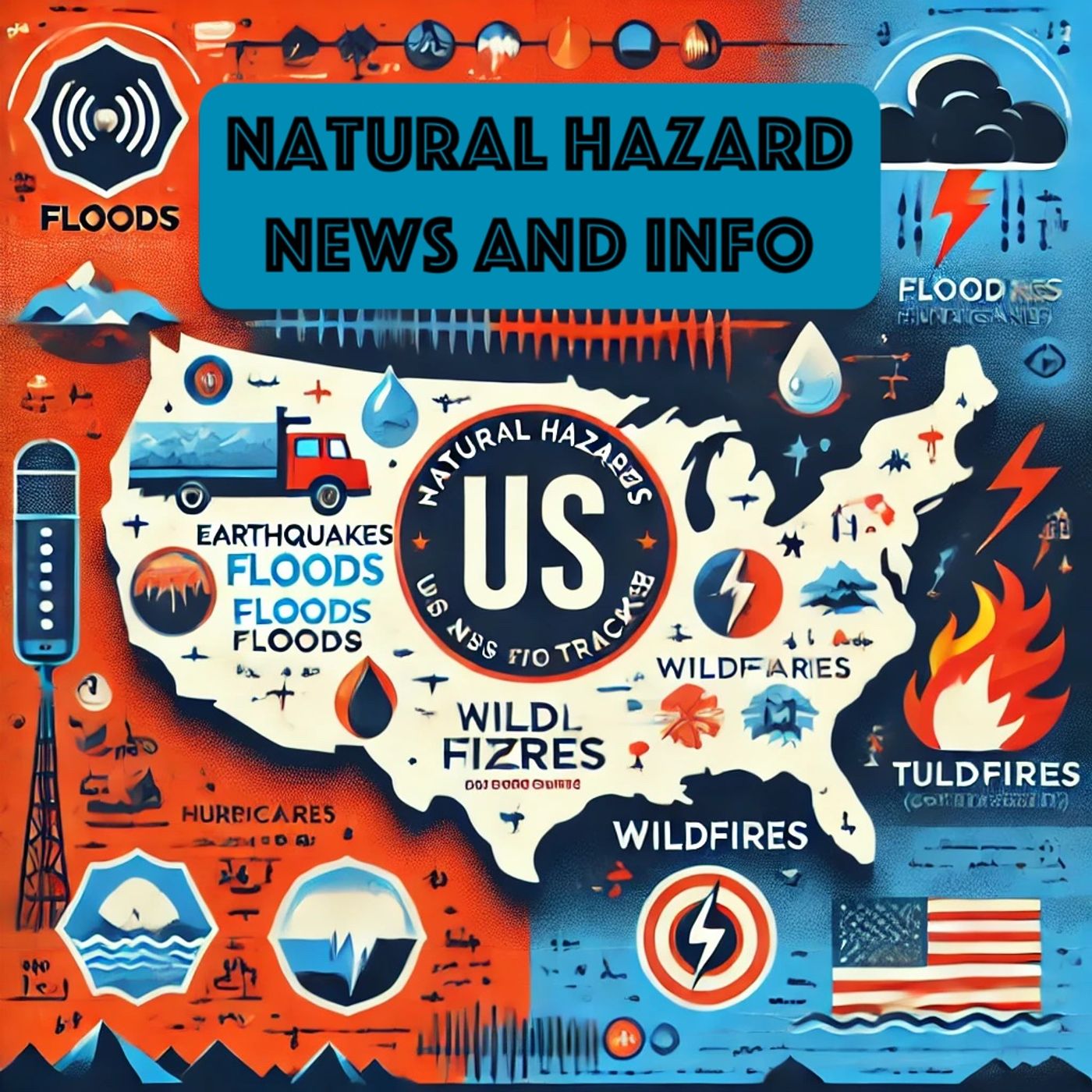
Natural Hazard News and Info TrackerUSGS Tackles Dual Natural Disasters, Showcasing Expertise and VersatilityIn an extraordinary demonstration of their capacity to handle multiple hazards simultaneously, the U.S. Geological Survey (USGS) experts are currently responding to two significant natural disasters. As Hurricane Helene barrels across the Atlantic, threatening coastal regions, USGS teams are also addressing another formidable natural hazard, highlighting their critical role in mitigating impacts and safeguarding communities.Hurricane Helene, a formidable force of nature, has prompted USGS scientists to intensify their research and data collection efforts. Their work is crucial in predicting the hurricane's path, assessing potential impacts, and providing vital information to decision-makers and the public. USGS experts...2024-10-1003 minFire Danger News and Info TrackerFire Danger News and Info TrackerCutting-Edge Fire Science: USGS Leads the Charge Against Wildfires in the WestWildfires pose a significant threat to life, property, and natural resources, especially in the western United States. Addressing this challenge requires cutting-edge fire science, and the U.S. Geological Survey (USGS) is at the forefront of this effort. By leveraging advanced technologies and interdisciplinary research, USGS scientists are developing innovative strategies for wildfire prediction, management, and recovery.USGS's Wildland Fire Science program plays a crucial role in understanding the dynamics of wildfires and their impacts. This comprehensive research initiative integrates data from satellite imagery, aerial reconnaissance, and field observations to create detailed fire behavior models. These models are...2024-09-2604 minFire Danger News and Info TrackerFire Danger News and Info TrackerUnraveling the Science Behind Wildfire Management: USGS Leads the Way in the Western U.S.Wildfires have increasingly become a significant threat across the Western United States, affecting ecosystems, communities, and economies. Fire science plays a critical role in understanding, predicting, and combating these devastating natural events. The United States Geological Survey (USGS) is at the forefront of wildland fire science, providing vital research and tools to help manage and mitigate the impacts of wildfires.One of the key aspects of USGS fire science is the study of fire behavior and its interaction with different landscapes. By analyzing vegetation types, weather patterns, and topography, USGS scientists can create models that predict wildfire spread...2024-09-2203 minFire Danger News and Info TrackerFire Danger News and Info TrackerHarness USGS Fire Science to Combat Wildfires in the WestFire Science Critical for Combating Wildfires Out WestWildfires are a growing concern in the western United States, posing significant threats to ecosystems, human communities, and economic resources. As these fires become more frequent and intense, advanced fire science becomes crucial in understanding and mitigating their impacts. The United States Geological Survey (USGS) is at the forefront of this effort, employing cutting-edge science to tackle the challenges posed by wildfires effectively.The USGS Wildland Fire Science program focuses on a multidisciplinary approach to wildfire research. This includes studying fire behavior, fire ecology, and fire effects to...2024-09-1903 minFire Danger News and Info TrackerFire Danger News and Info TrackerUSGS Tackles Wildfire Crisis: Cutting-Edge Research and Technology for Ecosystem ResilienceWildfires are a growing threat to ecosystems and communities across the western United States. As these fires become more frequent and intense, the role of fire science in managing and mitigating their impacts has never been more critical. The United States Geological Survey (USGS) is at the forefront of this effort, utilizing cutting-edge research and technology to combat wildfires effectively.The USGS Wildland Fire Science program plays a pivotal role in understanding fire behavior, predicting fire outbreaks, and reducing the devastating effects of wildfires. By analyzing a multitude of factors such as weather patterns, vegetation types, and topography...2024-09-1503 minFire Danger News and Info TrackerFire Danger News and Info TrackerMastering Wildfire Resilience: How USGS Leads the Way in Advanced Fire Science and MitigationWildfires have become an increasing threat throughout the western United States, making it imperative to lean on advanced fire science to combat this escalating issue. The U.S. Geological Survey (USGS) has taken significant steps to curb the destructive impact of wildfires by leveraging cutting-edge research and technology.USGS Wildland Fire Science is an initiative that focuses on understanding the behaviors, causes, and effects of wildfires. This research is crucial in enhancing how we prepare for and respond to these natural disasters. By analyzing fire patterns and the ecological aftermath, USGS scientists provide vital information that helps in...2024-09-1204 minWater News - USWater News - USUSGS Spearheads Innovative Water Monitoring Technologies for Sustainable Water Resource ManagementThe U.S. Geological Survey (USGS) is at the forefront of advancing water monitoring technologies to meet the growing demand for precise and actionable water data. This initiative is critical for understanding and managing the nation's vast and diverse water resources effectively. The development of next-generation water monitoring networks by the USGS is not only geared towards maintaining current capabilities but also driving technological innovations that can revolutionize water science.One of the key areas of focus for the USGS is enhancing the accuracy and reliability of water data collection. Traditional methods of water monitoring, while effective, often...2024-09-0504 minFire Danger News and Info TrackerFire Danger News and Info TrackerWildfire-Combating Fire Science: USGS Leads the Charge Out WestFire Science Critical for Combating Wildfires Out WestWildfires pose a significant threat to ecosystems, communities, and economies across the western United States. The U.S. Geological Survey (USGS) plays a pivotal role in understanding and mitigating these destructive events through advanced fire science.Through a multifaceted approach, USGS scientists research various aspects of wildfires, including fire behavior, effects on the landscape, and recovery processes. This comprehensive understanding is fundamental to developing effective strategies for wildfire prevention, management, and rehabilitation.One of the critical areas of USGS research is the analysis of fire behavior...2024-09-0503 minWater News - USWater News - USUSGS Pioneers Next-Generation Water Monitoring Technologies for Reliable and Timely DataThe U.S. Geological Survey (USGS) is at the forefront of developing the next generation of water monitoring technologies to ensure robust and reliable water data collection across the United States. As our nation's demand for accurate and timely water data grows, so too does the need for innovative advancements in monitoring networks.USGS is committed to staying ahead of technological trends and driving innovations in water monitoring. This commitment involves integrating cutting-edge sensors, real-time data transmission, and advanced analytical tools to provide more precise and comprehensive information on water resources. By leveraging these innovations, the USGS is...2024-09-0203 minOceans News and Info TrackerOceans News and Info Tracker"Safeguarding Ecosystems: USGS Tackles the Threat of Harmful Algal Blooms"Algal blooms, while part of the natural ecosystem, can sometimes transform into harmful algal blooms (HABs) that pose risks to both human health and wildlife. The U.S. Geological Survey (USGS) is actively investigating these phenomena to mitigate their impacts.HABs occur when algae grow excessively in water bodies, often spurred by nutrient pollution from agricultural runoff, wastewater discharges, and other human activities. While not all algal blooms are harmful, certain types can produce toxins harmful to humans, pets, and marine life.USGS scientists are engaged in a multifaceted approach to understand, predict, and prevent the...2024-08-2803 minFire Danger News and Info TrackerFire Danger News and Info TrackerUSGS Spearheads Cutting-Edge Wildfire Research to Protect Western US CommunitiesWildfires are a persistent threat to the western United States, where extended periods of dry weather and dense vegetation create a dangerous tinderbox. The U.S. Geological Survey (USGS) is at the forefront of combating these devastating fires through cutting-edge research and applications in fire science.Fire science is essential in understanding the complex interplay between natural landscapes and wildfire dynamics. USGS scientists use advanced technology, including satellite imagery and remote sensing, to monitor fire-prone areas effectively. By analyzing fire behavior and its impacts on various ecosystems, they provide crucial information that aids fire management agencies in making...2024-08-2502 minFire Danger News and Info TrackerFire Danger News and Info TrackerCombating Wildfires: How USGS Advances Fire Science for Safer CommunitiesWildfires in the Western United States have become increasingly frequent and destructive, emphasizing the critical importance of fire science in combating these natural disasters. The United States Geological Survey (USGS) plays a pivotal role in advancing our understanding and management of wildland fires through its comprehensive research and innovative solutions.USGS scientists are at the forefront of developing advanced tools and technologies to predict, monitor, and manage wildfires. These efforts include the use of satellite imagery, remote sensing, and GIS (Geographic Information System) mapping to track fire behavior and assess damage in real-time. By analyzing data on vegetation...2024-08-1803 minFire Danger News and Info TrackerFire Danger News and Info TrackerUSGS Plays Critical Role in Wildfire Mitigation and Management Across the Western U.S.The increasing frequency and severity of wildfires across the western United States necessitate a robust scientific approach to mitigate their impact. The U.S. Geological Survey (USGS) has been at the forefront of developing and applying fire science to better understand and combat these devastating events.Wildfires not only pose significant risks to human lives and property but also trigger long-term environmental effects, such as soil erosion, water contamination, and habitat loss. To address these challenges, the USGS Wildland Fire Science program conducts intensive research aimed at all stages of wildfire management—prevention, response, and recovery.Pr...2024-08-1503 minFire Danger News and Info TrackerFire Danger News and Info TrackerUSGS Fire Science Leads Wildfire Mitigation Efforts in the WestFire Science Critical for Combating Wildfires Out WestWildfires represent a significant threat to the western United States, posing dangers not only to natural landscapes but also to human lives and properties. Effective fire science is essential for mitigating these risks, and the United States Geological Survey (USGS) is at the forefront of this battle. The agency's dedicated research aims to understand the behavior of wildfires, predict their spread, and develop advanced tools and strategies to manage them more effectively.The USGS Wildland Fire Science webpage reveals how their scientific endeavors make tangible differences in wildfire...2024-08-1103 minFire Danger News and Info TrackerFire Danger News and Info TrackerUnleashing the Power of Fire Science: USGS Leads the Charge Against Wildfires in the WestFire science is proving to be critical in the battle against wildfires in the western United States. The US Geological Survey (USGS) is at the forefront in utilizing advanced science to mitigate the devastating impacts of these fires. Through rigorous research and innovative technologies, USGS is enhancing our understanding and management of wildfires, which are becoming increasingly frequent and severe due to climate change.USGS Wildland Fire Science encompasses a wide range of studies designed to understand fire behavior, the impact of fire on ecosystems, and the effectiveness of fire mitigation strategies. One of the primary focuses is...2024-08-0803 minFire Danger News and Info TrackerFire Danger News and Info TrackerCombating Wildfires: USGS Leads the Charge with Cutting-Edge Fire ScienceWildfires have become a prevalent and destructive force, particularly in the western United States. To effectively combat these infernos, the role of fire science has become more critical than ever. The U.S. Geological Survey (USGS) is at the forefront of this endeavor, using cutting-edge science to make a tangible difference in wildfire management and prevention. Fire science involves the study of wildfire behavior, the factors that influence it, and the best practices for managing it. USGS scientists employ a variety of innovative techniques to understand and mitigate the impacts of wildfires. For instance, they utilize satellite imagery...2024-08-0404 minEyes on EarthEyes on EarthEyes on Earth Episode 120 – Mapping the California CoastlineIn this episode of Eyes on Earth, we begin a series on Landsat’s usefulness in coastal studies. First, we talk with Sean Vitousek, a USGS research oceanographer, about changes to beaches in California and how he is using Landsat and other data to create models that can predict how the coastline may change in the future because of sea level rise and coastal erosion. Landsat’s global reach stretches back decades—that, along with its free availability, can help in planning for the prevention and adaptation to future hazards along the coast. See how Landsat complements other data and gr...2024-07-1619 minEyes on EarthEyes on EarthEyes on Earth Episode 114 – The Color of Water with LandsatTypically, we use Landsat data to study changes on the land—you know, Landsat. In this episode of Eyes on Earth, we learn how satellite images and pixels of water, along with actual water samples, are helpful in determining the productivity of lakes across the United States. We talk with Mendenhall Fellow and Research Geographer Dr. Michael Meyer about a recently released, freely accessible dataset that uses a metric called lake trophic state to validate the Landsat observations of thousands of lakes. The dataset was also named a USGS Open Science Success Story as part of the White House Of...2024-03-1223 minSounds of YellowstoneSounds of YellowstoneSteamboat Geyser — Sounds of Yellowstone (ASMR, Sleep, Concentration)Need time to concentrate or relax? Then listen to the gurgling and bubbly sounds of Steamboat Geyser in Yellowstone National Park, Wyoming. "Steamboat Geyser is the world’s tallest active geyser. It showers watchers and drenches the walkway. Days, months, or years pass between the major eruptions of Steamboat Geyser. Steamboat Geyser’s major eruptions (more than 300 feet high) are unpredictable and often many years apart. Its frequent “minor phase” eruptions eject water 10 to 40 feet high." (-NPS.gov)If you're looking for the video, check out Steamboat Geyser on the USGS YouTube channel. 2024-02-248h 00Eyes on EarthEyes on EarthEyes on Earth Episode 111 – Mendenhall Fellow’s Drought ForecastingIn this episode of Eyes on Earth, we spoke with Mikael Hiestand, a Mendenhall Postdoctoral Fellow. Using algorithms developed at EROS, Mikael is working on near-term drought forecasting. With synthetic Landsat data, he found that predicting evapotranspiration could be used as a means of drought prediction and monitoring. The Mendenhall Fellowship allows people who have just completed their PhD an opportunity to work on research with USGS scientists and prepare for their career.2024-01-2312 minEyes on Earth
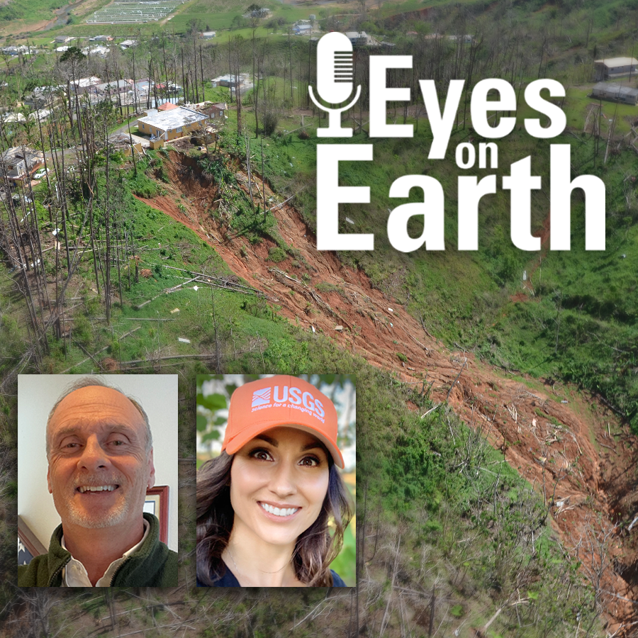
Eyes on EarthEyes on Earth Episode 110 – Geospatial Information Response TeamFirst responders need reliable, accurate mapping capabilities as quickly as possible in the wake of a disaster—and they don’t have time to download and organize it. In this episode of Eyes on Earth, we learn how the USGS Geospatial Information Response Team draws data from multiple sources to show what an area looked like before an event as well as after, creating accessible, usable maps and data sets for those bringing relief.2023-12-1926 minEyes on EarthEyes on EarthEyes on Earth Episode 108 – Landsat 8’s 100th Drag Make-Up ManeuverThe Landsat Program is considered the gold standard for satellite Earth-observation imagery. To keep it that way, the USGS EROS Flight Operations Team continually monitors the flight paths of the Landsat satellites to make sure they stay at a consistent 705-kilometer altitude. That means frequently speeding it up to counter the effects of atmospheric drag. But that’s not all. The team accounts for solar activity, space junk, and other factors to keep the satellites safe. Landsat 8’s 100^th^ Drag Make-Up maneuver in October 2023 gives us the opportunity, in this episode of Eyes on Earth, to talk about these and...2023-11-2119 minSounds of YellowstoneSounds of YellowstoneMudpot at Artists' Paintpots — Sounds of Yellowstone (ASMR, Sleep, Concentration)Need time to concentrate or relax? Then listen to the natural sounds of a mudpot in Yellowstone National Park, Wyoming. This mudpot is located in the Artists' Paintpots area located in Yellowstone National Park, Wyoming.If you're looking for the video, check out Mudpot at Artists' Paintpots on the USGS YouTube channel.2023-11-068h 00Sounds of YellowstoneSounds of YellowstoneTerrace Springs — Sounds of Yellowstone (ASMR, Sleep, Concentration)Need time to concentrate or relax? Then listen to the natural sounds of Terrace Springs in Yellowstone National Park, Wyoming. Terrace Springs is located near the Madison Junction in Yellowstone National Park, Wyoming.If you're looking for the video, check out Terrace Springs on the USGS YouTube channel.2023-11-068h 00Sounds of YellowstoneSounds of YellowstoneRustic Falls — Sounds of Yellowstone (ASMR, Sleep, Concentration)Need time to concentrate or relax? Then listen to the natural sounds of Rustic Falls in Yellowstone National Park, Wyoming. Rustic Falls is a few miles south of Mammoth Hot Springs in Yellowstone National Park, Wyoming.If you're looking for the video, check out Rustic Falls on the USGS YouTube channel.2023-11-068h 00Sounds of YellowstoneSounds of YellowstoneKepler Cascades — Sounds of Yellowstone (ASMR, Sleep, Concentration)Need time to concentrate or relax? Then listen to the natural sounds of Kepler Cascades in Yellowstone National Park, Wyoming. Kepler Cascades is located just a couple miles away from Old Faithful within Yellowstone National Park, Wyoming. If you're looking for the video, check out Beryl Spring on the USGS YouTube channel.2023-11-068h 00Sounds of YellowstoneSounds of YellowstoneFrying Pan Spring — Sounds of Yellowstone (ASMR, Sleep, Concentration)Need time to concentrate or relax? Then listen to the natural sounds of Frying Pan Spring in Yellowstone National Park, Wyoming. Frying Pan Spring is a hot spring that sounds like bacon on the frying pan and is located in Yellowstone National Park, Wyoming. Who doesn't love bacon?!If you're looking for the video, check out Frying Pan Spring on the USGS YouTube channel.2023-11-068h 00Sounds of YellowstoneSounds of YellowstoneEast Chinaman Spring — Sounds of Yellowstone (ASMR, Sleep, Concentration)Need time to concentrate or relax? Then listen to the natural sounds of East Chinaman Spring in Yellowstone National Park, Wyoming. East Chinaman Spring is located in the Upper Geyser Basin within Yellowstone National Park, Wyoming.If you're looking for the video, check out East Chinaman Spring on the USGS YouTube channel.2023-11-068h 00Sounds of YellowstoneSounds of YellowstoneCongress Pool — Sounds of Yellowstone (ASMR, Sleep, Concentration)Need time to concentrate or relax? Then listen to the natural sounds of Congress Pool in Yellowstone National Park, Wyoming. Congress Pool is a mud pool/mud pot located in the Norris Geyser Basin in Yellowstone National Park, Wyoming.If you're looking for the video, check out Congress Pool on the USGS YouTube channel.2023-11-068h 00Sounds of YellowstoneSounds of YellowstoneCinnamon Spouter — Sounds of Yellowstone (ASMR, Sleep, Concentration)Need time to concentrate or relax? Then listen to the natural sounds of Cinnamon Spouter in Yellowstone National Park, Wyoming. Cinnamon Spouter is located in the Black Sand Basin in Yellowstone National Park, Wyoming. If you're looking for the video, check out Cinnamon Spouter on the USGS YouTube channel.2023-11-068h 00Sounds of YellowstoneSounds of YellowstoneBridge Near Monument Geyser Basin Trailhead — Sounds of Yellowstone (ASMR, Sleep, Concentration)Need time to concentrate or relax? Then listen to the natural sounds of a flowing river through Yellowstone National Park, Wyoming. This audio is from a river below the bridge near the Monument Geyser Trailhead in Yellowstone National Park, Wyoming.If you're looking for the video, check out Bridge Near Monument Geyser Basin Trailhead on the USGS YouTube channel.2023-11-068h 00Sounds of YellowstoneSounds of YellowstoneBlue Mud Steam Vent — Sounds of Yellowstone (ASMR, Sleep, Concentration)Need time to concentrate or relax? Then listen to the natural sounds of Blue Mud Steam Vent in Yellowstone National Park, Wyoming. Blue Mud Steam Vent is found within the Norris Geyser Basin in Yellowstone National Park, Wyoming.If you're looking for the video, check out Blue Mud Steam Vent on the USGS YouTube channel.2023-11-068h 00Sounds of YellowstoneSounds of YellowstoneBeryl Spring — Sounds of Yellowstone (ASMR, Sleep, Concentration)Need time to concentrate or relax? Then listen to the natural sounds of Beryl Spring in Yellowstone National Park, Wyoming. Beryl Spring, in the Gibbon River valley south of Artist's Paintpots, is a complex plumbing system in Yellowstone National Park with a strongly and constantly boiling hot spring pool, and a powerful fumarole just behind the pool.If you're looking for the video, check out Beryl Spring on the USGS YouTube channel. 2023-11-068h 00Eyes on EarthEyes on EarthEyes on Earth Episode 106 – EROS 50th: Land Cover, Part 1Several decades ago, USGS EROS employees were pioneers in land cover mapping—turning satellite imagery into a record of what covers the land, from farmland to forest to urban areas. National and global datasets with a variety of uses resulted from these efforts. In this episode of Eyes on Earth, we explore some of this history, along with how it benefited people at the time and the mapping efforts that would follow. Our next episode will look at two modern efforts at EROS, NLCD and LCMAP, and how their strengths are merging for the next generation of land cover an...2023-10-3120 minEyes on EarthEyes on EarthEyes on Earth Episode 104 – EROS 50th: Alumni and Friends, Part 2At the USGS EROS 50th anniversary events on August 17-19, 2023, a special effort was made to include alumni who had worked at the center, especially those from the earliest years of EROS’ existence. This episode of Eyes on Earth is the second to highlight their stories, with emphasis on science, technology, and EROS’ international outlook.2023-09-2630 minEyes on EarthEyes on EarthEyes on Earth Episode 103 - EROS 50th: Alumni and Friends, Part 1At the USGS EROS 50th anniversary events on August 17-19, 2023, a special effort was made to include alumni who had worked at the center, especially those from the earliest years of EROS’ existence. This episode of Eyes on Earth highlights their stories, with emphasis on EROS’ history and its dedicated employees.2023-09-1927 minEyes on EarthEyes on EarthEyes on Earth Episode 100 – EROS 50th: Our LegacyAs USGS EROS turns 50 this month, our Eyes on Earth podcast also marks a big moment: Episode 100. To celebrate, we bring together some treasured moments from previous episodes in which people inside and outside of EROS share their thoughts on EROS and its role in the world of remote sensing, including as keeper of all Landsat satellite data.2023-08-0827 minEyes on EarthEyes on EarthEyes on Earth Episode 97 – EROS 50th: Earth As ArtSatellites capture an incredible variety of views of Earth. In this episode of Eyes on Earth, we talk with the three engineers at USGS EROS who started the USGS Earth As Art project. The Earth As Art origin story is an example of the initiative and creativity of EROS staff. This stunningly visual product grabs the public’s attention—and then leads to conversations about the value of remote sensing with satellites.2023-07-0416 minEyes on EarthEyes on EarthEyes on Earth Episode 96 – Generational ScienceIn this episode of Eyes on Earth, we talk with Peder Nelson about generational science and the responsibility we have to future generations to study our changing planet. It takes more than just data to make sense of land change. And while remote sensing scientists work with the deep archive of Landsat and other land data available from the USGS EROS Center, everyone can put themselves on the timeline of Landsat data. Citizen science projects allow anyone to participate in the observations that help us understand the world around us.2023-06-2119 minEyes on EarthEyes on EarthEyes on Earth Episode 95 – EROS 50th: Landsat Science TeamThe members of the five-year Landsat Science Teams, led jointly by the USGS and NASA with a strong tie to EROS, have brought a wide breadth of expertise, backgrounds and geographic locations to the table. In this episode of Eyes on Earth, we learn how members have explored strategies for the effective use of archived Landsat data and integration of future data, and how they have helped identify Landsat user needs for upcoming satellite sensors, including those on the future Landsat Next.  2023-06-0823 minEyes on EarthEyes on EarthEyes on Earth Episode 91 – Intro to AmericaViewAmericaView aims to advance Earth observation education through a network of programs based at universities in more than 40 states. In this episode of Eyes on Earth, we talk about AmericaView’s goals and how AmericaView and its member states explain remote sensing efforts to society in a variety of ways, including outreach to students who range from elementary to graduate school. We also give examples of the organization’s remote sensing research and describe AmericaView’s ties with the USGS and with Landsat.2023-03-0719 minEyes on EarthEyes on EarthEyes on Earth Episode 89 - EROS Workers and WeatherWhen the snow gets deep and the wind blows, it can be challenging for workers to travel to the USGS EROS Center, located several miles north of Sioux Falls, SD, on what used to be farmland. Most can telecommute these days, but in this episode of Eyes on Earth, we discover how essential employees ensure there is in-person continuous monitoring of Landsat ground station operations during winter weather—sometimes even requiring an overnight stay.2023-02-0711 minEyes on EarthEyes on EarthEyes on Earth Episode 86 - Tours at EROSThe USGS EROS Center is the home of the Landsat satellite archive. This data center and science center located on a former farm near Sioux Falls, SD, is one of the largest civilian archives of land imaging in the world. In this episode of Eyes on Earth, we discuss what visitors to EROS will learn on a tour, including examples of land change seen by Landsat and why EROS is located where it is. Find out how to contact the EROS Outreach Coordinator to schedule a tour, group visit, or school or civic presentation.2022-12-1713 minEyes on EarthEyes on EarthEyes on Earth Episode 75 – Mapping Dust Sources WorldwideClouds of dust kicked up in places like the Sahara can travel thousands of miles across the planet. We can see those clouds in satellite imagery, but we don’t typically know much about the composition of that dust. That’s a huge blind spot, because those unknown characteristics—such as the particles’ lightness or darkness—have an impact on what they do. The warming and cooling of the atmosphere, snow melt, ocean or rain forest fertilization, and even cloud formation can all be affected by dust cloud composition. Mapping those dust sources is the focus of the Earth Surface Mi...2022-05-2818 minEyes on EarthEyes on EarthEyes on Earth Episode 74 – A Satellite Cross Calibration MissionWhen the first Landsat satellite launched 50 years ago, it was the only game in town in terms of civilian land remote sensing. In the years that followed, a host of satellites have launched to serve similar purposes. But that data doesn't always play well together. Subtle differences between the measurements taken by satellites make it difficult to do apples-to-apples comparisons of land change. On this episode of Eyes on Earth, we hear from the USGS partners working with partners in Australia to launch a satellite cross calibration mission that will offer a common reference post and serve as a...2022-05-1419 minEyes on EarthEyes on EarthEyes on Earth Episode 73 – Global Water UseSome plants are simply better at making use of their water supply than others. More efficient plants can capture more carbon with less water, which has implications for carbon sequestration and ultimately for climate change modeling. In other words, the more we understand about water use efficiency, the more reliable our climate change models can be. And the only way to measure efficiency at the global scale is from space. On this episode of Eyes on Earth, we hear from a scientist who studied global water use using a sensor called ECOSTRESS, whose data are housed at the USGS...2022-04-2314 minEyes on EarthEyes on EarthEyes on Earth Episode 72 – Northward Shift of the Boreal ForestThe boreal forest, or taiga, stretches across nearly 5.7 million square miles in the northern latitudes. That’s nearly a quarter of all forested lands in the world. This sprawling biome also happens to be one of the most rapidly shifting in the face of climate change. Many studies have suggested that the taiga tree line is moving northward as temperatures warm worldwide, edging itself into the colder tundra. On this episode of Eyes On Earth, we hear from Professor Logan Berner, part of team at Northern Arizona University’s Global Earth Observation and Dynamics of Ecosystems (GEODE) Lab that used...2022-04-1919 minEyes on EarthEyes on EarthEyes on Earth Episode 71 – Blue Oak Forests of CaliforniaIn this episode of Eyes on Earth, we zero in on the use of USGS Land Change Monitoring, Assessment, and Projection (LCMAP) products to examine the effects of drought on California’s Blue Oaks. LCMAP datasets are built from Landsat data and reveal the land cover and change of every pixel in the conterminous United States, dating back to 1985. In this case, LCMAP helped identify areas of declines and losses of the Blue Oak trees that are native to California and found in the foothills surrounding the central valley and along the coast.2022-04-0514 minEyes on EarthEyes on EarthEyes on Earth Episode 70 - ECOSTRESS and Aquatic EcosystemsSummary: The Earth observation data archived here have plenty of value to the study of aquatic ecosystems. Landsat satellites can capture harmful algal blooms, for example. Spaceborne sensors can also record land surface temperatures, and that includes water surfaces. On this episode of Eyes on Earth, we hear about how a sensor called ECOSTRESS can be used to measure water temperatures at different times of day, and how those measurements could be useful in the monitoring and management of the endangered Delta smelt. ECOSTRESS data are available through the NASA Land Processes Distributed Active Archive Center (LP DAAC), located...2022-03-2221 minOutstanding in the FieldOutstanding in the FieldUSGS Outstanding in the Field, Episode 11, Designing Accessible Research for Rural CommunitiesThis is a special edition of Outstanding in the Field, the U.S. Geological Survey’s podcast series produced by the Ecosystems Mission Area. In this episode we highlight stories from the Alaska Voices podcast, a partnership between the U.S. Geological Survey’s Alaska Climate Adaptation Science Center and the University of Alaska Fairbanks.2022-03-1530 minOutstanding in the FieldOutstanding in the FieldUSGS Outstanding in the Field, Episode 11, Designing Accessible Research for Rural CommunitiesThis is a special edition of Outstanding in the Field, the U.S. Geological Survey’s podcast series produced by the Ecosystems Mission Area. In this episode we highlight stories from the Alaska Voices podcast, a partnership between the U.S. Geological Survey’s Alaska Climate Adaptation Science Center and the University of Alaska Fairbanks.2022-03-1530 minEyes on EarthEyes on EarthEyes on Earth Episode 69 - Thirty Years of Land Change in the U.S.Land change is a constant. Even land areas that see little major change can see disruptions from storms, heat waves, wildfires, or invasive species. But major changes aren't uncommon, either. Each year in the U.S., farm fields become tracts of suburban homes, wetlands become more permanent bodies of water, and shrublands burn to be replaced with grasslands. A team of researchers with the USGS Land Change Monitoring, Assessment, and Projection initiative (LCMAP) recently released a study documenting land cover class change from 1985-2016. On this episode of Eyes on Earth, we talk to the study’s lead author ab...2022-03-0818 minEyes on EarthEyes on EarthEyes on Earth Episode 66 – Exotic Annual GrassesThe rangelands of the western United States are changing more quickly than many other parts of the lower 48. Miles upon miles of the area or semi-arid landscapes in states like Idaho, Montana and Nevada are now carpeted by fire fueling invasive grasses. Cheatgrass is the most prevalent, which is troublesome for several reasons. First off, it greens up and browns down really quickly, leaving a layer of tinder-like vegetation. In many areas, it fills in the formerly barren spaces between thicker bunchgrasses and sagebrush, which in turn helps fires move rapidly from fuel source to fuel source. On this...2022-01-2519 minEyes on EarthEyes on EarthEyes on Earth Episode 64 - Colorado Bark BeetlesOutbreaks of native bark beetles can lead to conspicuous changes in a forest landscape. They’ve been present for thousands of years with occasional outbreaks, but there’s a lot we don’t yet understand about them. Exactly when and where have outbreaks occurred? How severe were they? What happened to the forest afterward? How will a warming climate influence outbreaks? On this episode of Eyes on Earth, we hear from researchers Dr. Sarah Hart and Dr. Kyle Rogers, who use Landsat to help find answers to those questions. A recent study led by Dr. Rodman used Landsat to identi...2021-12-2813 minEyes on EarthEyes on EarthEyes on Earth Episode 62 - Landsat 9 Launch Part 3For our third and final episode of Eyes on Earth from the September launch of Landsat 9, we hear from Virginia Norwood. She blazed a trail for women in remote sensing in the 1960s and 70s while working for Hughes Aircraft, a contractor for NASA. Norwood is known as the “Mother of Landsat” for her design of the Multispectral Scanner, or MSS, the sensor used to image the Earth’s surface by early Landsat satellites. Norwood met her fans during a Q&A a few hours after the launch sponsored by the USGS and Ladies of Landsat. The episode also featur...2021-12-0118 minEyes on EarthEyes on EarthEyes on Earth Episode 61 - Landsat 9 Launch Part 2Hundreds of scientists, officials, international representatives, and others witnessed the launch of Landsat 9 on September 27, 2021, from a handful of viewing sites around Santa Barbara County, California. Their interests were as varied as their backgrounds, but the new satellite’s extension of the Landsat program’s invaluable 50-year record of Earth observations was top of mind for the international partners who help the USGS collect Landsat data and the scientists who rely on those data to monitor the health of the planet. In this episode of Eyes on Earth, we talk with guests from around the world about their role in t...2021-11-1614 minOutstanding in the FieldOutstanding in the FieldUSGS Outstanding in the Field, Episode 10, BatsWelcome to the USGS Ecosystems Mission Area Outstanding in the Field podcast series that tells stories about our science, our adventures, and our efforts to better understand fish and wildlife and the ecosystems that support them. In this episode we head to southern Florida to learn about one of North America’s most misunderstood - yet threatened - mammals: bats.2021-10-2130 minOutstanding in the FieldOutstanding in the FieldUSGS Outstanding in the Field, Episode 10, BatsWelcome to the USGS Ecosystems Mission Area Outstanding in the Field podcast series that tells stories about our science, our adventures, and our efforts to better understand fish and wildlife and the ecosystems that support them. In this episode we head to southern Florida to learn about one of North America’s most misunderstood - yet threatened - mammals: bats.2021-10-2130 minOutstanding in the FieldOutstanding in the FieldUSGS Outstanding in the Field: Biocrusts (Ep. 9)Welcome to another episode of Outstanding in the Field, the U.S. Geological Survey’s podcast series produced by the Ecosystems Mission Area. We highlight our fun and fascinating fieldwork studying ecosystems across the country. Today we’ll be discussing tiny communities that are found on the surface of the soil in the harsh environments of cold and hot deserts. These often-overlooked communities are called biological soil crusts, or biocrusts for short, and USGS scientists at the Southwest Biological Science Center have been studying them for quite a while.2021-09-2730 minOutstanding in the FieldOutstanding in the FieldUSGS Outstanding in the Field: Biocrusts (Ep. 9)Welcome to another episode of Outstanding in the Field, the U.S. Geological Survey’s podcast series produced by the Ecosystems Mission Area. We highlight our fun and fascinating fieldwork studying ecosystems across the country. Today we’ll be discussing tiny communities that are found on the surface of the soil in the harsh environments of cold and hot deserts. These often-overlooked communities are called biological soil crusts, or biocrusts for short, and USGS scientists at the Southwest Biological Science Center have been studying them for quite a while.2021-09-2730 minEyes on EarthEyes on EarthEyes on Earth Episode 59 - Landsat 9 Ground SystemThe launch of Landsat 9 in September of 2021 represents a milestone for a joint USGS/NASA program that stretches back nearly 50 years. Landsat 9 will continue the legacy of unbroken, repeat Earth observations and contribute to our understanding of a changing planet. The primary USGS roles for Landsat satellites, which are built and launched by NASA, are to operate the ground system, process and archive the data, and distribute it to users around the world. On this episode of Eyes on Earth, we hear from two people who’ve been involved in the development of the Landsat 9 ground system to learn wh...2021-09-2122 minOutstanding in the FieldOutstanding in the FieldUSGS Outstanding in the Field, Episode 8, Braving thin iceThis is the first in a special edition of Outstanding in the Field, the U.S. Geological Survey’s podcast series produced by the Ecosystems Mission Area. In this series we will be highlighting stories from the Alaska Voices podcast, a partnership between the U.S. Geological Survey’s Alaska Climate Adaptation Science Center and the University of Alaska Fairbanks.2021-08-1830 minOutstanding in the FieldOutstanding in the FieldUSGS Outstanding in the Field, Episode 8, Braving thin iceThis is the first in a special edition of Outstanding in the Field, the U.S. Geological Survey’s podcast series produced by the Ecosystems Mission Area. In this series we will be highlighting stories from the Alaska Voices podcast, a partnership between the U.S. Geological Survey’s Alaska Climate Adaptation Science Center and the University of Alaska Fairbanks.2021-08-1830 minEyes on EarthEyes on EarthEyes on Earth Episode 49 – Fire AtlasTeams at the USGS EROS Center have completed fire atlases for nine National Parks across the U.S. Each atlas defines the size and severity of each fire in each park since 1984, including fires too small to be mapped by other programs. Yellowstone National Park has had nearly 100 fires, for example, ranging from a few acres to thousands of acres. The project used data from Landsat for earlier years, and both Landsat and Copernicus Sentinel-2 data for more recent fires. On this episode of Eyes on Earth, we hear from a project leader at EROS about the fire atlas...2021-05-0409 minOutstanding in the FieldOutstanding in the FieldOutstanding in the Field Episode 7 - Science in the SwampIn this episode of Outstanding in the Field, we take you to the swamps and coastal wetlands of Louisiana, the land of bayous and beignets and a state with one of the most dynamic coastlines in the United States. The wetlands that make up the Louisiana coast are vast and help protect important cultural and natural resources. Here we learn about how USGS plays a key role in monitoring coastal wetlands through the Coastwide Reference Monitoring System or CRMS.  2021-04-0830 minOutstanding in the FieldOutstanding in the FieldOutstanding in the Field Episode 7 - Science in the SwampIn this episode of Outstanding in the Field, we take you to the swamps and coastal wetlands of Louisiana, the land of bayous and beignets and a state with one of the most dynamic coastlines in the United States. The wetlands that make up the Louisiana coast are vast and help protect important cultural and natural resources. Here we learn about how USGS plays a key role in monitoring coastal wetlands through the Coastwide Reference Monitoring System or CRMS.  2021-04-0830 minEyes on EarthEyes on EarthEyes on Earth Episode 45 - Harmonized Landsat-SentinelLandsat satellites have monitoring the Earth’s surface for nearly 50 years, providing critical information for countless areas of study and real-world applications. But with observations only collected every 8-16 days, there are limits to what can be tracked. On today’s episode of Eyes on Earth, we hear about a soon-to-be-released data product that merges Landsat with data from the European Space Agency’s Sentinel-2 satellites, which will offer more opportunities to monitor rapid change. The harmonized Landsat-Sentinel data will be available through the Land Processes Distributed Active Archive Center (LP DAAC), located at the USGS Earth Resources Observation and Sc...2021-03-0918 minEyes on EarthEyes on EarthEyes on Earth Episode 43 - U.S.-Canada Water UseThe St. Mary and Milk Rivers cross the U.S. and Canadian border and supply water to both countries. Managing that resource in the interest of both nations is a matter of international collaboration and cooperation, and Landsat data is helping offer objective information on water use. On today’s episode of Eyes on Earth, we hear from Roy Sando of the USGS, who’s working with EROS experts and the International Joint Commission to turn Landsat-based evapotranspiration (ET) estimates into a tool for farmers and land managers on both sides of the border.  2021-02-0915 minEyes on EarthEyes on EarthEyes on Earth Episode 40 – Landsat Collection 2Landsat data is more useful today than at any other point in its nearly 50-year history. The USGS Collections strategy is a major reason why. Landsat Collections align and correct satellite acquisitions from 1972 through the present to make the data easier to work with through time. The USGS has now released Collection 2, an upgrade that improves geometric accuracy, improves interoperability with other satellite data sources, eases access to Landsat Level-2 science products, and makes Landsat data available in a cloud-friendly format for the first time. On this episode, we hear about what life was like for Landsat users before...2020-12-1521 minEyes on EarthEyes on EarthEyes on Earth Episode 39 – Brazil’s Water UseBrazil is a fascinating study in water use. Brazil uses roughly 72 percent of its water for irrigated agriculture, and its herds of cattle, pigs and poultry are among the largest in the world. Water management teams from that country’s National Water Agency have worked in recent years with researchers from the USGS EROS Center to learn how to map, and therefore more effectively manage, the South American country’s water resources. On this episode of Eyes on Earth, we hear from the Brazilian water experts and one of their collaborators at EROS.2020-12-0112 minOutstanding in the FieldOutstanding in the FieldUSGS Outstanding in the Field - Not Enough Beaches in Grand Canyon?In this episode of Outstanding in the Field, we are talking about beaches in a place that most people probably would not think of—the Grand Canyon. USGS scientists at the Southwest Biological Science Center’s Grand Canyon2020-10-2807 minOutstanding in the FieldOutstanding in the FieldUSGS Outstanding in the Field - Not Enough Beaches in Grand Canyon?In this episode of Outstanding in the Field, we are talking about beaches in a place that most people probably would not think of—the Grand Canyon. USGS scientists at the Southwest Biological Science Center’s Grand Canyon Monitoring and Research Center in Flagstaff, Arizona are looking at how a dam and vegetation are making things difficult for the beaches in Grand Canyon.  2020-10-1330 minOutstanding in the FieldOutstanding in the FieldUSGS Outstanding in the Field - Not Enough Beaches in Grand Canyon?In this episode of Outstanding in the Field, we are talking about beaches in a place that most people probably would not think of—the Grand Canyon. USGS scientists at the Southwest Biological Science Center’s Grand Canyon Monitoring and Research Center in Flagstaff, Arizona are looking at how a dam and vegetation are making things difficult for the beaches in Grand Canyon.  2020-10-1330 minEyes on EarthEyes on EarthEyes on Earth Episode 32 - Lunar CalibrationCalibration teams at the USGS EROS Center use a variety of methods to make sure the data collected by Landsat satellites are an accurate representation of the Earth’s surface. They’re constantly comparing new imagery to old, tweaking algorithms to correct issues that might emerge, and using unchanging Earth surface sites and on-the-ground readings to check for consistency. Since the launch of Landsat 8, they’ve come to rely on another unchanging landscape to check for quality: the lunar surface. In this episode of Eyes on Earth, we hear how it’s done.2020-08-2514 minEyes on EarthEyes on EarthEyes on Earth Episode 29 – Tracking Landscape Change with LCMAPThe U.S. Geological Survey took a bold step toward documenting change across the landscape with the launch of the first Landsat satellite in 1972. Since then, it’s collected nearly five decades of imagery. But it takes more than just imagery to understand change. It takes time, effort—and serious computing horsepower. The USGS Land Change Monitoring, Assessment, and Projection (LCMAP) initiative aims to use the full Landsat record to track change in long-term landscape conditions. In this episode of Eyes on Earth, we hear about LCMAP and what its 33-year product suite can tell us about change in the...2020-07-1415 minEyes on EarthEyes on EarthEyes on Earth Episode 26 – Satellite ConstellationsBetween them, Landsats 7 and 8 image the entire land surface of Earth every eight days. The USGS orbiters are just two of many Earth observing satellites flying at the same altitude and collecting data at the same time of day. Other “constellations” of satellites gather other kinds of data, traveling one after the other like cars on a train to collect information that can be used independently or combined to produce models that help us understand the health and well-being of the planet. In this episode of Eyes on Earth, we learn about those satellites, the value they provide, and how...2020-06-0212 minEyes on EarthEyes on EarthEyes on Earth Episode 22 – Meet the Mendenhall FellowThe Mendenhall Program offers a range of two-year post-doctoral research fellowships within the U.S. Geological Survey. Heather Tollerud took advantage of the program in 2015 to study drought and land cover at the USGS EROS Center, and has since become a key player in the Center’s innovative Land Change Monitoring, Assessment and Projection (LCMAP) initiative. In this episode of Eyes on Earth, we hear how Dr. Tollerud went from studying the harsh playas of northwestern Nevada to leading research and development for a national-scale project at the USGS. We also hear about a current Mendenhall fellowship opportunity that’s se...2020-04-1511 minOutstanding in the FieldOutstanding in the FieldOutstanding in the Field (Ep 5): Fish in the Grand CanyonThe USGS Ecosystems Mission Area brings you Outstanding in the Field, a series of stories about our science, our adventures, and our efforts to better understand our fish and wildlife and the ecosystems that support them. In this episode we describe some of the one-of-a-kind native fish species that call the Grand Canyon segment of the Colorado River home.  2019-10-0430 minOutstanding in the FieldOutstanding in the FieldOutstanding in the Field (Ep 5): Fish in the Grand CanyonThe USGS Ecosystems Mission Area brings you Outstanding in the Field, a series of stories about our science, our adventures, and our efforts to better understand our fish and wildlife and the ecosystems that support them. In this episode we describe some of the one-of-a-kind native fish species that call the Grand Canyon segment of the Colorado River home.  2019-10-0430 minEyes on EarthEyes on EarthEyes on Earth Episode 1 - Intro to EROSA rundown of the history of the USGS Earth Resources Observation and Science (EROS) Center, the Landsat program, and the Center's role in the observation and study of landscape change worldwide.  2019-09-0308 minOutstanding in the FieldOutstanding in the FieldOutstanding in the Field (Ep 4): Amphibian Surveys – Call of the FrogThe USGS Ecosystems Mission Area brings you Outstanding in the Field, a series of stories about our science, our adventures, and our efforts to better understand our fish and wildlife and the ecosystems that support them. In this episode we describe the USGS’s efforts to track frog populations in the southeast United States.   2019-08-2430 minOutstanding in the FieldOutstanding in the FieldOutstanding in the Field (Ep 4): Amphibian Surveys – Call of the FrogThe USGS Ecosystems Mission Area brings you Outstanding in the Field, a series of stories about our science, our adventures, and our efforts to better understand our fish and wildlife and the ecosystems that support them. In this episode we describe the USGS’s efforts to track frog populations in the southeast United States.   2019-08-2430 minOutstanding in the FieldOutstanding in the FieldOutstanding in the Field (Ep 3): Chronic Wasting Disease - Oh, DeerThe USGS Ecosystems Mission Area brings you Outstanding in the Field, a series of stories about our science, our adventures, and our efforts to better understand our fish and wildlife and the ecosystems that support them. In this episode we’ll be talking about chronic wasting disease, or CWD, a fatal and contagious wildlife disease that affects animals in the deer family and is of great concern in North America. USGS science is helping wildlife managers across the U.S. address this ominous disease.   2019-07-0230 minOutstanding in the FieldOutstanding in the FieldOutstanding in the Field (Ep 3): Chronic Wasting Disease - Oh, DeerThe USGS Ecosystems Mission Area brings you Outstanding in the Field, a series of stories about our science, our adventures, and our efforts to better understand our fish and wildlife and the ecosystems that support them. In this episode we’ll be talking about chronic wasting disease, or CWD, a fatal and contagious wildlife disease that affects animals in the deer family and is of great concern in North America. USGS science is helping wildlife managers across the U.S. address this ominous disease.   2019-07-0230 minOutstanding in the FieldOutstanding in the FieldOutstanding in the Field (Ep 2): Citizen Science—Your Data in ActionThe USGS Ecosystems Mission Area brings you Outstanding in the Field, a series of stories about our science, our adventures, and our efforts to better understand our fish and wildlife and the ecosystems that support them. In this episode we’re talking about citizen science and getting the public involved in the scientific process of monitoring aquatic insects in the Colorado River near the Glen Canyon Dam. Citizen science efforts aren’t new; but, in this case, the results changed how part of a world-famous river flowed for a summer in 2018.   2019-04-1130 minOutstanding in the FieldOutstanding in the FieldOutstanding in the Field (Ep 2): Citizen Science—Your Data in ActionThe USGS Ecosystems Mission Area brings you Outstanding in the Field, a series of stories about our science, our adventures, and our efforts to better understand our fish and wildlife and the ecosystems that support them. In this episode we’re talking about citizen science and getting the public involved in the scientific process of monitoring aquatic insects in the Colorado River near the Glen Canyon Dam. Citizen science efforts aren’t new; but, in this case, the results changed how part of a world-famous river flowed for a summer in 2018.   2019-04-1130 minOutstanding in the FieldOutstanding in the FieldOutstanding in the Field (Ep 1): To Bee or Not to BeeThe USGS Ecosystems Mission Area brings you Outstanding in the Field, a series of stories about our science, our adventures, and our efforts to better understand our fish and wildlife and the ecosystems that support them. This episode's buzz is all about pollinators, the birds, bees, bats, beetles, and other animals that feed on pollen from plants and help bring about one in three bites of food to our plates. Pollinators are crucial contributors to our environment and society by enhancing plant diversity in wild lands and providing food for humans in agricultural settings. Some three-fourths of all native...2018-12-1130 minOutstanding in the FieldOutstanding in the FieldOutstanding in the Field (Ep 1): To Bee or Not to BeeThe USGS Ecosystems Mission Area brings you Outstanding in the Field, a series of stories about our science, our adventures, and our efforts to better understand our fish and wildlife and the ecosystems that support them. This episode's buzz is all about pollinators, the birds, bees, bats, beetles, and other animals that feed on pollen from plants and help bring about one in three bites of food to our plates. Pollinators are crucial contributors to our environment and society by enhancing plant diversity in wild lands and providing food for humans in agricultural settings. Some three-fourths of all native...2018-12-1130 min